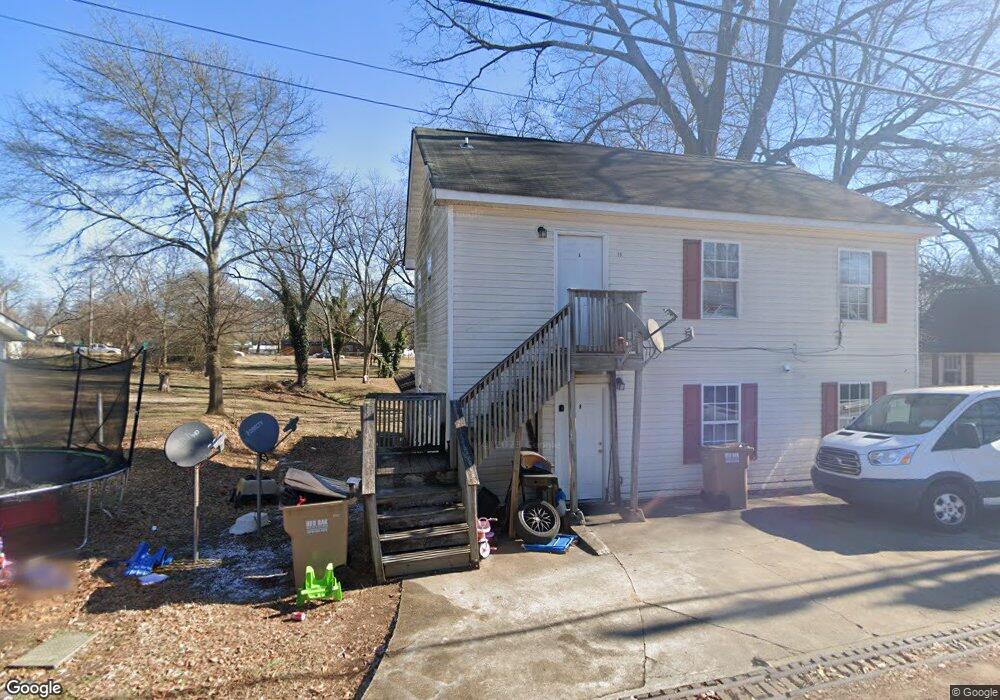
10 Tate St Gainesville, GA 30501
Browns Bridge NeighborhoodEstimated Value: $335,604 - $420,000
3
Beds
1
Bath
1,506
Sq Ft
$251/Sq Ft
Est. Value
About This Home
This home is located at 10 Tate St, Gainesville, GA 30501 and is currently estimated at $377,651, approximately $250 per square foot. 10 Tate St is a home located in Hall County with nearby schools including Lyman Hall Elementary School, West Hall Middle School, and West Hall High School.
Ownership History
Date
Name
Owned For
Owner Type
Purchase Details
Closed on
Aug 25, 2025
Sold by
Carrillos Properties Inc
Bought by
Qozb Development Llc
Current Estimated Value
Purchase Details
Closed on
Jul 15, 2014
Sold by
Branch Banking And Trust Co
Bought by
David Pierce Family Lp
Home Financials for this Owner
Home Financials are based on the most recent Mortgage that was taken out on this home.
Original Mortgage
$110,000
Interest Rate
4.24%
Mortgage Type
New Conventional
Purchase Details
Closed on
May 6, 2014
Sold by
Hothem Andrew A
Bought by
Branch Banking And Trust Co and C/O Property Tax Compliance
Purchase Details
Closed on
Jun 7, 2001
Sold by
Smith Raymond W
Bought by
Hothem Andrew A
Home Financials for this Owner
Home Financials are based on the most recent Mortgage that was taken out on this home.
Original Mortgage
$171,792
Interest Rate
7.05%
Mortgage Type
New Conventional
Create a Home Valuation Report for This Property
The Home Valuation Report is an in-depth analysis detailing your home's value as well as a comparison with similar homes in the area
Home Values in the Area
Average Home Value in this Area
Purchase History
| Date | Buyer | Sale Price | Title Company |
|---|---|---|---|
| Qozb Development Llc | -- | -- | |
| David Pierce Family Lp | $150,000 | -- | |
| Branch Banking And Trust Co | $80,000 | -- | |
| Hothem Andrew A | $190,000 | -- |
Source: Public Records
Mortgage History
| Date | Status | Borrower | Loan Amount |
|---|---|---|---|
| Previous Owner | David Pierce Family Lp | $110,000 | |
| Previous Owner | Hothem Andrew A | $171,792 |
Source: Public Records
Tax History
| Year | Tax Paid | Tax Assessment Tax Assessment Total Assessment is a certain percentage of the fair market value that is determined by local assessors to be the total taxable value of land and additions on the property. | Land | Improvement |
|---|---|---|---|---|
| 2025 | $4,509 | $183,040 | $20,640 | $162,400 |
| 2024 | $3,917 | $152,680 | $17,800 | $134,880 |
| 2023 | $3,850 | $143,840 | $17,800 | $126,040 |
| 2022 | $3,199 | $118,560 | $12,640 | $105,920 |
| 2021 | $2,415 | $86,400 | $8,000 | $78,400 |
| 2020 | $2,696 | $94,320 | $8,000 | $86,320 |
| 2019 | $614 | $17,018 | $8,000 | $9,018 |
| 2018 | $616 | $16,538 | $8,000 | $8,538 |
| 2017 | $597 | $16,058 | $8,000 | $8,058 |
| 2016 | $580 | $15,843 | $8,000 | $7,843 |
| 2015 | $529 | $13,843 | $6,000 | $7,843 |
| 2014 | $529 | $13,843 | $6,000 | $7,843 |
Source: Public Records
Map
Nearby Homes
- 593 Shallowford Rd NW
- 1639 Whiting Dr
- 0 Hilton Dr Unit 10529633
- 4171 Millstone Park Ln
- 0 Hilton Southwest Dr Unit 7697592
- 2054 Spring Rd
- 1255 Purina Dr
- 2147 Spring Rd
- 219 Shallowford Dr
- 221 Shallowford Dr
- 2244 Bennett Cir
- 1122 Villa Clara Way
- 1636 Atlanta Hwy
- 515 Nightfire Ct SW
- 510 Nightfire Ct SW
- 705 Oak St
- 354 Clarendon Ct SE
- 652 Wilshire Place
- #25 3022 Waterford Dr
- 2504 Browns Bridge Rd
- 1538 Lyman St
- 12 Tate St
- 1435 Lyman St
- 1505 Westside Dr
- 1437 Lyman St
- 1433 Lyman St
- 1521 Westside Dr
- 1524 Carter St
- 1501 Westside Dr
- 1528 Carter St
- 1536 Odell St
- 1508 Westside Dr
- 1510 Westside Dr
- 1429 Westside Dr
- 1429 Westside Dr Unit 58
- 1532 Carter St
- 1426 Lyman St
- 1525 Carter St
- 1506 Westside Dr
- 1511 Westside Dr
Your Personal Tour Guide
Ask me questions while you tour the home.