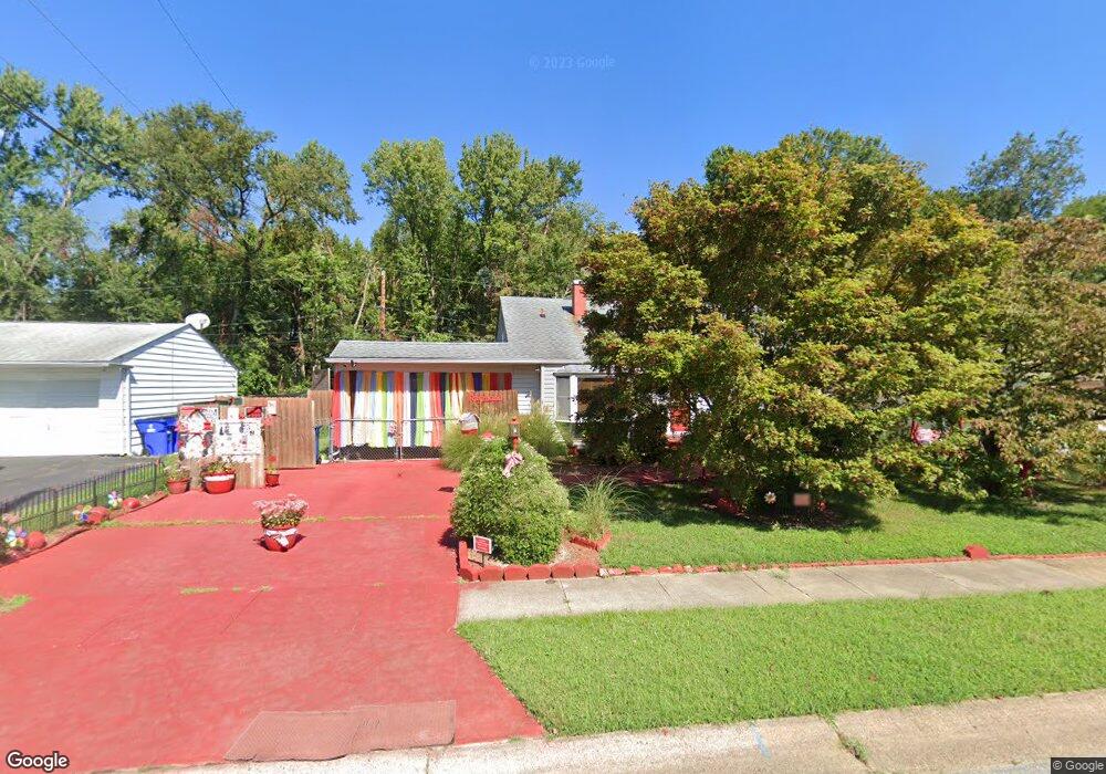
10 Todd Ln Newark, DE 19713
Estimated Value: $320,259 - $355,000
4
Beds
2
Baths
1,325
Sq Ft
$252/Sq Ft
Est. Value
About This Home
This home is located at 10 Todd Ln, Newark, DE 19713 and is currently estimated at $333,565, approximately $251 per square foot. 10 Todd Ln is a home located in New Castle County with nearby schools including Smith (Jennie E.) Elementary School, Kirk (George V.) Middle School, and Newark High School.
Ownership History
Date
Name
Owned For
Owner Type
Purchase Details
Closed on
Apr 13, 2011
Sold by
Oneill Thomas M and Oneill Andrea M
Bought by
Raymond Cheryl I
Current Estimated Value
Home Financials for this Owner
Home Financials are based on the most recent Mortgage that was taken out on this home.
Original Mortgage
$190,056
Outstanding Balance
$128,454
Interest Rate
4.37%
Mortgage Type
FHA
Estimated Equity
$205,111
Purchase Details
Closed on
Aug 1, 2005
Sold by
Krakowski John S and Krakowski Kathleen M
Bought by
Oneill Thomas M and Oneill Andrea M
Home Financials for this Owner
Home Financials are based on the most recent Mortgage that was taken out on this home.
Original Mortgage
$153,900
Interest Rate
5.67%
Mortgage Type
Fannie Mae Freddie Mac
Create a Home Valuation Report for This Property
The Home Valuation Report is an in-depth analysis detailing your home's value as well as a comparison with similar homes in the area
Home Values in the Area
Average Home Value in this Area
Purchase History
| Date | Buyer | Sale Price | Title Company |
|---|---|---|---|
| Raymond Cheryl I | $195,000 | None Available | |
| Oneill Thomas M | $208,900 | -- |
Source: Public Records
Mortgage History
| Date | Status | Borrower | Loan Amount |
|---|---|---|---|
| Open | Raymond Cheryl I | $190,056 | |
| Previous Owner | Oneill Thomas M | $153,900 |
Source: Public Records
Tax History
| Year | Tax Paid | Tax Assessment Tax Assessment Total Assessment is a certain percentage of the fair market value that is determined by local assessors to be the total taxable value of land and additions on the property. | Land | Improvement |
|---|---|---|---|---|
| 2024 | $1,967 | $46,200 | $9,300 | $36,900 |
| 2023 | $1,913 | $46,200 | $9,300 | $36,900 |
| 2022 | $1,909 | $46,200 | $9,300 | $36,900 |
| 2021 | $1,869 | $46,200 | $9,300 | $36,900 |
| 2020 | $1,820 | $46,200 | $9,300 | $36,900 |
| 2019 | $1,878 | $46,200 | $9,300 | $36,900 |
| 2018 | $1,566 | $46,200 | $9,300 | $36,900 |
| 2017 | $1,511 | $46,200 | $9,300 | $36,900 |
| 2016 | $1,507 | $46,200 | $9,300 | $36,900 |
| 2015 | $1,373 | $46,200 | $9,300 | $36,900 |
| 2014 | $1,372 | $46,200 | $9,300 | $36,900 |
Source: Public Records
Map
Nearby Homes
Your Personal Tour Guide
Ask me questions while you tour the home.