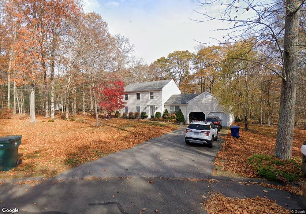
10 Whitman Ln Old Lyme, CT 06371
Estimated Value: $626,000 - $711,000
4
Beds
3
Baths
2,420
Sq Ft
$282/Sq Ft
Est. Value
About This Home
This home is located at 10 Whitman Ln, Old Lyme, CT 06371 and is currently estimated at $682,154, approximately $281 per square foot. 10 Whitman Ln is a home located in New London County with nearby schools including Mile Creek School, Lyme-Old Lyme Middle School, and Lyme-Old Lyme High School.
Ownership History
Date
Name
Owned For
Owner Type
Purchase Details
Closed on
Dec 23, 1997
Sold by
Bourque David E and Bourque Carey S
Bought by
Boehling Richard E and Boehling Sarah A
Current Estimated Value
Home Financials for this Owner
Home Financials are based on the most recent Mortgage that was taken out on this home.
Original Mortgage
$242,100
Outstanding Balance
$56,084
Interest Rate
7.38%
Mortgage Type
Unknown
Estimated Equity
$626,070
Purchase Details
Closed on
Nov 22, 1991
Sold by
Domnarski David A
Bought by
Bourque David E and Bourque Carey
Home Financials for this Owner
Home Financials are based on the most recent Mortgage that was taken out on this home.
Original Mortgage
$180,000
Interest Rate
8.7%
Mortgage Type
Unknown
Create a Home Valuation Report for This Property
The Home Valuation Report is an in-depth analysis detailing your home's value as well as a comparison with similar homes in the area
Home Values in the Area
Average Home Value in this Area
Purchase History
| Date | Buyer | Sale Price | Title Company |
|---|---|---|---|
| Boehling Richard E | $269,000 | -- | |
| Bourque David E | $225,000 | -- |
Source: Public Records
Mortgage History
| Date | Status | Borrower | Loan Amount |
|---|---|---|---|
| Closed | Bourque David E | $64,500 | |
| Open | Bourque David E | $242,100 | |
| Previous Owner | Bourque David E | $180,000 | |
| Previous Owner | Bourque David E | $180,000 |
Source: Public Records
Tax History Compared to Growth
Tax History
| Year | Tax Paid | Tax Assessment Tax Assessment Total Assessment is a certain percentage of the fair market value that is determined by local assessors to be the total taxable value of land and additions on the property. | Land | Improvement |
|---|---|---|---|---|
| 2025 | $6,953 | $428,400 | $124,700 | $303,700 |
| 2024 | $6,507 | $266,700 | $95,800 | $170,900 |
| 2023 | $6,267 | $266,700 | $95,800 | $170,900 |
| 2022 | $6,267 | $266,700 | $95,800 | $170,900 |
| 2021 | $6,214 | $266,700 | $95,800 | $170,900 |
| 2020 | $3,172 | $266,700 | $95,800 | $170,900 |
| 2019 | $3,172 | $271,700 | $100,800 | $170,900 |
| 2018 | $5,953 | $271,700 | $100,800 | $170,900 |
| 2017 | $3,127 | $271,700 | $100,800 | $170,900 |
| 2016 | $5,760 | $271,700 | $100,800 | $170,900 |
| 2015 | $5,602 | $271,700 | $100,800 | $170,900 |
| 2014 | $5,383 | $273,800 | $100,800 | $173,000 |
Source: Public Records
Map
Nearby Homes
- 15 Short Hills Rd
- 2 Riverdale Landing
- 231 Mile Creek Rd
- 13 Victoria Ln
- 188 4 Mile River Rd
- 22 Riverdale Landing
- 14 Colton Rd
- 284 Shore Rd
- 15 Freedom Way Unit 92
- 18 Twin Valley Rd
- 3 Twin Valley Rd
- 16 Twin Valley Rd
- Waramaug Plan at Riverside Reserve
- Lillinonah Plan at Riverside Reserve
- Highland Plan at Riverside Reserve
- Hayward Plan at Riverside Reserve
- Ashford Plan at Riverside Reserve
- 30 Hartford Ave Unit B
- 23 Over Brook Rd
- 95 Buttonball Rd