Estimated Value: $357,000 - $396,000
3
Beds
2
Baths
2,833
Sq Ft
$132/Sq Ft
Est. Value
About This Home
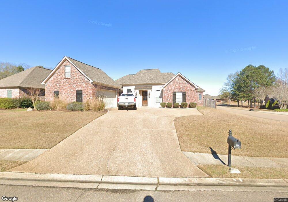
This home is located at 100 Asbury Point Unit 122, Pearl, MS 39208 and is currently estimated at $374,877, approximately $132 per square foot. 100 Asbury Point Unit 122 is a home located in Rankin County with nearby schools including Pearl Lower Elementary School, Pearl Upper School, and Northside Elementary School.
Ownership History
Date
Name
Owned For
Owner Type
Purchase Details
Closed on
Dec 20, 2017
Sold by
Moore Langston E and Brown Ashley H
Bought by
Clark Jimmy L and Clark Monica
Current Estimated Value
Home Financials for this Owner
Home Financials are based on the most recent Mortgage that was taken out on this home.
Original Mortgage
$232,000
Outstanding Balance
$195,223
Interest Rate
3.92%
Mortgage Type
New Conventional
Estimated Equity
$179,654
Purchase Details
Closed on
Nov 21, 2016
Sold by
Moore Langston E and Kennedy Lisa
Bought by
Moore Langston E and Brown Ashley H
Create a Home Valuation Report for This Property
The Home Valuation Report is an in-depth analysis detailing your home's value as well as a comparison with similar homes in the area
Home Values in the Area
Average Home Value in this Area
Purchase History
| Date | Buyer | Sale Price | Title Company |
|---|---|---|---|
| Clark Jimmy L | -- | Realty Title | |
| Moore Langston E | -- | None Available |
Source: Public Records
Mortgage History
| Date | Status | Borrower | Loan Amount |
|---|---|---|---|
| Open | Clark Jimmy L | $232,000 |
Source: Public Records
Tax History Compared to Growth
Tax History
| Year | Tax Paid | Tax Assessment Tax Assessment Total Assessment is a certain percentage of the fair market value that is determined by local assessors to be the total taxable value of land and additions on the property. | Land | Improvement |
|---|---|---|---|---|
| 2024 | $2,967 | $26,129 | $0 | $0 |
| 2023 | $2,792 | $24,734 | $0 | $0 |
| 2022 | $2,755 | $24,734 | $0 | $0 |
| 2021 | $2,755 | $24,734 | $0 | $0 |
| 2020 | $2,755 | $24,734 | $0 | $0 |
| 2019 | $2,482 | $22,030 | $0 | $0 |
| 2018 | $2,438 | $22,030 | $0 | $0 |
| 2017 | $4,107 | $33,045 | $0 | $0 |
| 2016 | $3,856 | $32,325 | $0 | $0 |
| 2015 | $3,856 | $32,325 | $0 | $0 |
| 2014 | $2,225 | $21,550 | $0 | $0 |
| 2013 | -- | $21,550 | $0 | $0 |
Source: Public Records
Map
Nearby Homes
- 0 Asbury Lane Dr Unit 4124886
- 126 Asbury Square
- 0 Eldorado Cove Unit 4107565
- 2022 S Cobblestone Cove
- 110 Alex Seals Ln
- 225 Burnham Rd
- 589 Asbury Lane Dr
- 167 Woodgate Dr
- 446 Piney Dr
- 418 Piney Dr
- 416 Piney Dr
- 406 Piney Dr
- 1015 Longwood Place
- HOLLY Plan at The Hollows
- IRIS Plan at The Hollows
- DESTIN Plan at The Hollows
- RHETT Plan at The Hollows
- RIVERSIDE Plan at The Hollows
- MADISON Plan at The Hollows
- 426 Piney Dr
- 100 Asbury Point
- 100 Asbury Point
- 102 Asbury Point
- 102 Asbury Point
- 104 Asbury Point
- 138 Asbury Square Unit 129
- 138 Asbury Square
- 101 Asbury Point
- 103 Asbury Point
- 305 Asbury Ct
- 105 Asbury Point
- 106 Asbury Point
- 310 Asbury Ct Unit 31
- 310 Asbury Ct
- 303 Asbury Ct
- 107 Asbury Point Unit 21
- 107 Asbury Point
- 241 Asbury Cir
- 108 Asbury Point Unit 23
- 108 Asbury Point