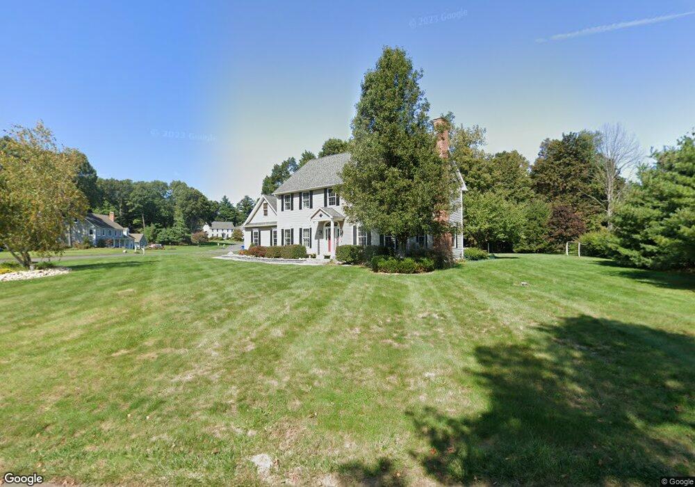
100 Bobolink Ln Somers, CT 06071
Estimated Value: $603,000 - $754,000
4
Beds
3
Baths
2,777
Sq Ft
$242/Sq Ft
Est. Value
About This Home
This home is located at 100 Bobolink Ln, Somers, CT 06071 and is currently estimated at $670,774, approximately $241 per square foot. 100 Bobolink Ln is a home located in Tolland County with nearby schools including Somers Elementary School, Mabelle B. Avery Middle School, and Somers High School.
Ownership History
Date
Name
Owned For
Owner Type
Purchase Details
Closed on
Jul 19, 2006
Sold by
Pan Roulier & Assoc
Bought by
Pruden Glen and Pruden Laura
Current Estimated Value
Home Financials for this Owner
Home Financials are based on the most recent Mortgage that was taken out on this home.
Original Mortgage
$325,000
Interest Rate
6.67%
Purchase Details
Closed on
Mar 31, 1992
Sold by
Carr David and Carr Rebecca
Bought by
Pruden Glen and Mahoney Laura
Create a Home Valuation Report for This Property
The Home Valuation Report is an in-depth analysis detailing your home's value as well as a comparison with similar homes in the area
Home Values in the Area
Average Home Value in this Area
Purchase History
| Date | Buyer | Sale Price | Title Company |
|---|---|---|---|
| Pruden Glen | $125,000 | -- | |
| Pruden Glen | $125,000 | -- | |
| Pruden Glen | $135,500 | -- |
Source: Public Records
Mortgage History
| Date | Status | Borrower | Loan Amount |
|---|---|---|---|
| Open | Pruden Glen | $310,000 | |
| Closed | Pruden Glen | $320,000 | |
| Closed | Pruden Glen | $325,000 |
Source: Public Records
Tax History Compared to Growth
Tax History
| Year | Tax Paid | Tax Assessment Tax Assessment Total Assessment is a certain percentage of the fair market value that is determined by local assessors to be the total taxable value of land and additions on the property. | Land | Improvement |
|---|---|---|---|---|
| 2025 | $9,326 | $308,700 | $76,000 | $232,700 |
| 2024 | $8,445 | $291,600 | $76,000 | $215,600 |
| 2023 | $8,255 | $291,600 | $76,000 | $215,600 |
| 2022 | $8,036 | $291,600 | $76,000 | $215,600 |
| 2021 | $7,774 | $291,600 | $76,000 | $215,600 |
| 2020 | $7,762 | $283,600 | $76,000 | $207,600 |
| 2019 | $4,322 | $276,300 | $84,300 | $192,000 |
| 2018 | $7,562 | $276,300 | $84,300 | $192,000 |
| 2017 | $7,037 | $276,300 | $84,300 | $192,000 |
| 2016 | $6,692 | $276,300 | $84,300 | $192,000 |
| 2015 | $6,352 | $271,800 | $88,800 | $183,000 |
| 2014 | $6,352 | $271,800 | $88,800 | $183,000 |
Source: Public Records
Map
Nearby Homes
- 369 Turnpike Rd
- 64 Somerset Ln
- 63 Rose Haven Rd
- 121 Florida Rd
- 92 Rose Haven Rd
- 64 Bradfield Dr
- 190 Root Rd
- 17 Long Hill Dr
- 142 Turnpike Rd
- 100 Battle St
- 12 & 16 Haas Rd
- 32 Michele Dr
- 63 Maple Ridge Dr
- 200 Hampden Rd
- 69 Colton Rd
- 175 Stafford Rd
- 169 Stafford Rd
- 969 Main St
- 42 Schneider Rd
- 64 Potash Hill Ln
- 10 Barn Swallow Dr
- 99 Bobolink Ln
- 84 Bobolink Ln
- 105 Bobolink Ln
- 106 Bobolink Ln
- 11 Barn Swallow Rd
- 115 Bobolink Ln
- 85 Bobolink Ln
- 2 Somerset Ln
- 112 Bobolink Ln
- 392 Turnpike Rd
- 74 Bobolink Ln
- 8 Rose Haven Rd
- 77 Bobolink Ln
- 4 Somerset Ln
- 370 Turnpike Rd
- 363 Turnpike Rd
- 5 Somerset Ln
- 10 Green Tree Ln
- 16 Rose Haven Rd