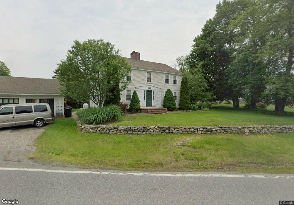
100 High Range Rd Londonderry, NH 03053
Estimated Value: $684,172 - $837,000
4
Beds
2
Baths
2,922
Sq Ft
$259/Sq Ft
Est. Value
About This Home
This home is located at 100 High Range Rd, Londonderry, NH 03053 and is currently estimated at $757,543, approximately $259 per square foot. 100 High Range Rd is a home with nearby schools including Matthew Thornton Elementary School, Londonderry Middle School, and Londonderry Senior High School.
Ownership History
Date
Name
Owned For
Owner Type
Purchase Details
Closed on
Jul 25, 2005
Sold by
Cendant Mobility Fin C
Bought by
Hardt Thomas A
Current Estimated Value
Home Financials for this Owner
Home Financials are based on the most recent Mortgage that was taken out on this home.
Original Mortgage
$297,000
Outstanding Balance
$155,316
Interest Rate
5.59%
Mortgage Type
Purchase Money Mortgage
Estimated Equity
$602,227
Purchase Details
Closed on
Dec 1, 1999
Sold by
Weigler Jon D
Bought by
Hilton Hanna K and Hilton Peter B
Home Financials for this Owner
Home Financials are based on the most recent Mortgage that was taken out on this home.
Original Mortgage
$121,600
Interest Rate
7.86%
Purchase Details
Closed on
Jun 14, 1999
Sold by
Odams Charles E
Bought by
Weigler Jon D
Home Financials for this Owner
Home Financials are based on the most recent Mortgage that was taken out on this home.
Original Mortgage
$180,000
Interest Rate
6.9%
Create a Home Valuation Report for This Property
The Home Valuation Report is an in-depth analysis detailing your home's value as well as a comparison with similar homes in the area
Home Values in the Area
Average Home Value in this Area
Purchase History
| Date | Buyer | Sale Price | Title Company |
|---|---|---|---|
| Hardt Thomas A | $330,000 | -- | |
| Cendant Mobility Fin C | $330,000 | -- | |
| Hilton Hanna K | $128,000 | -- | |
| Weigler Jon D | $300,000 | -- |
Source: Public Records
Mortgage History
| Date | Status | Borrower | Loan Amount |
|---|---|---|---|
| Open | Weigler Jon D | $297,000 | |
| Closed | Weigler Jon D | $297,000 | |
| Previous Owner | Weigler Jon D | $121,600 | |
| Previous Owner | Weigler Jon D | $180,000 |
Source: Public Records
Tax History Compared to Growth
Tax History
| Year | Tax Paid | Tax Assessment Tax Assessment Total Assessment is a certain percentage of the fair market value that is determined by local assessors to be the total taxable value of land and additions on the property. | Land | Improvement |
|---|---|---|---|---|
| 2024 | $9,066 | $561,700 | $197,100 | $364,600 |
| 2023 | $8,791 | $561,700 | $197,100 | $364,600 |
| 2022 | $8,944 | $484,000 | $148,700 | $335,300 |
| 2021 | $8,896 | $484,000 | $148,700 | $335,300 |
| 2020 | $6,894 | $342,800 | $144,900 | $197,900 |
| 2019 | $6,647 | $342,800 | $144,900 | $197,900 |
| 2018 | $3,449 | $288,300 | $120,900 | $167,400 |
| 2017 | $5,882 | $288,300 | $120,900 | $167,400 |
| 2016 | $6,140 | $285,600 | $120,900 | $164,700 |
| 2015 | $6,003 | $285,600 | $120,900 | $164,700 |
| 2014 | $6,023 | $285,600 | $120,900 | $164,700 |
| 2011 | -- | $292,000 | $120,900 | $171,100 |
Source: Public Records
Map
Nearby Homes
- 90 High Range Rd
- 88 High Range Rd
- 6 Wiley Hill Rd
- 12 Wiley Hill Rd
- 3 Chandler Dr
- 10 Jason Dr
- 11 Elise Ave Unit Lot 91
- 5 Delphi Way
- 3 Delphi Way
- 7 Delphi Way
- 4 Delphi Way
- 1 Delphi Way
- 1 Delphi Way Unit 10
- 5 Hickory Hill Dr
- 17 Lily Ln
- 19 Lily Ln
- 31 Midridge Cir
- 27 Midridge Cir
- 1 Lily Ln
- 214 Winding Pond Rd
- 98 High Range Rd
- 213 Pillsbury Rd
- 211 Pillsbury Rd
- 109 High Range Rd
- 113 High Range Rd
- 209 Pillsbury Rd
- 208 Pillsbury Rd
- 207 Pillsbury Rd
- 117 High Range Rd
- 204 Pillsbury Rd
- 205 Pillsbury Rd
- 106 High Range Rd
- 2 Carousel Ct
- 103 High Range Rd
- 108 High Range Rd
- 201 Pillsbury Rd
- 4 Carousel Ct
- 101 High Range Rd
- 1 Carousel Ct
- 121 High Range Rd