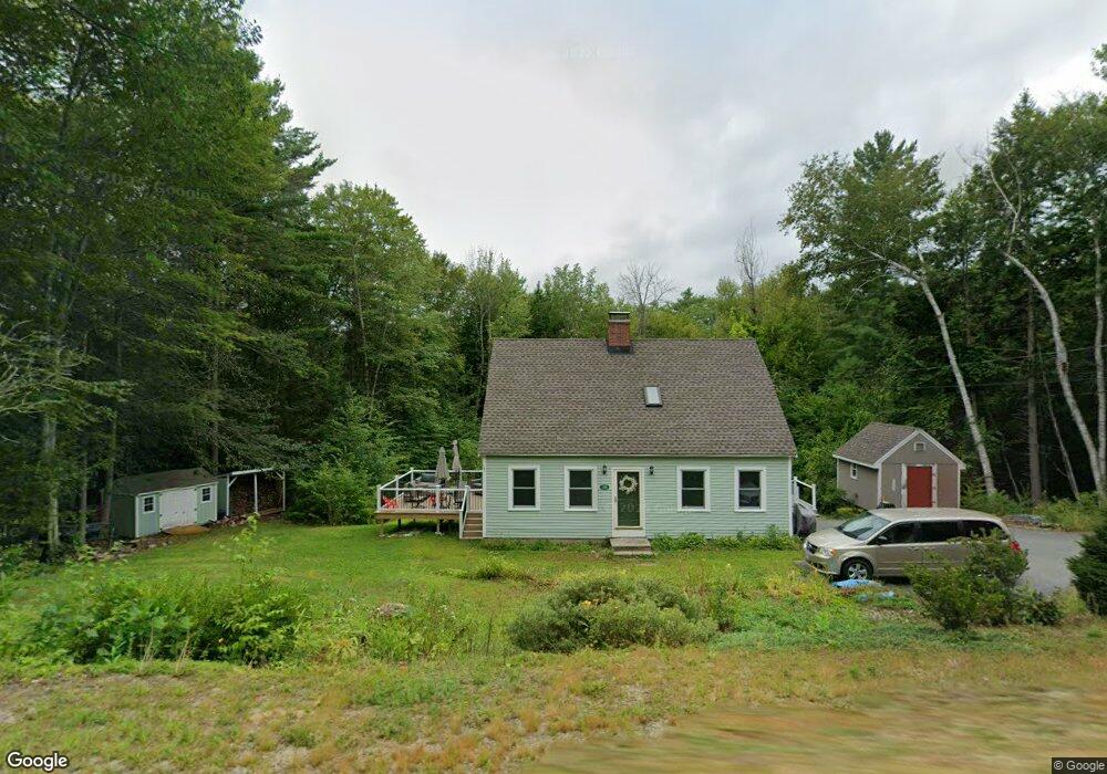
100 Proctor Rd Wilton, NH 03086
Estimated Value: $428,000 - $488,000
3
Beds
2
Baths
1,547
Sq Ft
$299/Sq Ft
Est. Value
About This Home
This home is located at 100 Proctor Rd, Wilton, NH 03086 and is currently estimated at $461,839, approximately $298 per square foot. 100 Proctor Rd is a home located in Hillsborough County with nearby schools including Florence Rideout Elementary School, Wilton-Lyndeborough Cooperative Middle School, and Wilton-Lyndeborough Cooperative High School.
Ownership History
Date
Name
Owned For
Owner Type
Purchase Details
Closed on
Jul 18, 2024
Sold by
Macpherson Mark R and Macpherson Vicki D
Bought by
Macpherson Ft and Macpherson
Current Estimated Value
Create a Home Valuation Report for This Property
The Home Valuation Report is an in-depth analysis detailing your home's value as well as a comparison with similar homes in the area
Home Values in the Area
Average Home Value in this Area
Purchase History
| Date | Buyer | Sale Price | Title Company |
|---|---|---|---|
| Macpherson Ft | -- | None Available | |
| Macpherson Ft | -- | None Available |
Source: Public Records
Tax History Compared to Growth
Tax History
| Year | Tax Paid | Tax Assessment Tax Assessment Total Assessment is a certain percentage of the fair market value that is determined by local assessors to be the total taxable value of land and additions on the property. | Land | Improvement |
|---|---|---|---|---|
| 2024 | $7,270 | $292,300 | $122,400 | $169,900 |
| 2023 | $6,489 | $292,300 | $122,400 | $169,900 |
| 2022 | $6,039 | $292,300 | $122,400 | $169,900 |
| 2021 | $5,618 | $292,300 | $122,400 | $169,900 |
| 2020 | $6,084 | $207,000 | $86,600 | $120,400 |
| 2019 | $6,011 | $207,000 | $86,600 | $120,400 |
| 2018 | $5,953 | $207,000 | $86,600 | $120,400 |
| 2017 | $5,624 | $207,000 | $86,600 | $120,400 |
| 2016 | $5,452 | $207,000 | $86,600 | $120,400 |
| 2015 | $5,668 | $215,200 | $103,000 | $112,200 |
| 2014 | $5,552 | $215,200 | $103,000 | $112,200 |
| 2013 | $5,605 | $215,400 | $103,000 | $112,400 |
Source: Public Records
Map
Nearby Homes
- 81 Abbot Hill Acres
- 88 McGettigan Rd Unit 88-6-1
- 27 Island St
- 10 Mill St
- 8 Maple St
- F/88-5 McGettigan Rd
- F/88-4 McGettigan Rd
- F-88-10 Aria Hill Dr
- F-88-11 Aria Hill Dr
- F-88-12 Aria Hill Dr
- F-88-7 Aria Hill Dr
- Lot F-88-9 Aria Hill Dr
- 134 Falcon Ridge Rd Unit 23
- Lots 4 & 7 Gibbons & Robbins Rd
- 0 Marden Rd
- 59 Goldsmith Rd
- 60 Goldsmith Rd
- 30 Holden Ln
- 545 Elm St Unit 34
- 119 Boynton Hill Rd
- 92 Proctor Rd
- 34 Greene St
- 110 Proctor Rd
- 45 Greene St
- 26 Greene St
- 41 Greene St
- 86 Proctor Rd
- 33 Greene St
- 118 Proctor Rd
- 27 Greene St
- 18 Greene St
- 55 Abbot Hill Acres
- 78 Proctor Rd
- 63 Abbot Hill Acres
- 67 Abbot Hill Acres
- 37 Abbot Hill Acres
- 75 Abbot Hill Acres
- 19 Greene St
- 87 Abbot Hill Acres
- 44 Abbot Hill Acres