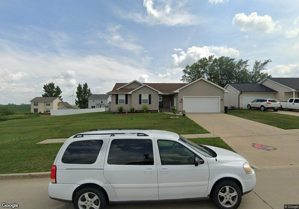
100 SE 15th St Stuart, IA 50250
Estimated Value: $247,000 - $302,000
3
Beds
2
Baths
1,265
Sq Ft
$212/Sq Ft
Est. Value
About This Home
This home is located at 100 SE 15th St, Stuart, IA 50250 and is currently estimated at $268,141, approximately $211 per square foot. 100 SE 15th St is a home located in Adair County with nearby schools including West Central Valley High School.
Ownership History
Date
Name
Owned For
Owner Type
Purchase Details
Closed on
Jul 6, 2021
Sold by
Blair Nicholas L and Blair Toni
Bought by
Makus Justin W and Makus Katelynn J
Current Estimated Value
Home Financials for this Owner
Home Financials are based on the most recent Mortgage that was taken out on this home.
Original Mortgage
$204,625
Outstanding Balance
$185,262
Interest Rate
2.9%
Mortgage Type
FHA
Estimated Equity
$82,879
Purchase Details
Closed on
Mar 18, 2017
Sold by
Mcpheron Jordan P and Mcpheron Valerie A
Bought by
Blair Nicholas L
Purchase Details
Closed on
Mar 11, 2014
Sold by
Swafford Austin Blake and Swafford Mariah Lee
Bought by
Mcphernon Jordan P
Home Financials for this Owner
Home Financials are based on the most recent Mortgage that was taken out on this home.
Original Mortgage
$113,600
Interest Rate
4.2%
Mortgage Type
New Conventional
Purchase Details
Closed on
Dec 21, 2010
Sold by
Swafford Austin B and Yates Mariah L
Bought by
Swafford Austin B and Swafford Mariah L
Create a Home Valuation Report for This Property
The Home Valuation Report is an in-depth analysis detailing your home's value as well as a comparison with similar homes in the area
Purchase History
| Date | Buyer | Sale Price | Title Company |
|---|---|---|---|
| Makus Justin W | $208,500 | None Listed On Document | |
| Blair Nicholas L | $151,500 | None Available | |
| Mcphernon Jordan P | $142,000 | None Available | |
| Swafford Austin B | -- | None Available |
Source: Public Records
Mortgage History
| Date | Status | Borrower | Loan Amount |
|---|---|---|---|
| Open | Makus Justin W | $204,625 | |
| Previous Owner | Mcphernon Jordan P | $113,600 |
Source: Public Records
Tax History
| Year | Tax Paid | Tax Assessment Tax Assessment Total Assessment is a certain percentage of the fair market value that is determined by local assessors to be the total taxable value of land and additions on the property. | Land | Improvement |
|---|---|---|---|---|
| 2025 | $4,132 | $272,000 | $35,990 | $236,010 |
| 2024 | $4,132 | $246,300 | $35,990 | $210,310 |
| 2023 | $3,612 | $246,300 | $35,990 | $210,310 |
| 2022 | $2,862 | $186,020 | $25,710 | $160,310 |
| 2021 | $2,862 | $162,520 | $25,710 | $136,810 |
| 2020 | $3,256 | $151,010 | $25,710 | $125,300 |
| 2019 | $3,472 | $151,010 | $0 | $0 |
| 2018 | $3,434 | $0 | $0 | $0 |
| 2017 | $3,270 | $142,110 | $0 | $0 |
| 2016 | $3,312 | $142,110 | $23,290 | $118,820 |
| 2015 | $3,312 | $149,201 | $0 | $0 |
| 2014 | $3,508 | $149,201 | $0 | $0 |
Source: Public Records
Map
Nearby Homes
- 524 S Western St
- 103 All Saint's Dr
- 1015 SE 5th St
- 1015 S 5th St
- 320 S Western St
- 1620 Tiernan Trail
- 103 N Harrison St
- 216 N Gaines St
- 223 N Fremont St
- 304 N Harrison St
- 103 St Mary's Ct
- 404 N Sherman St
- 313 N Adair St
- 1304 NE 2nd St
- 523 N Sherman St
- 215 Varley Ln
- 406 Wildcat Ct
- 1416 NE 2nd St
- 716 N Main St
- 1625 Tiernan Trail
Your Personal Tour Guide
Ask me questions while you tour the home.