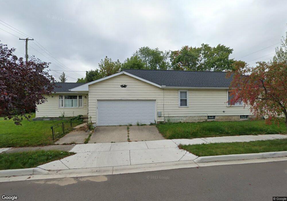
1000 Samantha Ave Lansing, MI 48910
Old Everett NeighborhoodEstimated Value: $180,000 - $197,000
3
Beds
3
Baths
1,867
Sq Ft
$100/Sq Ft
Est. Value
About This Home
This home is located at 1000 Samantha Ave, Lansing, MI 48910 and is currently estimated at $185,810, approximately $99 per square foot. 1000 Samantha Ave is a home located in Ingham County with nearby schools including Kendon School, Attwood School, and Everett High School.
Ownership History
Date
Name
Owned For
Owner Type
Purchase Details
Closed on
Aug 30, 2018
Sold by
Estate Of Daniel Carl Gillengerten
Bought by
Haug Irene and Haug Ingmar
Current Estimated Value
Home Financials for this Owner
Home Financials are based on the most recent Mortgage that was taken out on this home.
Original Mortgage
$65,000
Outstanding Balance
$40,025
Interest Rate
4.5%
Mortgage Type
New Conventional
Estimated Equity
$145,785
Purchase Details
Closed on
Mar 27, 1997
Sold by
Gillengerten Theresa E
Bought by
Gillengerten Daniel C
Purchase Details
Closed on
Dec 18, 1992
Sold by
Gillengerten Theresa E
Bought by
Gillengerten Daniel C and Gillengerten Theresa E
Purchase Details
Closed on
Dec 1, 1992
Sold by
Kuepper Donald K and Kuepper Barbara J
Bought by
Gillengerten Theresa E
Create a Home Valuation Report for This Property
The Home Valuation Report is an in-depth analysis detailing your home's value as well as a comparison with similar homes in the area
Home Values in the Area
Average Home Value in this Area
Purchase History
| Date | Buyer | Sale Price | Title Company |
|---|---|---|---|
| Haug Irene | $94,000 | Tri County Title Agency Llc | |
| Gillengerten Daniel C | -- | -- | |
| Gillengerten Daniel C | -- | -- | |
| Gillengerten Theresa E | $45,000 | -- |
Source: Public Records
Mortgage History
| Date | Status | Borrower | Loan Amount |
|---|---|---|---|
| Open | Haug Irene | $65,000 |
Source: Public Records
Tax History
| Year | Tax Paid | Tax Assessment Tax Assessment Total Assessment is a certain percentage of the fair market value that is determined by local assessors to be the total taxable value of land and additions on the property. | Land | Improvement |
|---|---|---|---|---|
| 2025 | $10,216 | $88,700 | $9,800 | $78,900 |
| 2024 | $70 | $85,600 | $9,800 | $75,800 |
| 2023 | $7,923 | $75,800 | $9,800 | $66,000 |
| 2022 | $7,058 | $69,500 | $9,300 | $60,200 |
| 2021 | $5,994 | $65,500 | $5,800 | $59,700 |
| 2020 | $5,013 | $62,700 | $5,800 | $56,900 |
| 2019 | $4,698 | $60,600 | $5,800 | $54,800 |
| 2018 | $3,101 | $51,200 | $5,800 | $45,400 |
| 2017 | $2,977 | $51,200 | $5,800 | $45,400 |
| 2016 | $2,375 | $46,000 | $5,800 | $40,200 |
| 2015 | $2,375 | $43,900 | $11,650 | $32,250 |
| 2014 | $2,375 | $42,900 | $8,501 | $34,399 |
Source: Public Records
Map
Nearby Homes
- 1101 Kendon Dr
- 4719 S Pennsylvania Ave
- 0 Glenwood Ave
- 4815 S Pennsylvania Ave
- 801 Jessop Ave
- 810 Fenton St
- 817 Jessop Ave
- 709 Jessop Ave
- 3907 Glenwood Ave
- 629 Emily Ave
- 600 E Cavanaugh Rd
- 1109 Barr Ave
- 601 Jessop Ave
- 705 Hunter Blvd
- 522 E Cavanaugh Rd
- 3533 Glenwood Ave
- 3603 Parkway Dr
- 1115 Shirley St
- 616 Glendale Ave
- 201 E Syringa Dr
- 4511 S Pennsylvania Ave
- 1014 Samantha Ave
- 4425 S Pennsylvania Ave
- 4517 S Pennsylvania Ave
- 4501 S Pennsylvania Ave
- 4500 Alpha St
- 1015 Samantha Ave
- 4419 S Pennsylvania Ave
- 4523 S Pennsylvania Ave
- 4415 S Pennsylvania Ave
- 4412 Alpha St
- 4524 Alpha St
- 4501 Alpha St
- 4407 S Pennsylvania Ave
- 4406 Alpha St
- 4421 Alpha St
- 4601 S Pennsylvania Ave
- 4600 Alpha St
- 4515 Alpha St
- 1106 Samantha Ave
Your Personal Tour Guide
Ask me questions while you tour the home.