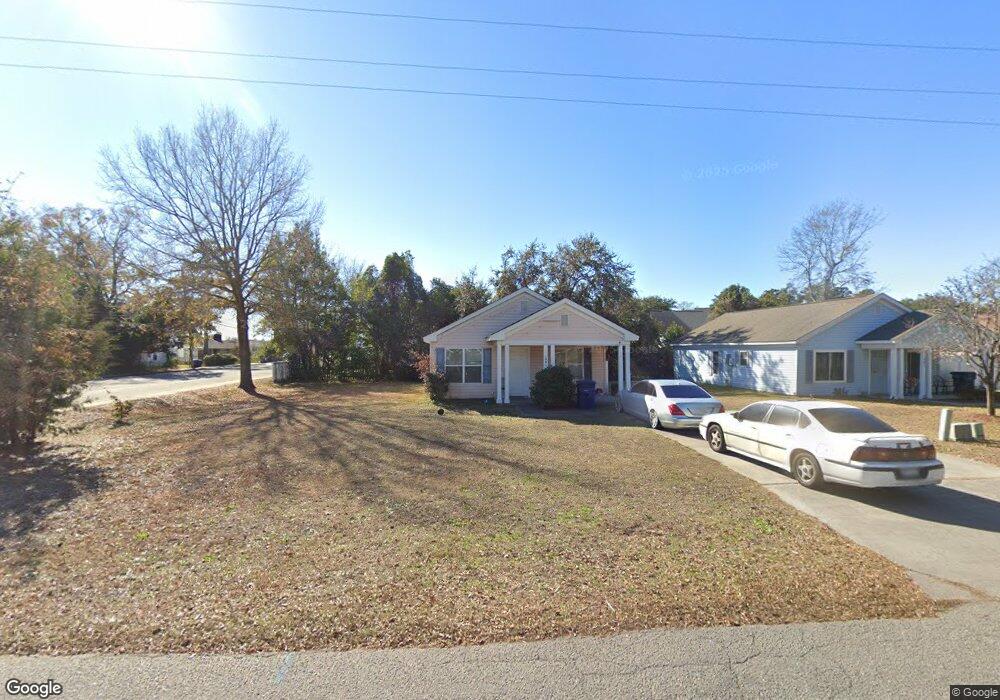
1001 Spivey Ave Myrtle Beach, SC 29577
Downtown Myrtle Beach NeighborhoodEstimated Value: $226,848 - $282,000
4
Beds
2
Baths
1,212
Sq Ft
$208/Sq Ft
Est. Value
About This Home
This home is located at 1001 Spivey Ave, Myrtle Beach, SC 29577 and is currently estimated at $252,212, approximately $208 per square foot. 1001 Spivey Ave is a home located in Horry County with nearby schools including Myrtle Beach Child Development Center, Myrtle Beach Primary School, and Myrtle Beach Elementary School.
Ownership History
Date
Name
Owned For
Owner Type
Purchase Details
Closed on
Jun 28, 2012
Sold by
Special Referee Horry County
Bought by
Anderson Brothers Bank
Current Estimated Value
Purchase Details
Closed on
Mar 31, 2009
Sold by
Lawrence Delrita Dawn
Bought by
Doers Unlimited Llc
Purchase Details
Closed on
Nov 17, 2004
Sold by
Simmons Darryl and Simmons Sherlyn D
Bought by
Lawrence Delrita Dawn
Home Financials for this Owner
Home Financials are based on the most recent Mortgage that was taken out on this home.
Original Mortgage
$67,800
Interest Rate
9.15%
Mortgage Type
Purchase Money Mortgage
Create a Home Valuation Report for This Property
The Home Valuation Report is an in-depth analysis detailing your home's value as well as a comparison with similar homes in the area
Home Values in the Area
Average Home Value in this Area
Purchase History
| Date | Buyer | Sale Price | Title Company |
|---|---|---|---|
| Anderson Brothers Bank | $60,000 | -- | |
| Doers Unlimited Llc | $60,000 | -- | |
| Lawrence Delrita Dawn | $79,800 | -- |
Source: Public Records
Mortgage History
| Date | Status | Borrower | Loan Amount |
|---|---|---|---|
| Previous Owner | Lawrence Delrita Dawn | $67,800 |
Source: Public Records
Tax History Compared to Growth
Tax History
| Year | Tax Paid | Tax Assessment Tax Assessment Total Assessment is a certain percentage of the fair market value that is determined by local assessors to be the total taxable value of land and additions on the property. | Land | Improvement |
|---|---|---|---|---|
| 2024 | $1,994 | $13,121 | $5,100 | $8,021 |
| 2023 | $1,994 | $6,810 | $1,083 | $5,727 |
| 2021 | $1,840 | $7,250 | $1,352 | $5,898 |
| 2020 | $1,755 | $7,250 | $1,352 | $5,898 |
| 2019 | $1,755 | $7,250 | $1,352 | $5,898 |
| 2018 | $0 | $5,921 | $941 | $4,980 |
| 2017 | $1,557 | $5,921 | $941 | $4,980 |
| 2016 | -- | $5,921 | $941 | $4,980 |
| 2015 | $1,539 | $5,922 | $942 | $4,980 |
| 2014 | $1,497 | $5,922 | $942 | $4,980 |
Source: Public Records
Map
Nearby Homes
- 1102 Spivey Ave
- 1104 Dunbar St
- 1101 Carver St
- 1301 Hemingway St
- 1001 Graham Ave
- 1211 Washington St
- 913 White St
- 1301 King St
- 1605 Legion St
- TBD Acline Ave
- (1.5 Acres) 10th Ave N
- 1414 Dunbar St Unit 12
- 300 10th Ave N
- 1200 N Ocean Blvd Unit 1011
- 1200 N Ocean Blvd Unit 307
- 1200 N Ocean Blvd Unit 403
- 1200 N Ocean Blvd Unit 309
- 1200 N Ocean Blvd Unit 411
- 1200 N Ocean Blvd Unit 404
- 1200 N Ocean Blvd Unit 905
- 1005 Spivey Ave
- 1004 Futrell Dr
- 1000 Futrell Dr
- 1008 Futrell Dr
- 1009 Spivey Ave
- 1101 Dunbar St
- 1012 Futrell Dr
- 1014 Dunbar St
- 1000 Spivey Ave
- 1016 Futrell Dr
- 1010 Spivey Ave
- 1016 Dunbar St
- 1013 Spivey Ave
- 1020 Futrell Dr
- 1020 Futrell Dr Unit A
- 1010 Dunbar St
- 1003 Futrell Dr
- 1103 Dunbar St
- 1103 Dunbar St
- 1103 Dunbar St Unit 4