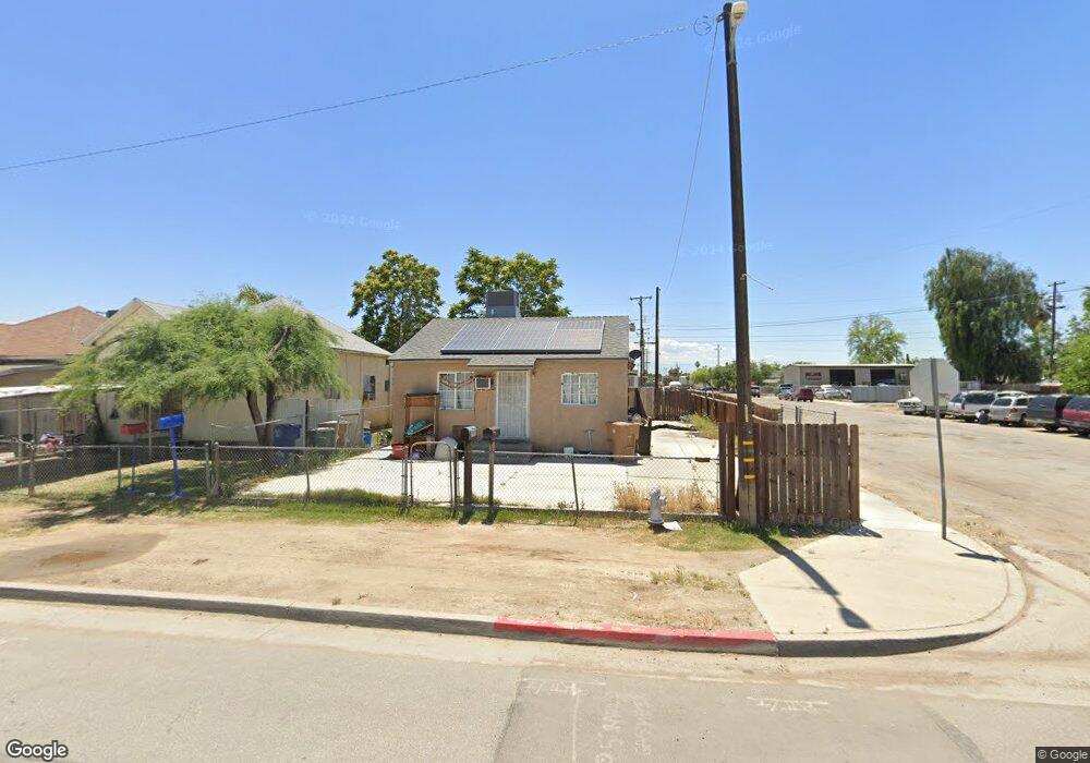
1001 Sumner St Bakersfield, CA 93305
East Bakersfield NeighborhoodEstimated Value: $161,125 - $233,000
2
Beds
1
Bath
576
Sq Ft
$329/Sq Ft
Est. Value
About This Home
This home is located at 1001 Sumner St, Bakersfield, CA 93305 and is currently estimated at $189,781, approximately $329 per square foot. 1001 Sumner St is a home located in Kern County with nearby schools including Longfellow Elementary School, Washington Middle School, and Bakersfield High School.
Ownership History
Date
Name
Owned For
Owner Type
Purchase Details
Closed on
Oct 2, 2012
Sold by
Macca Eduardo and Macca Ruth
Bought by
Maccas Management Llc
Current Estimated Value
Purchase Details
Closed on
Oct 17, 2011
Sold by
Eh Pooled 711 Lp
Bought by
Macca Eduardo and Macca Ruth
Purchase Details
Closed on
Aug 29, 2011
Sold by
Deutsche Bank National Trust Company
Bought by
Eh Pooled 711 Lp
Purchase Details
Closed on
Dec 6, 2010
Sold by
Sanchez Jose De Jesus and Cabrera Margaret Mary
Bought by
Deutsche Bank National Trust Company
Purchase Details
Closed on
Feb 27, 2007
Sold by
Cabrera Jorge
Bought by
Cabrera Margaret Mary
Home Financials for this Owner
Home Financials are based on the most recent Mortgage that was taken out on this home.
Original Mortgage
$190,000
Interest Rate
9.05%
Mortgage Type
New Conventional
Create a Home Valuation Report for This Property
The Home Valuation Report is an in-depth analysis detailing your home's value as well as a comparison with similar homes in the area
Home Values in the Area
Average Home Value in this Area
Purchase History
| Date | Buyer | Sale Price | Title Company |
|---|---|---|---|
| Maccas Management Llc | -- | None Available | |
| Macca Eduardo | $22,000 | None Available | |
| Eh Pooled 711 Lp | $12,500 | None Available | |
| Deutsche Bank National Trust Company | $40,000 | Accommodation | |
| Cabrera Margaret Mary | -- | Commonwealth Land Title Co |
Source: Public Records
Mortgage History
| Date | Status | Borrower | Loan Amount |
|---|---|---|---|
| Previous Owner | Cabrera Margaret Mary | $190,000 |
Source: Public Records
Tax History
| Year | Tax Paid | Tax Assessment Tax Assessment Total Assessment is a certain percentage of the fair market value that is determined by local assessors to be the total taxable value of land and additions on the property. | Land | Improvement |
|---|---|---|---|---|
| 2025 | $1,026 | $27,620 | $12,555 | $15,065 |
| 2024 | $996 | $27,079 | $12,309 | $14,770 |
| 2023 | $996 | $26,549 | $12,068 | $14,481 |
| 2022 | $956 | $26,030 | $11,832 | $14,198 |
| 2021 | $862 | $25,520 | $11,600 | $13,920 |
| 2020 | $829 | $25,260 | $11,482 | $13,778 |
| 2019 | $813 | $25,260 | $11,482 | $13,778 |
| 2018 | $799 | $24,281 | $11,037 | $13,244 |
| 2017 | $791 | $23,806 | $10,821 | $12,985 |
| 2016 | $757 | $23,340 | $10,609 | $12,731 |
| 2015 | $746 | $22,990 | $10,450 | $12,540 |
| 2014 | $724 | $22,541 | $10,246 | $12,295 |
Source: Public Records
Map
Nearby Homes
- 923 Sumner St
- 1030 E 19th St Unit 3
- 1032 E 19th St Unit 3
- 1102 E 18th St
- 821 Kentucky St Unit 823
- 1106 Kentucky St
- 1104 Gage St
- 804 Kentucky St
- 1302 E 19th St
- 1331 Beale Ave
- 1222 E 18th St
- 0 E 18th St
- 1107 Monterey St
- 1101 Eureka St
- 1311 E 18th St
- 1130 Dolores St
- 1326 Kentucky St Unit B
- 1007 Dolores St
- 926 Niles St
- 1124 Baker St
Your Personal Tour Guide
Ask me questions while you tour the home.