Estimated Value: $166,000 - $204,000
3
Beds
2
Baths
815
Sq Ft
$233/Sq Ft
Est. Value
About This Home
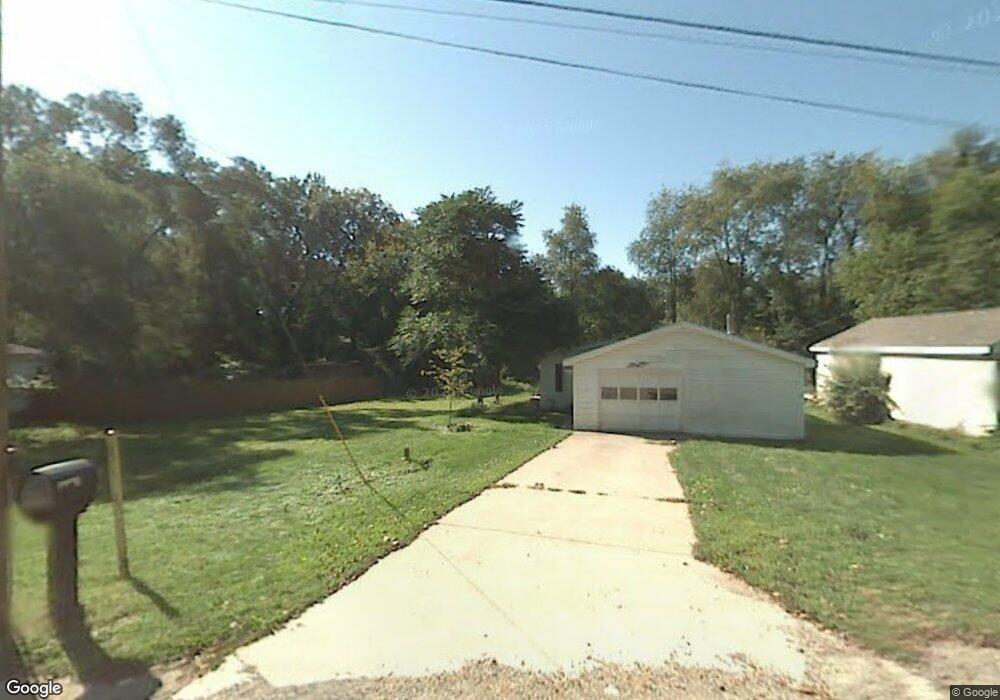
This home is located at 1002 Birch St, Niles, MI 49120 and is currently estimated at $189,678, approximately $232 per square foot. 1002 Birch St is a home located in Berrien County with nearby schools including Ballard Elementary School, Oak Manor Sixth Grade Center, and Ring Lardner Middle School.
Ownership History
Date
Name
Owned For
Owner Type
Purchase Details
Closed on
Jan 15, 2018
Sold by
Lue Kathleen J Van and Tabbert George F
Bought by
Tabbert Terry L and Tabbert Tammy
Current Estimated Value
Purchase Details
Closed on
Feb 11, 2011
Sold by
Tabbert George F and Tabbert Terry L
Bought by
Vanlue Kathleen J and Tabbert George F
Purchase Details
Closed on
Nov 8, 2010
Sold by
Tabbert George F
Bought by
Tabbert Terry L and Tabbert George F
Purchase Details
Closed on
Jun 3, 2010
Sold by
The Huntington National Bank
Bought by
Tabbert George F
Purchase Details
Closed on
Jun 25, 2009
Sold by
Brock Inez E
Bought by
The Huntington National Bank
Purchase Details
Closed on
Feb 25, 1997
Purchase Details
Closed on
Nov 26, 1996
Purchase Details
Closed on
Jul 25, 1991
Purchase Details
Closed on
Apr 7, 1986
Create a Home Valuation Report for This Property
The Home Valuation Report is an in-depth analysis detailing your home's value as well as a comparison with similar homes in the area
Home Values in the Area
Average Home Value in this Area
Purchase History
| Date | Buyer | Sale Price | Title Company |
|---|---|---|---|
| Tabbert Terry L | $26,000 | None Available | |
| Vanlue Kathleen J | -- | None Available | |
| Tabbert Terry L | -- | None Available | |
| Tabbert George F | $16,200 | Hbi Title Services Inc | |
| The Huntington National Bank | $28,490 | None Available | |
| -- | $20,000 | -- | |
| -- | -- | -- | |
| -- | -- | -- | |
| -- | -- | -- |
Source: Public Records
Tax History
| Year | Tax Paid | Tax Assessment Tax Assessment Total Assessment is a certain percentage of the fair market value that is determined by local assessors to be the total taxable value of land and additions on the property. | Land | Improvement |
|---|---|---|---|---|
| 2025 | $1,482 | $86,900 | $0 | $0 |
| 2024 | $1,158 | $80,800 | $0 | $0 |
| 2023 | $1,110 | $76,100 | $0 | $0 |
| 2022 | $1,057 | $54,700 | $0 | $0 |
| 2021 | $1,304 | $47,700 | $3,700 | $44,000 |
| 2020 | $1,291 | $49,100 | $0 | $0 |
| 2019 | $1,271 | $37,300 | $1,700 | $35,600 |
| 2018 | $1,230 | $37,300 | $0 | $0 |
| 2017 | $1,210 | $31,600 | $0 | $0 |
| 2016 | $1,321 | $35,000 | $0 | $0 |
| 2015 | $1,362 | $36,800 | $0 | $0 |
| 2014 | $1,065 | $36,500 | $0 | $0 |
Source: Public Records
Map
Nearby Homes
- 926 Birch St
- 1050 Pine St
- 1 Grand Ave
- 621 French St
- V/L Wesaw Rd
- 11 N Barrett St
- 1010 Tomahawk Ln
- 124 S State St
- 1290 Missions East Dr
- 117 N Fairview Ave
- 211 S Street Joseph Ave
- 220 Christiana Dr
- 0 Signal Point Dr Unit 26005621
- 319 S 5th St
- 300 Carefree Ct
- Integrity 1610 Plan at Carefree Villas
- Integrity 1605 Plan at Carefree Villas
- Integrity 1250 Plan at Carefree Villas
- Integrity 1530 Plan at Carefree Villas
- 1005 Winchester Ct
Your Personal Tour Guide
Ask me questions while you tour the home.