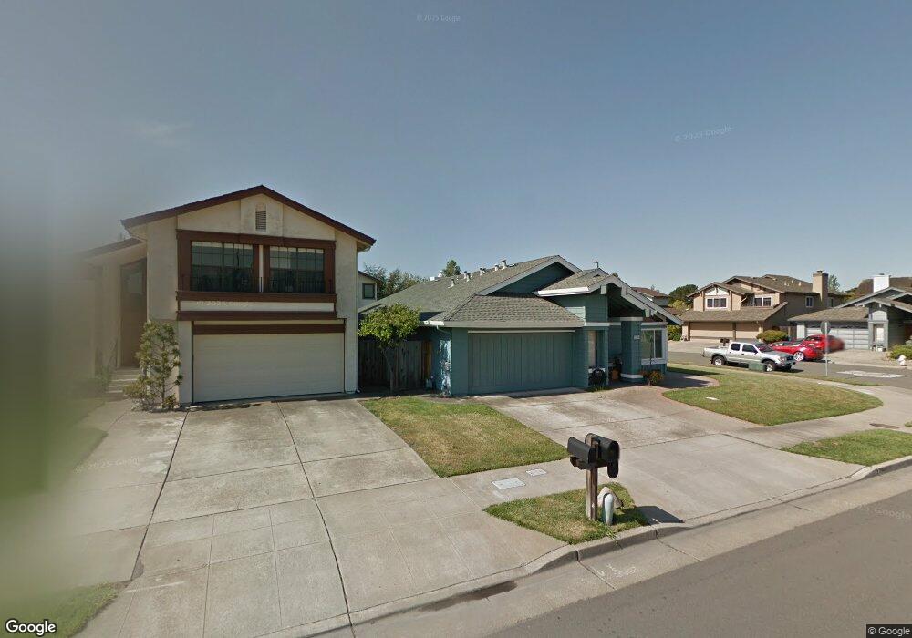
1002 Otis Dr Alameda, CA 94501
South Shore NeighborhoodEstimated Value: $1,415,475 - $1,559,000
3
Beds
2
Baths
1,837
Sq Ft
$806/Sq Ft
Est. Value
About This Home
This home is located at 1002 Otis Dr, Alameda, CA 94501 and is currently estimated at $1,480,369, approximately $805 per square foot. 1002 Otis Dr is a home located in Alameda County with nearby schools including William G. Paden Elementary School, Will C. Wood Middle School, and Encinal Junior/Senior High.
Ownership History
Date
Name
Owned For
Owner Type
Purchase Details
Closed on
Jun 15, 2012
Sold by
Pastorino Angelo
Bought by
Kawabata Gregory K and Mototake Kawabata Kinuko
Current Estimated Value
Purchase Details
Closed on
Aug 15, 2001
Sold by
Pastorino Angelo
Bought by
Pastorino Angelo
Purchase Details
Closed on
Jul 16, 1998
Sold by
Pastorino Rose
Bought by
Pastorino Rose and Pastorino Angelo
Create a Home Valuation Report for This Property
The Home Valuation Report is an in-depth analysis detailing your home's value as well as a comparison with similar homes in the area
Home Values in the Area
Average Home Value in this Area
Purchase History
| Date | Buyer | Sale Price | Title Company |
|---|---|---|---|
| Kawabata Gregory K | $596,500 | First American Title Company | |
| Pastorino Angelo | -- | -- | |
| Pastorino Rose | -- | -- | |
| Pastorino Rose | -- | -- |
Source: Public Records
Tax History
| Year | Tax Paid | Tax Assessment Tax Assessment Total Assessment is a certain percentage of the fair market value that is determined by local assessors to be the total taxable value of land and additions on the property. | Land | Improvement |
|---|---|---|---|---|
| 2025 | $11,158 | $742,197 | $224,696 | $524,501 |
| 2024 | $11,158 | $727,512 | $220,292 | $514,220 |
| 2023 | $10,737 | $720,112 | $215,973 | $504,139 |
| 2022 | $10,497 | $698,992 | $211,738 | $494,254 |
| 2021 | $10,243 | $685,154 | $207,588 | $484,566 |
| 2020 | $10,119 | $685,062 | $205,461 | $479,601 |
| 2019 | $9,508 | $671,634 | $201,434 | $470,200 |
| 2018 | $9,269 | $658,469 | $197,485 | $460,984 |
| 2017 | $8,847 | $645,561 | $193,614 | $451,947 |
| 2016 | $8,856 | $632,904 | $189,818 | $443,086 |
| 2015 | $8,825 | $623,401 | $186,968 | $436,433 |
| 2014 | $8,377 | $611,191 | $183,306 | $427,885 |
Source: Public Records
Map
Nearby Homes
- 955 Shorepoint Ct Unit 110
- 955 Shorepoint Ct Unit 216
- 960 Shorepoint Ct Unit 215
- 933 Shoreline Dr Unit 203
- 1000 Central Ave
- 1305 Webster St Unit C202
- 1305 Webster St Unit C102
- 1321 Webster St Unit D119
- 1321 Webster St Unit D116
- 1333 Webster St Unit A107
- 1203 Benton St
- 1512 Mozart St
- 1327 Webster St Unit B101
- 1523 Verdi St
- 1500 Alameda Ave Unit G
- 1211 Paru St
- 325 Kitty Hawk Rd Unit 207
- 1822 Clinton Ave
- 610 Grand St
- 1401 Cottage St Unit D
- 1006 Otis Dr
- 1003 Rosewood Way
- 1010 Otis Dr
- 1007 Rosewood Way
- 589 Tarryton Isle
- 593 Tarryton Isle
- 585 Tarryton Isle
- 1011 Rosewood Way
- 1014 Otis Dr
- 581 Tarryton Isle
- 1009 Otis Dr Unit 2
- 1015 Rosewood Way
- 600 Tarryton Isle
- 1018 Otis Dr
- 577 Tarryton Isle
- 920 Otis Dr
- 1015 Otis Dr
- 1019 Rosewood Way
- 572 Tarryton Isle
- 933 Otis Dr
Your Personal Tour Guide
Ask me questions while you tour the home.