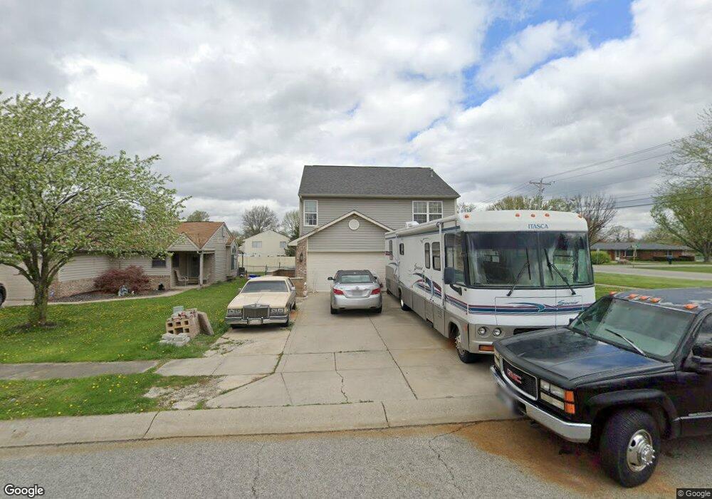
1002 Squirrel Ridge Rd Anderson, IN 46013
Estimated Value: $229,000 - $245,000
3
Beds
3
Baths
1,984
Sq Ft
$118/Sq Ft
Est. Value
About This Home
This home is located at 1002 Squirrel Ridge Rd, Anderson, IN 46013 and is currently estimated at $234,093, approximately $117 per square foot. 1002 Squirrel Ridge Rd is a home located in Madison County with nearby schools including Erskine Elementary School, Highland Middle School, and Anderson High School.
Ownership History
Date
Name
Owned For
Owner Type
Purchase Details
Closed on
Dec 9, 2005
Sold by
Crosser Properties I Llc
Bought by
Hudson Sharon and Hudson Bertram
Current Estimated Value
Home Financials for this Owner
Home Financials are based on the most recent Mortgage that was taken out on this home.
Original Mortgage
$104,400
Outstanding Balance
$67,787
Interest Rate
9.37%
Mortgage Type
Adjustable Rate Mortgage/ARM
Estimated Equity
$166,306
Create a Home Valuation Report for This Property
The Home Valuation Report is an in-depth analysis detailing your home's value as well as a comparison with similar homes in the area
Home Values in the Area
Average Home Value in this Area
Purchase History
| Date | Buyer | Sale Price | Title Company |
|---|---|---|---|
| Hudson Sharon | -- | -- |
Source: Public Records
Mortgage History
| Date | Status | Borrower | Loan Amount |
|---|---|---|---|
| Open | Hudson Sharon | $104,400 |
Source: Public Records
Tax History Compared to Growth
Tax History
| Year | Tax Paid | Tax Assessment Tax Assessment Total Assessment is a certain percentage of the fair market value that is determined by local assessors to be the total taxable value of land and additions on the property. | Land | Improvement |
|---|---|---|---|---|
| 2025 | $302 | $141,400 | $15,100 | $126,300 |
| 2024 | $302 | $141,400 | $15,100 | $126,300 |
| 2023 | $155 | $129,300 | $14,300 | $115,000 |
| 2022 | $155 | $133,300 | $14,100 | $119,200 |
| 2021 | $0 | $116,500 | $14,000 | $102,500 |
| 2020 | $0 | $112,000 | $13,400 | $98,600 |
| 2019 | $0 | $110,300 | $13,400 | $96,900 |
| 2018 | $0 | $102,200 | $13,400 | $88,800 |
| 2017 | $0 | $102,600 | $13,400 | $89,200 |
| 2016 | $0 | $101,400 | $13,400 | $88,000 |
| 2014 | $700 | $93,600 | $12,200 | $81,400 |
| 2013 | $700 | $94,500 | $12,200 | $82,300 |
Source: Public Records
Map
Nearby Homes
- 717 Church St
- 1247 Flint Ct
- 814 Rustic Rd
- 6216 Rocky Rd
- 1021 Sandra Dr
- 1015 Pebble Ct
- 328 W 53rd St Unit 51
- 328 W 53rd St Unit 18
- 328 W 53rd St Unit 50
- 328 W 53rd St Unit 17
- 328 W 53rd St Unit 10
- 202 Asbury Dr
- 220 E 54th St
- 4413 Brenda Dr
- 606 S Buckingham Ct Unit 8-B
- 150 Appian Way
- 4826 Main St
- 4248 S 100 W
- 0 Sheridan St Unit MBR22051619
- 6440 Main St
- 1006 Squirrel Ridge Rd
- 1012 Squirrel Ridge Rd
- 1001 Fox Trace Dr
- 1003 Fox Trace Dr
- 5612 Madison Ave
- 5624 Silver Fox Ct
- 1018 Squirrel Ridge Rd
- 1009 Fox Trace Dr
- 1015 Fox Trace Dr
- 930 Hattie Dr
- 931 Hattie Dr
- 1024 Squirrel Ridge Rd
- 5630 Madison Ave
- 1027 Fox Trace Dr
- 1002 Fox Trace Dr
- 5627 Silver Fox Ct
- 5638 Silver Fox Ct
- 1008 Fox Trace Dr
- 5618 Red Fox Ct
- 922 Hattie Dr