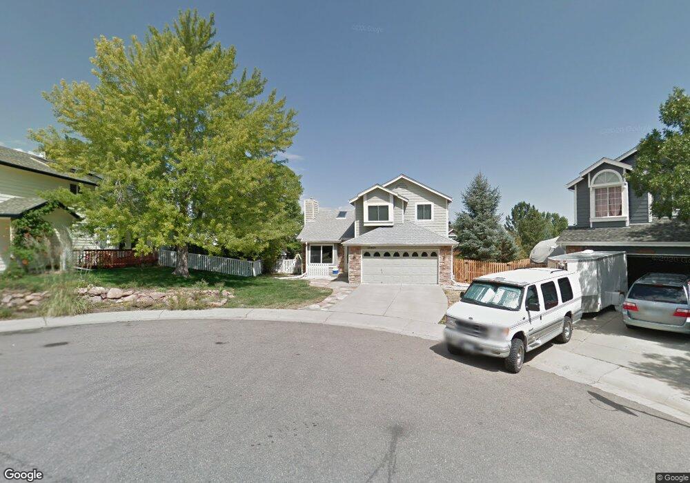
10045 Telluride St Littleton, CO 80125
Estimated Value: $546,000 - $583,258
4
Beds
3
Baths
2,323
Sq Ft
$243/Sq Ft
Est. Value
About This Home
This home is located at 10045 Telluride St, Littleton, CO 80125 and is currently estimated at $565,315, approximately $243 per square foot. 10045 Telluride St is a home located in Douglas County with nearby schools including Roxborough Elementary School, Roxborough Intermediate School, and Ranch View Middle School.
Ownership History
Date
Name
Owned For
Owner Type
Purchase Details
Closed on
Dec 27, 2019
Sold by
Page Carrie
Bought by
Hare Katherine Marie
Current Estimated Value
Home Financials for this Owner
Home Financials are based on the most recent Mortgage that was taken out on this home.
Original Mortgage
$389,500
Outstanding Balance
$344,801
Interest Rate
3.7%
Mortgage Type
New Conventional
Estimated Equity
$220,514
Purchase Details
Closed on
Dec 18, 2017
Sold by
Moore Carrie and Page Ryan
Bought by
Page Carrie
Home Financials for this Owner
Home Financials are based on the most recent Mortgage that was taken out on this home.
Original Mortgage
$304,000
Interest Rate
3.9%
Mortgage Type
VA
Purchase Details
Closed on
Jul 21, 2014
Sold by
Roth Carlton J and Roth Paulette K
Bought by
Moore Carrie and Page Ryan
Home Financials for this Owner
Home Financials are based on the most recent Mortgage that was taken out on this home.
Original Mortgage
$275,000
Interest Rate
4.23%
Mortgage Type
VA
Purchase Details
Closed on
Oct 17, 2003
Sold by
Pierce Malcolm C
Bought by
Roth Carlton J and Roth Paulette K
Home Financials for this Owner
Home Financials are based on the most recent Mortgage that was taken out on this home.
Original Mortgage
$205,103
Interest Rate
6.1%
Mortgage Type
FHA
Purchase Details
Closed on
Jun 26, 1998
Sold by
Ferris Donald W and Verekyken Jill A
Bought by
Pierce Malcolm C
Home Financials for this Owner
Home Financials are based on the most recent Mortgage that was taken out on this home.
Original Mortgage
$124,200
Interest Rate
7.13%
Purchase Details
Closed on
May 21, 1996
Sold by
Findley John Robert and Williams Ann Laree
Bought by
Ferris Donald W and Vereyken Jill A
Home Financials for this Owner
Home Financials are based on the most recent Mortgage that was taken out on this home.
Original Mortgage
$104,950
Interest Rate
8.06%
Mortgage Type
Balloon
Purchase Details
Closed on
Jul 15, 1988
Sold by
Village Homes Roxborough Inc
Bought by
Findlay John Robert and Williams Ann Laree
Purchase Details
Closed on
Dec 30, 1986
Sold by
Roxborough Village Joint Venture Esl Cor
Bought by
Village Homes Roxborough Inc
Create a Home Valuation Report for This Property
The Home Valuation Report is an in-depth analysis detailing your home's value as well as a comparison with similar homes in the area
Home Values in the Area
Average Home Value in this Area
Purchase History
| Date | Buyer | Sale Price | Title Company |
|---|---|---|---|
| Hare Katherine Marie | $410,000 | Fidelity National Title | |
| Page Carrie | -- | Paramount Title | |
| Moore Carrie | $275,000 | Meridian Title & Escrow Llc | |
| Roth Carlton J | $208,000 | -- | |
| Pierce Malcolm C | $138,000 | -- | |
| Ferris Donald W | $134,950 | -- | |
| Findlay John Robert | $101,600 | -- | |
| Village Homes Roxborough Inc | $78,800 | -- |
Source: Public Records
Mortgage History
| Date | Status | Borrower | Loan Amount |
|---|---|---|---|
| Open | Hare Katherine Marie | $389,500 | |
| Previous Owner | Page Carrie | $304,000 | |
| Previous Owner | Moore Carrie | $275,000 | |
| Previous Owner | Roth Carlton J | $205,103 | |
| Previous Owner | Pierce Malcolm C | $124,200 | |
| Previous Owner | Ferris Donald W | $104,950 |
Source: Public Records
Tax History Compared to Growth
Tax History
| Year | Tax Paid | Tax Assessment Tax Assessment Total Assessment is a certain percentage of the fair market value that is determined by local assessors to be the total taxable value of land and additions on the property. | Land | Improvement |
|---|---|---|---|---|
| 2024 | $3,751 | $39,560 | $7,140 | $32,420 |
| 2023 | $3,776 | $39,560 | $7,140 | $32,420 |
| 2022 | $2,981 | $28,500 | $5,250 | $23,250 |
| 2021 | $3,115 | $28,500 | $5,250 | $23,250 |
| 2020 | $2,956 | $25,500 | $5,670 | $19,830 |
| 2019 | $3,003 | $25,500 | $5,670 | $19,830 |
| 2018 | $2,924 | $20,280 | $4,440 | $15,840 |
| 2017 | $2,810 | $20,280 | $4,440 | $15,840 |
| 2016 | $2,532 | $18,050 | $3,580 | $14,470 |
| 2015 | $2,616 | $18,050 | $3,580 | $14,470 |
| 2014 | $2,261 | $14,510 | $1,990 | $12,520 |
Source: Public Records
Map
Nearby Homes
- 8032 Mount Ouray Rd
- 8109 Mount Ouray Rd
- 7832 Elmwood St
- 8145 Monte Vista Cir
- 7888 Canvasback Cir
- 9804 Rosalee Peak St
- 9753 Middle Peak St
- 9786 Rosalee Peak St
- 8176 Locust Dr
- 8129 Locust Dr
- 9780 Banner Peak St
- 8132 Mount Harvard Rd
- 7680 Elmwood St
- 7910 Jared Way
- 9613 Browns Peak Cir
- 9625 Browns Peak Cir
- 9617 Browns Peak Cir
- Panorama Plan at Prospect Village at Sterling Ranch - Townhomes
- Peak Plan at Prospect Village at Sterling Ranch - Townhomes
- 10441 Beech St
- 10055 Telluride St
- 10041 Telluride St
- 10082 Westside Cir
- 10076 Westside Cir
- 10088 Westside Cir
- 10063 Telluride St
- 10094 Westside Cir
- 10070 Westside Cir
- 10036 Telluride St
- 10071 Telluride St
- 10100 Westside Cir
- 10044 Telluride St
- 10054 Telluride St
- 10062 Telluride St
- 10081 Telluride St
- 10081 Westside Cir
- 10089 Westside Cir
- 10095 Westside Cir
- 10058 Westside Cir
- 10070 Telluride St