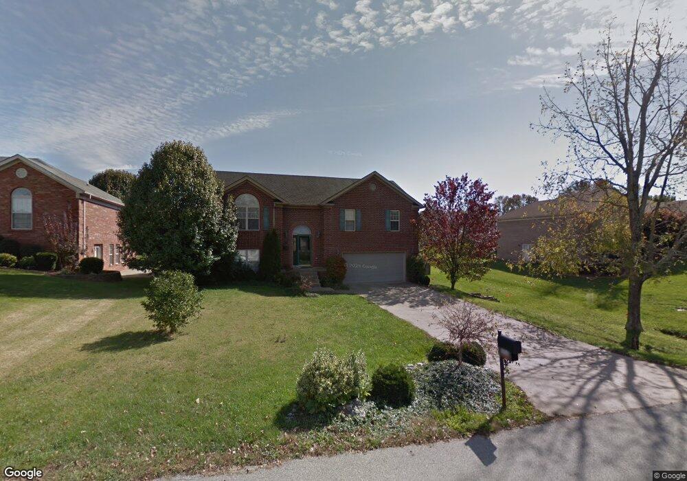
1006 Brookstone Ct Georgetown, IN 47122
Estimated Value: $337,000 - $358,000
4
Beds
3
Baths
1,983
Sq Ft
$174/Sq Ft
Est. Value
About This Home
This home is located at 1006 Brookstone Ct, Georgetown, IN 47122 and is currently estimated at $345,586, approximately $174 per square foot. 1006 Brookstone Ct is a home located in Floyd County with nearby schools including Georgetown Elementary School, Highland Hills Middle School, and Floyd Central High School.
Ownership History
Date
Name
Owned For
Owner Type
Purchase Details
Closed on
May 31, 2011
Sold by
Fortner Bradley S and Fortner Stephanie L
Bought by
Elsmore Christie A
Current Estimated Value
Home Financials for this Owner
Home Financials are based on the most recent Mortgage that was taken out on this home.
Original Mortgage
$100,000
Outstanding Balance
$69,023
Interest Rate
4.81%
Mortgage Type
New Conventional
Estimated Equity
$276,563
Purchase Details
Closed on
Feb 10, 2006
Sold by
Sarraf Bashar and Sarraf Amal
Bought by
Fortner Bradley S and Murphy Stephanie L
Home Financials for this Owner
Home Financials are based on the most recent Mortgage that was taken out on this home.
Original Mortgage
$66,000
Interest Rate
6.2%
Mortgage Type
Credit Line Revolving
Create a Home Valuation Report for This Property
The Home Valuation Report is an in-depth analysis detailing your home's value as well as a comparison with similar homes in the area
Home Values in the Area
Average Home Value in this Area
Purchase History
We collect this data history from publicly available records. To have your information removed, we recommend requesting removal directly through your county’s website.
| Date | Buyer | Sale Price | Title Company |
|---|---|---|---|
| Elsmore Christie A | -- | None Available | |
| Fortner Bradley S | -- | None Available |
Source: Public Records
Mortgage History
We collect this data history from publicly available records. To have your information removed, we recommend requesting removal directly through your county’s website.
| Date | Status | Borrower | Loan Amount |
|---|---|---|---|
| Open | Elsmore Christie A | $100,000 | |
| Previous Owner | Fortner Bradley S | $66,000 | |
| Previous Owner | Fortner Bradley S | $66,500 |
Source: Public Records
Tax History
| Year | Tax Paid | Tax Assessment Tax Assessment Total Assessment is a certain percentage of the fair market value that is determined by local assessors to be the total taxable value of land and additions on the property. | Land | Improvement |
|---|---|---|---|---|
| 2025 | $2,781 | $312,600 | $39,200 | $273,400 |
| 2024 | $2,885 | $306,900 | $39,200 | $267,700 |
| 2023 | $2,463 | $276,200 | $39,200 | $237,000 |
| 2022 | $2,332 | $248,500 | $39,200 | $209,300 |
| 2021 | $2,131 | $231,300 | $39,200 | $192,100 |
| 2020 | $2,098 | $233,700 | $39,200 | $194,500 |
| 2019 | $1,952 | $225,200 | $39,200 | $186,000 |
| 2018 | $1,784 | $208,700 | $39,200 | $169,500 |
| 2017 | $1,667 | $189,300 | $39,200 | $150,100 |
| 2016 | $1,385 | $173,700 | $39,200 | $134,500 |
| 2014 | $1,623 | $174,500 | $39,200 | $135,300 |
| 2013 | -- | $171,600 | $39,200 | $132,400 |
Source: Public Records
Map
Nearby Homes
- 2022 Brookstone Way
- 2031 Brookstone Way
- 1034 Brookstone Ct
- 8003 Schrieber Rd
- 1037 Brookstone Ct
- 1056 Brookstone Ct
- 1236 Walts Rd
- 7005 Mitsch Unit Lot 969
- 7309 Rainelle Ct
- 8151 - LOT 951 Zelpha Blvd
- 8153 - LOT 952 Zelpha Blvd
- 8145 - LOT 907 Zelpha Blvd
- 8147 - LOT 908 Zelpha Blvd
- 7003 Mitsch Unit Lot 970
- 7001 Mitsch Unit Lot 971
- 829 Green Row Rd
- 2009 Mary Ella Dr Unit 231
- 8164- LOT 932 Zelpha Blvd
- 8164 Zelpha Blvd Unit Lot 932
- 2008 Mary Ella Dr Unit 232
- 1008 Brookstone Ct
- 1004 Brookstone Ct
- 3004 Brookhill Ct
- 3006 Brookhill Ct
- 3002 Brookhill Ct
- 1007 Brookstone Ct
- 1009 Brookstone Ct
- 1002 Brookstone Ct
- 1005 Brookstone Ct
- 3008 Brookhill Ct
- 3000 Brookhill Ct
- 1012 Brookstone Ct
- 1011 Brookstone Ct
- 1003 Brookstone Ct
- 3010 Brookhill Ct
- 1013 Brookstone Ct
- 1014 Brookstone Ct
- 3005 Brookhill Ct
- 3012 Brookhill Ct
- 2010 Brookstone Way
Your Personal Tour Guide
Ask me questions while you tour the home.