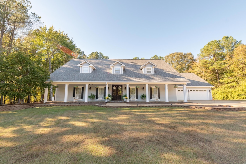
1008 Mabus Rd Ackerman, MS 39735
Estimated payment $3,043/month
Total Views
7,361
5
Beds
5
Baths
4,364
Sq Ft
$128
Price per Sq Ft
Highlights
- In Ground Pool
- Deck
- No HOA
- Ackerman Elementary School Rated A
- Traditional Architecture
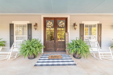
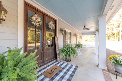
- Covered Patio or Porch
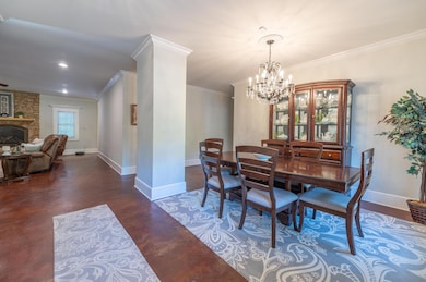
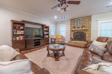
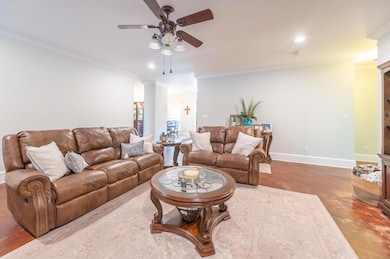
About This Home
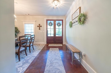
This Beautiful Two-Story estate offers over 4300 square feet of living space, sitting on 10 acres right outside the city limits. With 5 bedrooms and 5 full baths, expansive kitchen and living room. This home also features a dedicated office, a rec room, and a bonus room. Step outside to your very own backyard retreat, with an inground pool, covered outdoor kitchen area and sitting area. This property truly has it all.
Home Details
Home Type
- Single Family
Est. Annual Taxes
- $2,009
Year Built
- Built in 2007
Lot Details
- 10 Acre Lot
- Back Yard Fenced
Parking
- 2 Car Attached Garage
Home Design
- Traditional Architecture
- Slab Foundation
- Architectural Shingle Roof
- HardiePlank Type
Interior Spaces
- 4,364 Sq Ft Home
- Ceiling Fan
- Aluminum Window Frames
Kitchen
- Stove
- Built-In Microwave
- Dishwasher
Flooring
- Carpet
- Concrete
- Tile
Bedrooms and Bathrooms
- 5 Bedrooms
- 5 Full Bathrooms
Outdoor Features
- In Ground Pool
- Deck
- Covered Patio or Porch
Utilities
- Central Heating and Cooling System
- Electric Water Heater
- Septic Tank
Community Details
- No Home Owners Association
Listing and Financial Details
- Assessor Parcel Number 057 0007 0001002
Map
Create a Home Valuation Report for This Property
The Home Valuation Report is an in-depth analysis detailing your home's value as well as a comparison with similar homes in the area
Tax History
| Year | Tax Paid | Tax Assessment Tax Assessment Total Assessment is a certain percentage of the fair market value that is determined by local assessors to be the total taxable value of land and additions on the property. | Land | Improvement |
|---|---|---|---|---|
| 2025 | $2,609 | $34,517 | $1,387 | $33,130 |
| 2024 | $2,009 | $27,286 | $1,378 | $25,908 |
| 2023 | $1,907 | $27,294 | $1,386 | $25,908 |
| 2022 | $1,896 | $27,162 | $1,402 | $25,760 |
| 2021 | $1,896 | $27,162 | $1,402 | $25,760 |
| 2020 | $1,804 | $26,022 | $1,421 | $24,601 |
| 2019 | $1,804 | $26,022 | $1,421 | $24,601 |
| 2018 | $1,805 | $26,030 | $1,429 | $24,601 |
| 2017 | $1,804 | $26,020 | $1,419 | $24,601 |
| 2016 | -- | $24,599 | $1,390 | $23,209 |
| 2015 | -- | $24,578 | $1,369 | $23,209 |
| 2013 | -- | $25,975 | $1,338 | $24,637 |
Source: Public Records
Property History
| Date | Event | Price | List to Sale | Price per Sq Ft |
|---|---|---|---|---|
| 10/21/2025 10/21/25 | For Sale | $560,000 | -- | $128 / Sq Ft |
Source: Golden Triangle Association of REALTORS®
Purchase History
| Date | Type | Sale Price | Title Company |
|---|---|---|---|
| Warranty Deed | -- | -- | |
| Warranty Deed | -- | -- |
Source: Public Records
Mortgage History
| Date | Status | Loan Amount | Loan Type |
|---|---|---|---|
| Open | $260,000 | New Conventional | |
| Previous Owner | $351,000 | Purchase Money Mortgage |
Source: Public Records
Source: Golden Triangle Association of REALTORS®
MLS Number: 25-2176
APN: 057-0007-0001002
Nearby Homes
- 11379 Mississippi 15
- Hwy 15
- Williams Choctaw County Unit MS
- 0 State Highway 790
- 46 W Center St
- 129 N Gaston St
- 235 N Commerce St
- 15548 Mississippi 15
- 0 Mississippi 15
- 7840 Mississippi 12
- Hwy 15 N
- 261 E Sides Ave
- 99 Ford
- 400 Pittman Rd
- 4580 Reform Sturgis Rd
- 0 Bright Rd
- 2001 Harold Reid Rd
- 0 Mississippi 12
- 3645 McGee - Thompson Rd
- Hwy 9
- 2573 Hawkins Rd
- 21 Player Ln
- 1300 Old Highway 12
- 205 Lynn Ln
- 1257 Louisville St Unit 21
- 1257 Louisville St Unit 11
- 1255 Louisville St Unit 9
- 110 Lynn Ln
- 1200 Louisville St
- 405 Sycamore St
- 905 Louisville St
- 905 Louisville St
- 905 Louisville St
- 905 Louisville St
- 500 Louisville St
- 125 Camden Place
- 104 Pilcher St
- 300 Green St
- 625 S Montgomery St
- 300 Carver Dr

Your Personal Tour Guide
Ask me questions while you tour the home.