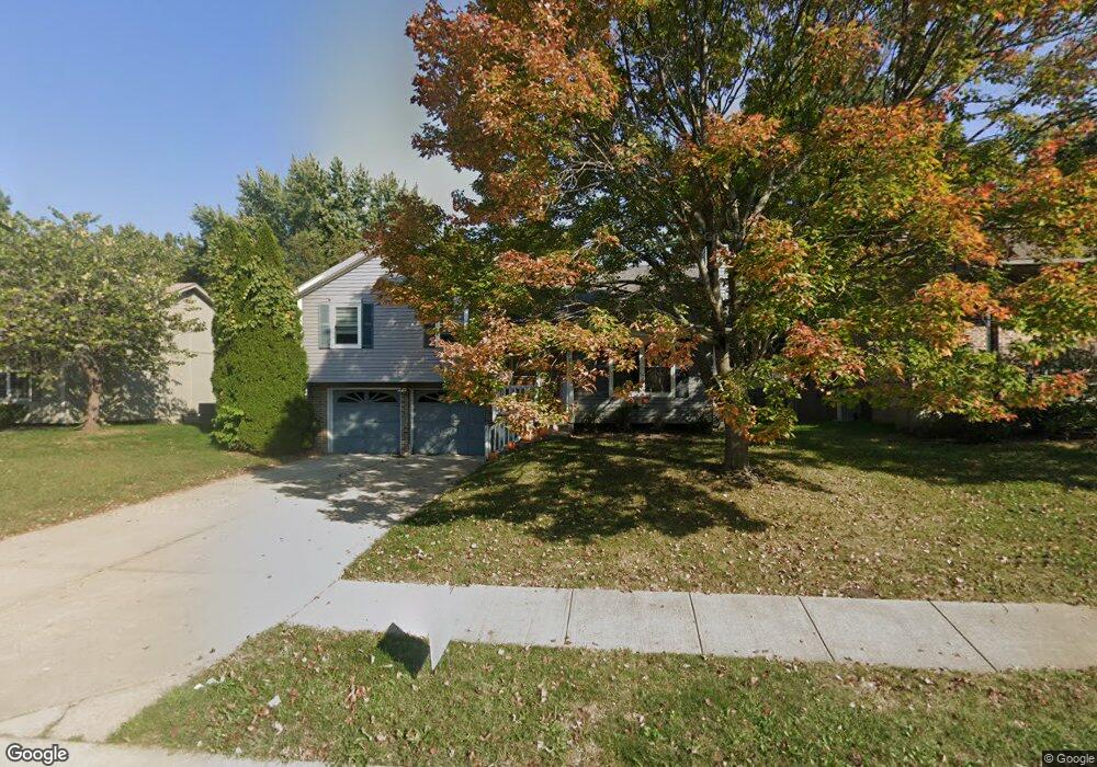
1009 NE Jason Ave Lees Summit, MO 64086
Estimated Value: $282,772 - $310,000
3
Beds
2
Baths
1,092
Sq Ft
$270/Sq Ft
Est. Value
About This Home
This home is located at 1009 NE Jason Ave, Lees Summit, MO 64086 and is currently estimated at $294,443, approximately $269 per square foot. 1009 NE Jason Ave is a home located in Jackson County with nearby schools including Richardson Elementary School, Bernard C. Campbell Middle School, and Lee's Summit North High School.
Ownership History
Date
Name
Owned For
Owner Type
Purchase Details
Closed on
Aug 20, 2024
Sold by
Karen L Mayer Living Trust and Banks Leann
Bought by
Banks Leann
Current Estimated Value
Purchase Details
Closed on
Jul 24, 2008
Sold by
Mayer Karen L
Bought by
The Karen L Mayer Living Trust
Home Financials for this Owner
Home Financials are based on the most recent Mortgage that was taken out on this home.
Original Mortgage
$91,012
Interest Rate
6.36%
Mortgage Type
Unknown
Purchase Details
Closed on
Aug 27, 2001
Sold by
Mayer Karen L
Bought by
Mayer Eva R and Mayer Martin F
Create a Home Valuation Report for This Property
The Home Valuation Report is an in-depth analysis detailing your home's value as well as a comparison with similar homes in the area
Home Values in the Area
Average Home Value in this Area
Purchase History
| Date | Buyer | Sale Price | Title Company |
|---|---|---|---|
| Banks Leann | -- | None Listed On Document | |
| Mayer Eva R | -- | -- |
Source: Public Records
Tax History Compared to Growth
Tax History
| Year | Tax Paid | Tax Assessment Tax Assessment Total Assessment is a certain percentage of the fair market value that is determined by local assessors to be the total taxable value of land and additions on the property. | Land | Improvement |
|---|---|---|---|---|
| 2025 | $3,080 | $33,670 | $7,163 | $26,507 |
| 2024 | $3,058 | $42,655 | $5,263 | $37,392 |
| 2023 | $3,058 | $42,655 | $5,548 | $37,107 |
| 2022 | $2,055 | $25,460 | $4,788 | $20,672 |
| 2021 | $2,098 | $25,460 | $4,788 | $20,672 |
| 2020 | $2,016 | $24,230 | $4,788 | $19,442 |
| 2019 | $1,961 | $24,230 | $4,788 | $19,442 |
| 2018 | $2,077 | $23,815 | $3,483 | $20,332 |
| 2017 | $2,046 | $23,815 | $3,483 | $20,332 |
| 2016 | $2,046 | $23,218 | $3,667 | $19,551 |
| 2014 | $1,915 | $21,309 | $3,661 | $17,648 |
Source: Public Records
Map
Nearby Homes
- 1032 NE Bristol Dr
- 2313 NE Old Paint Rd
- 2504 NE Dale Hunter Trail
- 2505 NE Dale Hunter Trail
- 2312 NE Sweet Water Dr
- 1016 NE Remington Ct
- 1928 NE Dill Cir
- 416 NE Bitter Creek Rd
- 1916 NE Patterson Dr
- 1901 NE Patterson Dr
- 1809 NE Griffin Dr
- 2329 NE Lake Breeze Ln
- 1676 NE Ozark Dr
- 514 NE Viewpark Dr
- 2504 NE Woodland Oak Cir
- 1726 NE Duchess Dr
- 713 NE Aaron Dr
- 1620 NE Misty Ln
- 107 NE Greystone Dr Unit 59
- 2520 NE Woodland Oak Cir
- 1005 NE Jason Ave
- 1013 NE Jason Ave
- 1008 NE Jason Ave
- 1001 NE Jason Ave
- 1017 NE Jason Ave
- 1012 NE Jason Ave
- 1008 NE Carousel Ln
- 1004 NE Carousel Ln
- 1000 NE Jason Ave
- 1016 NE Jason Ave
- 941 NE Jason Ave
- 1016 NE Carousel Ln
- 1000 NE Carousel Ln
- 940 NE Jason Ave
- 1044 NE Carousel Ln
- 1020 NE Jason Ave
- 940 NE Carousel Ln
- 937 NE Jason Ave
- 1040 NE Carousel Ln
- 1013 NE Carousel Ln