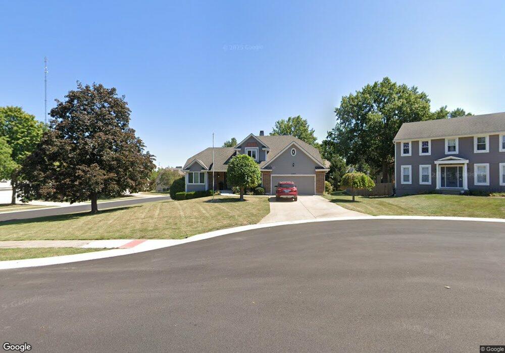
1009 NW Springdale Dr Lees Summit, MO 64081
Estimated Value: $436,513 - $497,000
3
Beds
3
Baths
2,482
Sq Ft
$187/Sq Ft
Est. Value
About This Home
This home is located at 1009 NW Springdale Dr, Lees Summit, MO 64081 and is currently estimated at $463,628, approximately $186 per square foot. 1009 NW Springdale Dr is a home located in Jackson County with nearby schools including Cedar Creek Elementary School, Bernard C. Campbell Middle School, and Lee's Summit North High School.
Ownership History
Date
Name
Owned For
Owner Type
Purchase Details
Closed on
Mar 27, 2025
Sold by
Bandlow Kathy
Bought by
Bandlow Kathy and Goodpaster Lori A
Current Estimated Value
Purchase Details
Closed on
May 31, 2013
Sold by
Bandlow Robert E
Bought by
Bandlow Kathy Jo
Purchase Details
Closed on
Jun 19, 2001
Sold by
Hall Mary I
Bought by
Bandlow Robert E and Bandlow Kathy J
Home Financials for this Owner
Home Financials are based on the most recent Mortgage that was taken out on this home.
Original Mortgage
$123,000
Interest Rate
7.08%
Mortgage Type
Purchase Money Mortgage
Create a Home Valuation Report for This Property
The Home Valuation Report is an in-depth analysis detailing your home's value as well as a comparison with similar homes in the area
Home Values in the Area
Average Home Value in this Area
Purchase History
| Date | Buyer | Sale Price | Title Company |
|---|---|---|---|
| Bandlow Kathy | -- | None Listed On Document | |
| Bandlow Kathy Jo | -- | None Available | |
| Bandlow Robert E | -- | Stewart Title |
Source: Public Records
Mortgage History
| Date | Status | Borrower | Loan Amount |
|---|---|---|---|
| Previous Owner | Bandlow Robert E | $123,000 |
Source: Public Records
Tax History Compared to Growth
Tax History
| Year | Tax Paid | Tax Assessment Tax Assessment Total Assessment is a certain percentage of the fair market value that is determined by local assessors to be the total taxable value of land and additions on the property. | Land | Improvement |
|---|---|---|---|---|
| 2025 | $4,736 | $68,598 | $14,750 | $53,848 |
| 2024 | $4,736 | $65,588 | $11,759 | $53,829 |
| 2023 | $4,701 | $65,588 | $11,759 | $53,829 |
| 2022 | $4,187 | $51,870 | $5,905 | $45,965 |
| 2021 | $4,274 | $51,870 | $5,905 | $45,965 |
| 2020 | $4,310 | $51,794 | $5,905 | $45,889 |
| 2019 | $4,192 | $51,794 | $5,905 | $45,889 |
| 2018 | $3,931 | $45,077 | $5,139 | $39,938 |
| 2017 | $3,931 | $45,077 | $5,139 | $39,938 |
| 2016 | $3,773 | $42,826 | $5,111 | $37,715 |
| 2014 | $3,754 | $41,768 | $5,097 | $36,671 |
Source: Public Records
Map
Nearby Homes
- 2257 NW Summerfield Dr
- 813 NW High Point Dr
- 2436 NW Valley View Dr
- 2501 NW Shady Bend Ln
- 2209 NW Wellington Ct
- 2007 NW Chipman Rd
- 130 NW Ambersham Dr
- 2503 NW Windwood Dr
- 505 NW Ambersham Dr
- 2536 NW Bent Tree Cir
- 2122 NW Ashurst Dr
- 2110 NW Ashurst Dr
- 2508 NW Bent Tree Cir
- 2090 NW O'Brien Rd
- 2086 NW O'Brien Rd
- 13004 E 99th St
- 361 NW Patch Ct
- Monterey Plan at Reserve at Woodside Ridge
- Oakleigh Plan at Reserve at Woodside Ridge
- Ashland Plan at Reserve at Woodside Ridge
- 1005 NW Springdale Dr
- 920 NW Winterset St
- 2333 NW Summerfield Dr
- 2337 NW Summerfield Dr
- 916 NW Winterset St
- 2341 NW Summerfield Dr
- 1001 NW Springdale Dr
- 2345 NW Summerfield Dr
- 1000 NW Springdale Dr
- 912 NW Winterset St
- 2329 NW Summerfield Dr
- 2349 NW Summerfield Dr
- 908 NW Winterset St
- 2325 NW Summerfield Dr
- 908 NW Falcon Dr
- 921 NW Winterset St
- 2320 NW Summerfield Dr
- 917 NW Winterset St
- 2353 NW Summerfield Dr
- 905 NW Falcon Dr