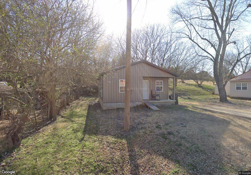
1009 Waddle St Pocahontas, AR 72455
Estimated Value: $67,728 - $120,000
--
Bed
1
Bath
720
Sq Ft
$125/Sq Ft
Est. Value
About This Home
This home is located at 1009 Waddle St, Pocahontas, AR 72455 and is currently estimated at $89,932, approximately $124 per square foot. 1009 Waddle St is a home located in Randolph County with nearby schools including Pocahontas Elementary School, M.D. Williams Middle School, and Pocahontas Junior High School.
Ownership History
Date
Name
Owned For
Owner Type
Purchase Details
Closed on
Dec 12, 2011
Sold by
High Melba
Bought by
Smith Jollie and Lawrence Roxanne
Current Estimated Value
Purchase Details
Closed on
Sep 20, 2000
Bought by
Land Commissioner To Girard
Purchase Details
Closed on
Sep 8, 2000
Bought by
Union Planters To High
Purchase Details
Closed on
Mar 30, 2000
Bought by
Commissioner To Union Planters
Purchase Details
Closed on
Jun 15, 1998
Bought by
Randolph Co To State
Purchase Details
Closed on
Nov 15, 1995
Bought by
Randolph To Girard
Purchase Details
Closed on
Jan 1, 1989
Bought by
Morris To Randolph
Purchase Details
Closed on
Jan 1, 1988
Bought by
High To Morris
Purchase Details
Closed on
Jan 1, 1985
Bought by
Morris To High
Create a Home Valuation Report for This Property
The Home Valuation Report is an in-depth analysis detailing your home's value as well as a comparison with similar homes in the area
Home Values in the Area
Average Home Value in this Area
Purchase History
| Date | Buyer | Sale Price | Title Company |
|---|---|---|---|
| Smith Jollie | -- | -- | |
| Land Commissioner To Girard | -- | -- | |
| Union Planters To High | $2,000 | -- | |
| Commissioner To Union Planters | -- | -- | |
| Randolph Co To State | -- | -- | |
| Randolph To Girard | $5,000 | -- | |
| Morris To Randolph | $9,000 | -- | |
| High To Morris | -- | -- | |
| Morris To High | -- | -- |
Source: Public Records
Tax History Compared to Growth
Tax History
| Year | Tax Paid | Tax Assessment Tax Assessment Total Assessment is a certain percentage of the fair market value that is determined by local assessors to be the total taxable value of land and additions on the property. | Land | Improvement |
|---|---|---|---|---|
| 2024 | $364 | $8,980 | $1,000 | $7,980 |
| 2023 | $364 | $8,980 | $1,000 | $7,980 |
| 2022 | $364 | $8,980 | $1,000 | $7,980 |
| 2021 | $41 | $1,000 | $1,000 | $0 |
| 2020 | $41 | $1,000 | $1,000 | $0 |
| 2019 | $41 | $1,000 | $1,000 | $0 |
| 2018 | $123 | $3,035 | $1,000 | $2,035 |
| 2017 | $104 | $2,815 | $1,000 | $1,815 |
| 2016 | $104 | $2,815 | $1,000 | $1,815 |
| 2015 | $104 | $2,815 | $1,000 | $1,815 |
| 2014 | $99 | $2,815 | $1,000 | $1,815 |
Source: Public Records
Map
Nearby Homes
- 1202 N Pratt St
- 1606 W Pyburn St
- 1508 W Pyburn St
- 907 N Pratt St
- 1506 N Pratt St
- 1700 Lewallen St
- 1504 N Park St
- 1212 Highland Blvd
- 2005 Frenken St
- 915 W Pyburn St
- 805 W Pyburn St
- 1305 Witt St
- 2100 Lee St
- 1801 Randolph St
- 1707 N Thomasville Ave
- 1715 Convent St
- 2301 Pyburn Extended
- 1803 N Park St
- 613 W Pine St
- 1004 Ridgecrest St
- 1001 Waddle St
- 1505 Dalton St
- 1005 Waddle St
- 1409 Dalton St
- 1109 N Weible St
- 1113 Jones St
- 1102 Hunter St
- 1202 N Weible St
- 1203 N Weible St
- 1005 N Weible St
- 1109 Jones St
- 905 Waddle St
- 1006 N Weible St
- 1206 N Weible St
- 1114 Jones St
- 1605 Dalton St
- 1003 N Weible St
- 0 Jones St
- 0 Waddle Ave
- 1106 Jones St