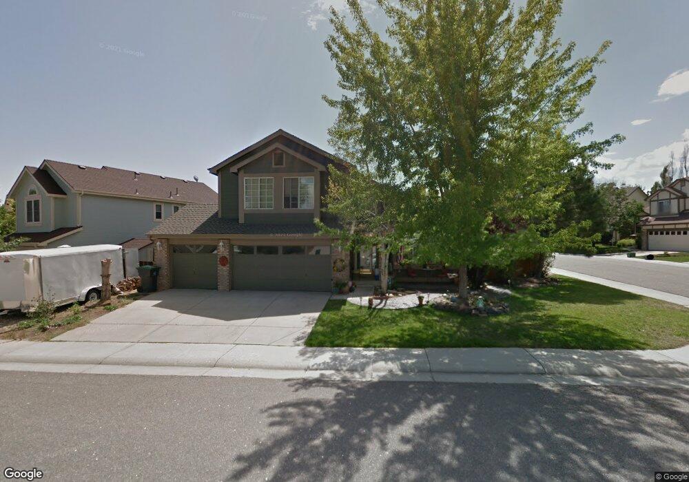
10098 Silvercliff Ln Littleton, CO 80125
Estimated Value: $619,000 - $760,000
4
Beds
3
Baths
2,318
Sq Ft
$304/Sq Ft
Est. Value
About This Home
This home is located at 10098 Silvercliff Ln, Littleton, CO 80125 and is currently estimated at $705,407, approximately $304 per square foot. 10098 Silvercliff Ln is a home located in Douglas County with nearby schools including Roxborough Elementary School, Roxborough Intermediate School, and Ranch View Middle School.
Ownership History
Date
Name
Owned For
Owner Type
Purchase Details
Closed on
May 12, 2004
Sold by
Packo Michael J and Packo Karrie A
Bought by
Didonato Ronald and Didonato Melissa
Current Estimated Value
Home Financials for this Owner
Home Financials are based on the most recent Mortgage that was taken out on this home.
Original Mortgage
$260,000
Outstanding Balance
$115,441
Interest Rate
4.75%
Mortgage Type
Unknown
Estimated Equity
$589,966
Purchase Details
Closed on
May 11, 1998
Sold by
Douglas Co Board Commissioners
Bought by
Executive Homes Roxborough Village
Purchase Details
Closed on
Jul 28, 1994
Sold by
U S Home Corp
Bought by
Packo Michael J and Packo Karrie A
Home Financials for this Owner
Home Financials are based on the most recent Mortgage that was taken out on this home.
Original Mortgage
$153,900
Interest Rate
8.3%
Create a Home Valuation Report for This Property
The Home Valuation Report is an in-depth analysis detailing your home's value as well as a comparison with similar homes in the area
Home Values in the Area
Average Home Value in this Area
Purchase History
| Date | Buyer | Sale Price | Title Company |
|---|---|---|---|
| Didonato Ronald | $325,000 | -- | |
| Executive Homes Roxborough Village | -- | -- | |
| Packo Michael J | $171,291 | -- |
Source: Public Records
Mortgage History
| Date | Status | Borrower | Loan Amount |
|---|---|---|---|
| Open | Didonato Ronald | $260,000 | |
| Previous Owner | Packo Michael J | $153,900 | |
| Closed | Didonato Ronald | $48,750 |
Source: Public Records
Tax History Compared to Growth
Tax History
| Year | Tax Paid | Tax Assessment Tax Assessment Total Assessment is a certain percentage of the fair market value that is determined by local assessors to be the total taxable value of land and additions on the property. | Land | Improvement |
|---|---|---|---|---|
| 2024 | $4,419 | $45,960 | $8,860 | $37,100 |
| 2023 | $4,448 | $45,960 | $8,860 | $37,100 |
| 2022 | $3,395 | $32,450 | $6,340 | $26,110 |
| 2021 | $3,547 | $32,450 | $6,340 | $26,110 |
| 2020 | $3,594 | $31,010 | $6,460 | $24,550 |
| 2019 | $3,652 | $31,010 | $6,460 | $24,550 |
| 2018 | $3,860 | $26,770 | $5,190 | $21,580 |
| 2017 | $3,709 | $26,770 | $5,190 | $21,580 |
| 2016 | $3,356 | $23,920 | $4,300 | $19,620 |
| 2015 | $3,467 | $23,920 | $4,300 | $19,620 |
| 2014 | $3,095 | $19,860 | $2,390 | $17,470 |
Source: Public Records
Map
Nearby Homes
- 8109 Mount Ouray Rd
- 8032 Mount Ouray Rd
- 8176 Locust Dr
- 8129 Locust Dr
- 9804 Rosalee Peak St
- 10441 Beech St
- 9780 Banner Peak St
- 9786 Rosalee Peak St
- 7888 Canvasback Cir
- 10448 Kicking Horse Dr
- 9613 Browns Peak Cir
- 9625 Browns Peak Cir
- 9617 Browns Peak Cir
- Panorama Plan at Prospect Village at Sterling Ranch - Townhomes
- Peak Plan at Prospect Village at Sterling Ranch - Townhomes
- 9753 Middle Peak St
- 8145 Monte Vista Cir
- 8433 Mount Kataka Loop
- 9790 Mount Kataka Point
- 8132 Mount Harvard Rd
- 10088 Silvercliff Ln
- 10068 Silvercliff Ln
- 10014 Westside Cir
- 10007 Westside Cir
- 10058 Silvercliff Ln
- 10005 Westside Cir
- 10009 Westside Cir
- 10016 Westside Cir
- 10011 Westside Cir
- 10099 Silvercliff Ln
- 10013 Westside Cir
- 10089 Silvercliff Ln
- 10079 Silvercliff Ln
- 10048 Silvercliff Ln
- 10069 Silvercliff Ln
- 10171 Westside Cir
- 10015 Westside Cir
- 8232 Westside St
- 10018 Westside Cir
- 10167 Westside Cir