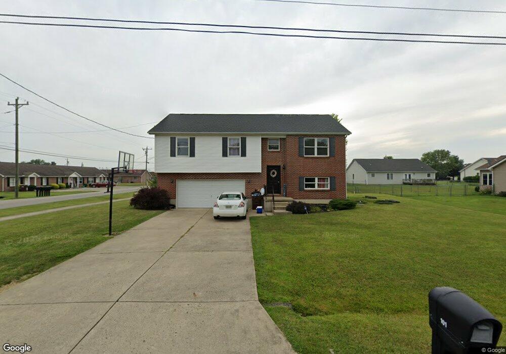
101 Boulder Dr Mount Orab, OH 45154
Estimated Value: $261,000 - $323,000
3
Beds
3
Baths
2,076
Sq Ft
$140/Sq Ft
Est. Value
About This Home
This home is located at 101 Boulder Dr, Mount Orab, OH 45154 and is currently estimated at $290,166, approximately $139 per square foot. 101 Boulder Dr is a home located in Brown County with nearby schools including Western Brown High School.
Ownership History
Date
Name
Owned For
Owner Type
Purchase Details
Closed on
Mar 19, 2008
Sold by
Va
Bought by
Tull Tommy and Tull Tommy L
Current Estimated Value
Home Financials for this Owner
Home Financials are based on the most recent Mortgage that was taken out on this home.
Original Mortgage
$115,225
Interest Rate
6.01%
Mortgage Type
VA
Purchase Details
Closed on
Dec 19, 2007
Sold by
Millhouse Danny J
Bought by
Va
Purchase Details
Closed on
Sep 30, 2005
Sold by
Breeze Jarrod D
Bought by
Millhouse Danny J
Home Financials for this Owner
Home Financials are based on the most recent Mortgage that was taken out on this home.
Original Mortgage
$135,757
Interest Rate
5.82%
Mortgage Type
VA
Create a Home Valuation Report for This Property
The Home Valuation Report is an in-depth analysis detailing your home's value as well as a comparison with similar homes in the area
Home Values in the Area
Average Home Value in this Area
Purchase History
| Date | Buyer | Sale Price | Title Company |
|---|---|---|---|
| Tull Tommy | -- | None Available | |
| Va | $105,756 | None Available | |
| Millhouse Danny J | $132,900 | Advanced Land Title Agency |
Source: Public Records
Mortgage History
| Date | Status | Borrower | Loan Amount |
|---|---|---|---|
| Previous Owner | Tull Tommy | $115,225 | |
| Previous Owner | Millhouse Danny J | $135,757 |
Source: Public Records
Tax History Compared to Growth
Tax History
| Year | Tax Paid | Tax Assessment Tax Assessment Total Assessment is a certain percentage of the fair market value that is determined by local assessors to be the total taxable value of land and additions on the property. | Land | Improvement |
|---|---|---|---|---|
| 2024 | $2,603 | $83,920 | $4,730 | $79,190 |
| 2023 | $2,603 | $45,240 | $4,160 | $41,080 |
| 2022 | $1,520 | $45,240 | $4,160 | $41,080 |
| 2021 | $1,459 | $45,240 | $4,160 | $41,080 |
| 2020 | $1,281 | $37,700 | $3,470 | $34,230 |
| 2019 | $1,366 | $34,310 | $3,470 | $30,840 |
| 2018 | $1,228 | $34,310 | $3,470 | $30,840 |
| 2017 | $1,200 | $32,680 | $3,470 | $29,210 |
| 2016 | $1,200 | $32,680 | $3,470 | $29,210 |
| 2015 | $113 | $3,150 | $3,150 | $0 |
| 2014 | $113 | $3,150 | $3,150 | $0 |
| 2013 | $113 | $3,150 | $3,150 | $0 |
Source: Public Records
Map
Nearby Homes
- 103 Stone Trace Dr
- 108 Boulder Dr
- 100 Longwood Blvd
- 115 Sweet Bay Trail
- 153 Willow Run Rd
- 3524 Pleasant Hill Rd
- 3305 Pleasant Hill Rd
- 0 State Route 32 Unit 1795308
- 216 Red Bud Ln
- 309 1/2 Water St
- 408 Smith Ave
- 100 Robin Ave
- 329 E Main St
- 213 Katelin Ln
- 402 E Main St
- 204 Katelin Ln
- 14663 Day Rd
- 506 E Main St
- 781 S High St
- 2437 Tri County Hwy
- 101 Boulder Dr
- 103 Boulder Dr
- 100 Nathans Ln
- 102 Boulder Dr
- 185 Boyd Rd Unit 189
- 102 Nathans Ln
- 104 Boulder Dr
- 105 Boulder Dr
- 104 Nathans Ln
- 106 Boulder Dr
- 103 Stone Trace Dr
- 101 Nathans Ln
- 101 Stone Trace Dr
- 103 Nathans Ln
- 106 Nathans Ln
- 105 Stone Trace Dr
- 107 Boulder Dr
- 105 Nathans Ln
- 102 Stone Trace Dr
- 100 Baylie Dr