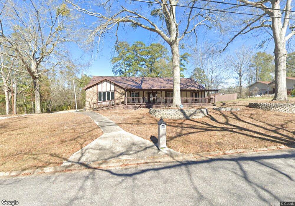
101 Christopher Dr Enterprise, AL 36330
Estimated Value: $174,000 - $258,000
3
Beds
2
Baths
1,998
Sq Ft
$106/Sq Ft
Est. Value
About This Home
This home is located at 101 Christopher Dr, Enterprise, AL 36330 and is currently estimated at $211,353, approximately $105 per square foot. 101 Christopher Dr is a home located in Coffee County with nearby schools including Harrand Creek Elementary School, Dauphin Junior High School, and Enterprise High School.
Ownership History
Date
Name
Owned For
Owner Type
Purchase Details
Closed on
Feb 12, 2025
Sold by
Federal Home Loan Mortgage Corporation
Bought by
Bond Tristi
Current Estimated Value
Home Financials for this Owner
Home Financials are based on the most recent Mortgage that was taken out on this home.
Original Mortgage
$157,700
Outstanding Balance
$156,488
Interest Rate
6.91%
Mortgage Type
New Conventional
Estimated Equity
$54,865
Purchase Details
Closed on
Oct 7, 2008
Sold by
Jackson Martha S
Bought by
Mccord Mark C and Mccord Florence Elaine
Home Financials for this Owner
Home Financials are based on the most recent Mortgage that was taken out on this home.
Original Mortgage
$176,208
Interest Rate
5.96%
Create a Home Valuation Report for This Property
The Home Valuation Report is an in-depth analysis detailing your home's value as well as a comparison with similar homes in the area
Purchase History
| Date | Buyer | Sale Price | Title Company |
|---|---|---|---|
| Bond Tristi | $166,000 | None Listed On Document | |
| Bond Tristi | $166,000 | None Listed On Document | |
| Mccord Mark C | -- | -- |
Source: Public Records
Mortgage History
| Date | Status | Borrower | Loan Amount |
|---|---|---|---|
| Open | Bond Tristi | $157,700 | |
| Closed | Bond Tristi | $157,700 | |
| Previous Owner | Mccord Mark C | $176,208 |
Source: Public Records
Tax History
| Year | Tax Paid | Tax Assessment Tax Assessment Total Assessment is a certain percentage of the fair market value that is determined by local assessors to be the total taxable value of land and additions on the property. | Land | Improvement |
|---|---|---|---|---|
| 2024 | $2,075 | $43,140 | $5,715 | $37,425 |
| 2023 | $1,923 | $36,008 | $5,600 | $30,408 |
| 2022 | $0 | $18,020 | $0 | $0 |
| 2021 | $0 | $16,120 | $0 | $0 |
| 2020 | $0 | $15,600 | $0 | $0 |
| 2019 | $626 | $15,600 | $0 | $0 |
| 2018 | $626 | $14,780 | $0 | $0 |
| 2017 | $627 | $14,800 | $0 | $0 |
| 2016 | $636 | $15,020 | $0 | $0 |
| 2015 | $636 | $15,020 | $0 | $0 |
| 2014 | $632 | $14,920 | $0 | $0 |
| 2013 | $633 | $0 | $0 | $0 |
Source: Public Records
Map
Nearby Homes
- 287 County Road 755
- 209 Wildwood Dr
- 322 Lakes Dr
- 114 Iroquois Rd
- 216 Morgan Ln
- 302 Robin Ln
- 608 Wildwood Dr
- 105 Comanche St
- 203 W Emerald Dr
- 208 Deerfield Dr
- 406 Iroquois Rd
- 202 Deerfield Dr
- 311 Antler Dr
- 117 Deerfield Dr
- 105 Deerfield Dr
- 170 Commons Dr
- 120 Crestview Dr
- 117 Foxhill Dr
- 121 Lightfoot Dr
- 119 Frisco Ln
- 103 Christopher Dr
- 116 Harrand Creek Dr
- 204 Harrand Creek Dr
- 201 Harrand Creek Dr
- 203 Harrand Creek Dr
- 203 Harrand Creek Dr
- 105 Christopher Dr
- 102 Christopher Dr
- 117 Harrand Creek Dr
- 206 Harrand Creek Dr
- 114 Harrand Creek Dr
- 114 Harrand Creek Dr
- 107 Christopher Dr
- 208 Harrand Creek Dr
- 207 Harrand Creek Dr
- 115 Harrand Creek Dr
- 209 Harrand Creek Dr
- 112 Harrand Creek Dr
- 106 Christopher Dr
- 211 Harrand Creek Dr
Your Personal Tour Guide
Ask me questions while you tour the home.