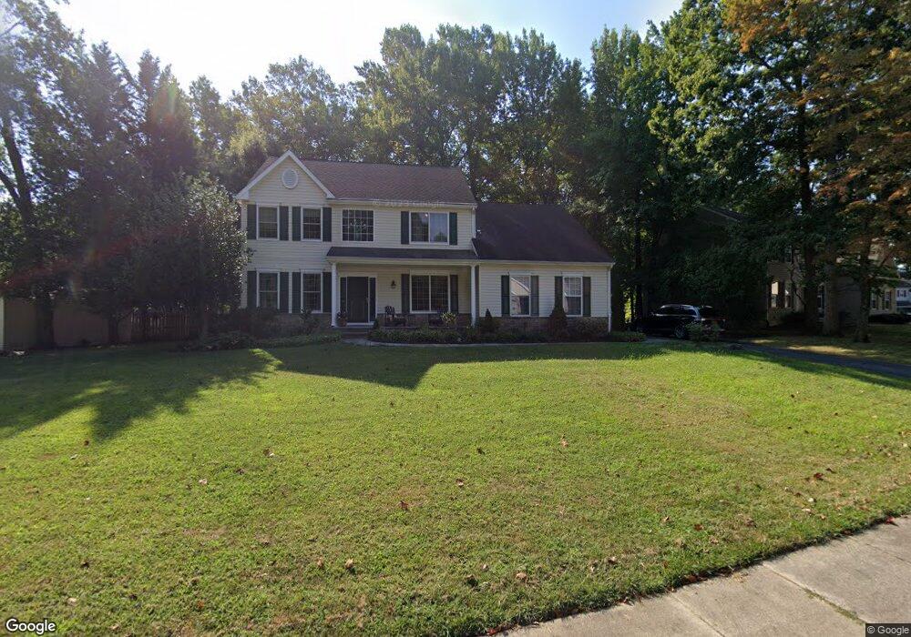
101 Michaels Ln Newark, DE 19713
Estimated Value: $351,000 - $574,000
4
Beds
3
Baths
2,452
Sq Ft
$192/Sq Ft
Est. Value
About This Home
This home is located at 101 Michaels Ln, Newark, DE 19713 and is currently estimated at $471,876, approximately $192 per square foot. 101 Michaels Ln is a home located in New Castle County with nearby schools including Smith (Jennie E.) Elementary School, Christiana High School, and Kirk (George V.) Middle School.
Ownership History
Date
Name
Owned For
Owner Type
Purchase Details
Closed on
Mar 12, 2002
Sold by
Corrigan Kimberly A
Bought by
Corrigan Kimberly A and Frenze Gerard J
Current Estimated Value
Home Financials for this Owner
Home Financials are based on the most recent Mortgage that was taken out on this home.
Original Mortgage
$194,600
Interest Rate
7.04%
Create a Home Valuation Report for This Property
The Home Valuation Report is an in-depth analysis detailing your home's value as well as a comparison with similar homes in the area
Home Values in the Area
Average Home Value in this Area
Purchase History
| Date | Buyer | Sale Price | Title Company |
|---|---|---|---|
| Corrigan Kimberly A | $48,600 | Commonwealth Land Title Ins |
Source: Public Records
Mortgage History
| Date | Status | Borrower | Loan Amount |
|---|---|---|---|
| Closed | Corrigan Kimberly A | $194,600 |
Source: Public Records
Tax History Compared to Growth
Tax History
| Year | Tax Paid | Tax Assessment Tax Assessment Total Assessment is a certain percentage of the fair market value that is determined by local assessors to be the total taxable value of land and additions on the property. | Land | Improvement |
|---|---|---|---|---|
| 2024 | $4,278 | $97,200 | $17,400 | $79,800 |
| 2023 | $4,177 | $97,200 | $17,400 | $79,800 |
| 2022 | $4,152 | $97,200 | $17,400 | $79,800 |
| 2021 | $4,066 | $97,200 | $17,400 | $79,800 |
| 2020 | $3,963 | $97,200 | $17,400 | $79,800 |
| 2019 | $3,814 | $97,200 | $17,400 | $79,800 |
| 2018 | $3,441 | $97,200 | $17,400 | $79,800 |
| 2017 | $3,324 | $97,200 | $17,400 | $79,800 |
| 2016 | $3,293 | $97,200 | $17,400 | $79,800 |
| 2015 | $3,010 | $97,200 | $17,400 | $79,800 |
| 2014 | $3,023 | $97,200 | $17,400 | $79,800 |
Source: Public Records
Map
Nearby Homes
- 135 Salem Church Rd
- 1200 Chelmsford Cir
- 12 Martin Dr
- 3 E Regal Blvd
- 3027 Ogletown Rd
- 10 Davies Rd
- 42 Lynch Farm Dr
- 59 E Shady Dr
- 713 Birchwood Dr
- 1705 Mel Ln
- 6 Maywood Dr
- 731 Rosemary Way
- 210 Felix Dr
- 725 Rosemary Way
- Schubert Plan at Chestnut Hill Preserve - Townhomes
- Mendelssohn Plan at Chestnut Hill Preserve - Townhomes
- 138 Felix Dr
- 29 N Skyward Dr
- 907 Greentree Rd
- 46 Upland Ct
- 105 Michaels Ln
- 202 Tessa Ct
- 204 Tessa Ct
- 206 Tessa Ct
- 102 Michaels Ln
- 104 Michaels Ln
- 107 Michaels Ln
- 100 Michaels Ln
- 106 Michaels Ln
- 208 Tessa Ct
- 109 Michaels Ln
- 111 Michaels Ln
- 110 Michaels Ln
- 133 Gumspring Rd
- 133 1/2 Gumspring Rd
- 103 Salem Church Rd
- 121 Gumspring Rd
- 411 Stanley Plaza Blvd
- 409 Stanley Plaza Blvd
- 407 Stanley Plaza Blvd