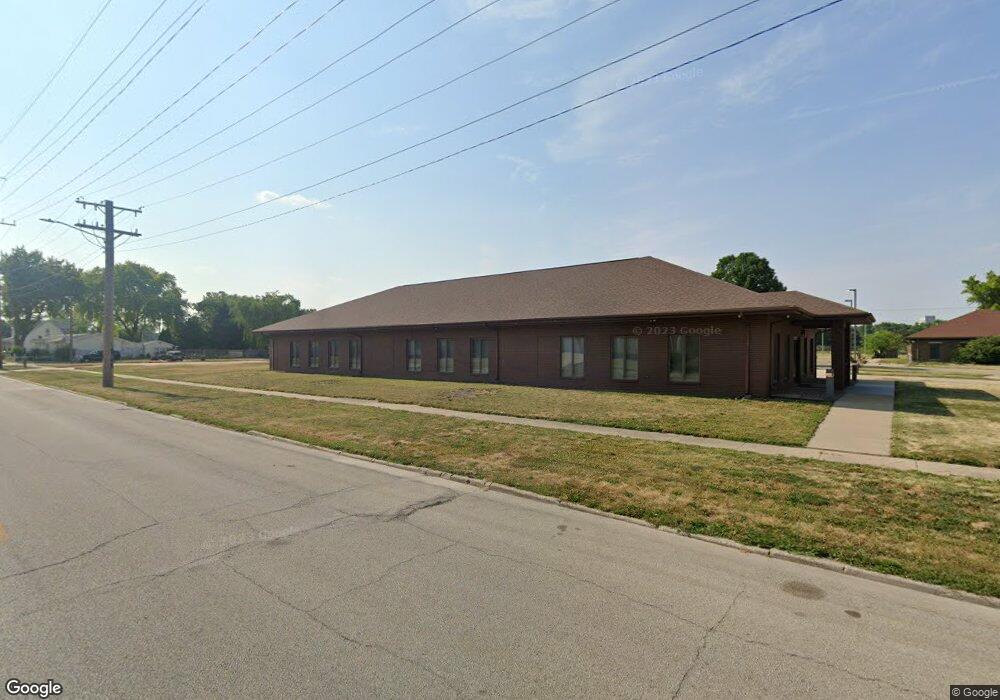
101 N 16th St Springfield, IL 62703
Pioneer Park NeighborhoodEstimated Value: $159,128
Studio
--
Bath
4,620
Sq Ft
$34/Sq Ft
Est. Value
About This Home
This home is located at 101 N 16th St, Springfield, IL 62703 and is currently estimated at $159,128, approximately $34 per square foot. 101 N 16th St is a home located in Sangamon County with nearby schools including Fairview Elementary School, Washington Middle School, and Lanphier High School.
Ownership History
Date
Name
Owned For
Owner Type
Purchase Details
Closed on
Oct 12, 2021
Sold by
United Cerebral Palsy Of The Land Of Lin
Bought by
Ruby Funeral Services & Crematories Inc
Current Estimated Value
Home Financials for this Owner
Home Financials are based on the most recent Mortgage that was taken out on this home.
Original Mortgage
$94,400
Interest Rate
2.8%
Mortgage Type
Construction
Purchase Details
Closed on
Jun 14, 2005
Purchase Details
Closed on
Mar 15, 2001
Create a Home Valuation Report for This Property
The Home Valuation Report is an in-depth analysis detailing your home's value as well as a comparison with similar homes in the area
Home Values in the Area
Average Home Value in this Area
Purchase History
| Date | Buyer | Sale Price | Title Company |
|---|---|---|---|
| Ruby Funeral Services & Crematories Inc | $118,000 | Sorling Northrup | |
| -- | -- | -- | |
| -- | $240,000 | -- |
Source: Public Records
Mortgage History
| Date | Status | Borrower | Loan Amount |
|---|---|---|---|
| Closed | Ruby Funeral Services & Crematories Inc | $94,400 |
Source: Public Records
Tax History
| Year | Tax Paid | Tax Assessment Tax Assessment Total Assessment is a certain percentage of the fair market value that is determined by local assessors to be the total taxable value of land and additions on the property. | Land | Improvement |
|---|---|---|---|---|
| 2024 | $7,390 | $87,979 | $8,010 | $79,969 |
| 2023 | $7,105 | $80,360 | $7,316 | $73,044 |
| 2022 | $3,933 | $43,896 | $6,940 | $36,956 |
| 2021 | $762 | $8,470 | $1,587 | $6,883 |
| 2020 | $0 | $0 | $0 | $0 |
| 2019 | $0 | $0 | $0 | $0 |
| 2018 | $0 | $0 | $0 | $0 |
| 2017 | $0 | $0 | $0 | $0 |
| 2016 | $0 | $0 | $0 | $0 |
| 2015 | -- | $0 | $0 | $0 |
| 2014 | -- | $0 | $0 | $0 |
| 2013 | -- | $0 | $0 | $0 |
Source: Public Records
Map
Nearby Homes
- 1415 E Jefferson St
- 1405 E Edwards St
- 1521 E Matheny Ave
- 810 E Edwards St
- 2236 E Adams St
- 8 S Old State Capitol Plaza Unit A
- 222 S David St
- 718 S 7th St Unit 1003
- 718 S 7th St Unit 405
- 718 S 7th St Unit 904
- 253 White City Blvd
- 1401 Enterprise St
- 930 N 8th St
- 1119 N 11th St
- 1129 E Reservoir St
- 1037 N 8th St
- 300 Forrest Ave Unit 62
- 300 Forrest Ave Unit 107
- 300 Forrest Ave Unit 109
- 1111 N Albany St Unit 1
- 120 N 15th St
- 1530 E Washington St
- 116 N 15th St
- 1506 E Washington St
- 1500 E Washington St
- 1504 E Washington St
- 130 N 16th St
- 122 N 15th St
- 1429 E Washington St
- 1419 E Washington St
- 1527 E Adams St
- 1515 E Adams St
- 1507 E Adams St
- 1417 E Washington St
- 1509 E Adams St
- 1420 E Washington St
- 1501 E Adams St
- 1411 E Washington St
- 1603 E Adams St
- 1414 E Washington St
Your Personal Tour Guide
Ask me questions while you tour the home.