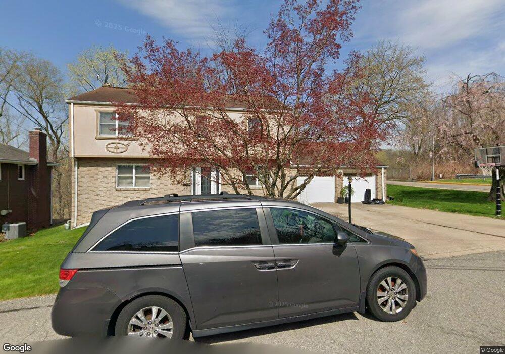
101 Red Bird Point Ln Pittsburgh, PA 15202
Estimated Value: $340,000 - $505,000
3
Beds
3
Baths
1,748
Sq Ft
$227/Sq Ft
Est. Value
About This Home
This home is located at 101 Red Bird Point Ln, Pittsburgh, PA 15202 and is currently estimated at $396,187, approximately $226 per square foot. 101 Red Bird Point Ln is a home located in Allegheny County with nearby schools including Avonworth Elementary School, Avonworth Middle School, and Avonworth High School.
Ownership History
Date
Name
Owned For
Owner Type
Purchase Details
Closed on
Jan 31, 2008
Sold by
Murphey Matthew C
Bought by
Le Simon T
Current Estimated Value
Home Financials for this Owner
Home Financials are based on the most recent Mortgage that was taken out on this home.
Original Mortgage
$194,850
Interest Rate
6.13%
Mortgage Type
New Conventional
Purchase Details
Closed on
Oct 5, 2004
Sold by
Dunham David
Bought by
Murphey Matthew
Home Financials for this Owner
Home Financials are based on the most recent Mortgage that was taken out on this home.
Original Mortgage
$157,000
Interest Rate
5.81%
Mortgage Type
New Conventional
Create a Home Valuation Report for This Property
The Home Valuation Report is an in-depth analysis detailing your home's value as well as a comparison with similar homes in the area
Home Values in the Area
Average Home Value in this Area
Purchase History
| Date | Buyer | Sale Price | Title Company |
|---|---|---|---|
| Le Simon T | $216,500 | -- | |
| Murphey Matthew | $196,000 | -- |
Source: Public Records
Mortgage History
| Date | Status | Borrower | Loan Amount |
|---|---|---|---|
| Previous Owner | Le Simon T | $194,850 | |
| Previous Owner | Murphey Matthew | $157,000 |
Source: Public Records
Tax History Compared to Growth
Tax History
| Year | Tax Paid | Tax Assessment Tax Assessment Total Assessment is a certain percentage of the fair market value that is determined by local assessors to be the total taxable value of land and additions on the property. | Land | Improvement |
|---|---|---|---|---|
| 2025 | $5,873 | $185,300 | $36,200 | $149,100 |
| 2024 | $5,873 | $185,300 | $36,200 | $149,100 |
| 2023 | $5,536 | $185,300 | $36,200 | $149,100 |
| 2022 | $5,414 | $185,300 | $36,200 | $149,100 |
| 2021 | $1,603 | $185,300 | $36,200 | $149,100 |
| 2020 | $5,414 | $185,300 | $36,200 | $149,100 |
| 2019 | $5,149 | $185,300 | $36,200 | $149,100 |
| 2018 | $876 | $185,300 | $36,200 | $149,100 |
| 2017 | $5,069 | $185,300 | $36,200 | $149,100 |
| 2016 | $876 | $185,300 | $36,200 | $149,100 |
| 2015 | $876 | $185,300 | $36,200 | $149,100 |
| 2014 | $5,070 | $185,300 | $36,200 | $149,100 |
Source: Public Records
Map
Nearby Homes
- 83 Gibson St
- 184 Superior Ave
- 7504 Brighton Rd
- 8179 Ohio River Blvd Unit 32
- 8179 Ohio River Blvd Unit 36
- 99 Maple Ave
- 331 Eicher Rd
- 320 Dalzell Ave
- 213 Pennsylvania Ave
- 217 Pennsylvania Ave
- 326 Breading Ave
- 8298 Ohio River Blvd
- 223 Hazelwood Ave
- 241 Hazelwood Ave
- 239 Allison Ave
- 391 Roosevelt Rd
- 0 Forest Ave Unit 1712039
- 228 Sylvan Walk
- 248 Berringer Place
- 4 Thornridge Rd
- 103 Red Bird Point Ln
- 91 Center Ave
- 102 Red Bird Point Ln
- 104 Red Bird Point Ln
- 85 Center Ave
- 83 Center Ave
- 107 Red Bird Point Ln
- 107 Redbird Point Ln
- 106 Red Bird Point Ln
- 86 Camp Horne Rd
- 79 Center Ave
- 54 Hiland Ave
- 73 Center Ave
- 52 Hiland Ave
- 92 Courtney St
- 48 Pittsburgh St
- 77 Courtney St
- 73 Hiland Ave
- 90 Courtney St
- 80 Courtney St