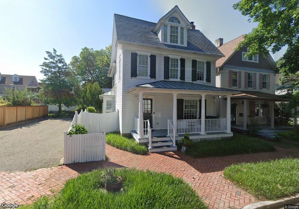
101 S Queen St Chestertown, MD 21620
Estimated Value: $661,000 - $690,000
--
Bed
3
Baths
2,322
Sq Ft
$288/Sq Ft
Est. Value
About This Home
This home is located at 101 S Queen St, Chestertown, MD 21620 and is currently estimated at $669,745, approximately $288 per square foot. 101 S Queen St is a home located in Kent County with nearby schools including Center for Innovation, Kent County Middle School, and Kent County High School.
Ownership History
Date
Name
Owned For
Owner Type
Purchase Details
Closed on
Dec 9, 2003
Sold by
O'Brien Linda A
Bought by
Harvey Robert Allen Trustee
Current Estimated Value
Purchase Details
Closed on
Feb 24, 2000
Sold by
O'Brien Robert F and O'Brien Linda A
Bought by
O'Brien Linda A
Purchase Details
Closed on
Apr 27, 1999
Sold by
Foley Edith N
Bought by
O'Brien Robert F and O'Brien Linda A
Create a Home Valuation Report for This Property
The Home Valuation Report is an in-depth analysis detailing your home's value as well as a comparison with similar homes in the area
Home Values in the Area
Average Home Value in this Area
Purchase History
| Date | Buyer | Sale Price | Title Company |
|---|---|---|---|
| Harvey Robert Allen Trustee | $359,000 | -- | |
| O'Brien Linda A | -- | -- | |
| O'Brien Robert F | $149,000 | -- |
Source: Public Records
Tax History Compared to Growth
Tax History
| Year | Tax Paid | Tax Assessment Tax Assessment Total Assessment is a certain percentage of the fair market value that is determined by local assessors to be the total taxable value of land and additions on the property. | Land | Improvement |
|---|---|---|---|---|
| 2025 | $8,391 | $535,400 | $251,200 | $284,200 |
| 2024 | $8,070 | $514,900 | $0 | $0 |
| 2023 | $7,748 | $494,400 | $0 | $0 |
| 2022 | $7,380 | $473,900 | $251,200 | $222,700 |
| 2021 | $7,338 | $471,067 | $0 | $0 |
| 2020 | $7,338 | $468,233 | $0 | $0 |
| 2019 | $7,279 | $465,400 | $251,200 | $214,200 |
| 2018 | $7,232 | $465,400 | $251,200 | $214,200 |
| 2017 | $7,000 | $465,400 | $0 | $0 |
| 2016 | -- | $465,400 | $0 | $0 |
| 2015 | $7,362 | $465,400 | $0 | $0 |
| 2014 | $7,362 | $465,400 | $0 | $0 |
Source: Public Records
Map
Nearby Homes
- 105 High St
- 228 S Water St
- 206 Cannon St
- 206 S Water St
- 349 High St
- 349 & 351 High St
- 200 Washington Ave
- 517 High St
- 109 S College Ave
- 611 Cannon St
- 234 N College Ave
- 222 Mount Vernon Ave
- 423 Calvert St
- 0 East St
- 118 Little Harbor Way Unit 202
- 36 Landing Ln
- 103 Landing Ln
- 37 Landing Ln
- 35 Landing Ln
- 25 Landing Ln