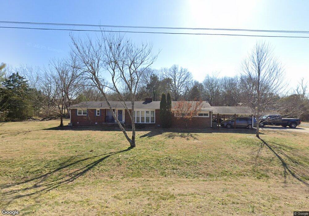
101 Stable Rd Franklin, TN 37069
Estimated Value: $649,000 - $1,025,000
Studio
2
Baths
2,208
Sq Ft
$354/Sq Ft
Est. Value
About This Home
This home is located at 101 Stable Rd, Franklin, TN 37069 and is currently estimated at $780,735, approximately $353 per square foot. 101 Stable Rd is a home located in Williamson County with nearby schools including Walnut Grove Elementary School, Grassland Middle School, and Franklin High School.
Ownership History
Date
Name
Owned For
Owner Type
Purchase Details
Closed on
Aug 30, 2013
Sold by
Stewart Brenda C
Bought by
Payne Michael and Payne Meghan
Current Estimated Value
Home Financials for this Owner
Home Financials are based on the most recent Mortgage that was taken out on this home.
Original Mortgage
$120,000
Outstanding Balance
$29,885
Interest Rate
4.39%
Mortgage Type
New Conventional
Estimated Equity
$750,850
Purchase Details
Closed on
Mar 31, 2003
Sold by
Brannon Kathleen L
Bought by
Stewart Brenda C
Home Financials for this Owner
Home Financials are based on the most recent Mortgage that was taken out on this home.
Original Mortgage
$128,000
Interest Rate
5.82%
Purchase Details
Closed on
Nov 21, 1997
Sold by
Brannon Thomas R
Bought by
Brannon Kathleen L
Purchase Details
Closed on
Nov 30, 1993
Sold by
Crane Mary C
Bought by
Brannon Thomas R
Create a Home Valuation Report for This Property
The Home Valuation Report is an in-depth analysis detailing your home's value as well as a comparison with similar homes in the area
Purchase History
| Date | Buyer | Sale Price | Title Company |
|---|---|---|---|
| Payne Michael | $150,000 | None Available | |
| Stewart Brenda C | $160,000 | -- | |
| Brannon Kathleen L | -- | -- | |
| Brannon Thomas R | $97,357 | -- |
Source: Public Records
Mortgage History
| Date | Status | Borrower | Loan Amount |
|---|---|---|---|
| Open | Payne Michael | $120,000 | |
| Previous Owner | Stewart Brenda C | $128,000 | |
| Closed | Stewart Brenda C | $24,000 |
Source: Public Records
Tax History
| Year | Tax Paid | Tax Assessment Tax Assessment Total Assessment is a certain percentage of the fair market value that is determined by local assessors to be the total taxable value of land and additions on the property. | Land | Improvement |
|---|---|---|---|---|
| 2025 | $2,063 | $160,600 | $60,000 | $100,600 |
| 2024 | $2,063 | $109,725 | $32,500 | $77,225 |
| 2023 | $2,063 | $109,725 | $32,500 | $77,225 |
| 2022 | $2,063 | $109,725 | $32,500 | $77,225 |
| 2021 | $2,063 | $109,725 | $32,500 | $77,225 |
| 2020 | $1,699 | $76,525 | $22,500 | $54,025 |
| 2019 | $1,699 | $76,525 | $22,500 | $54,025 |
| 2018 | $1,645 | $76,525 | $22,500 | $54,025 |
| 2017 | $1,645 | $76,525 | $22,500 | $54,025 |
Source: Public Records
Map
Nearby Homes
- 1109 Howell Dr
- 113 Pine Circle Dr
- 201 Lake Ridge Ct
- 604 Meadowgreen Dr
- 148 Cavalcade Cir
- 1009 Chapel Ct
- 1001 Chapel Ct
- 1013 Chapel Ct
- 352 Cannonade Cir
- 504 Lake Valley Ct
- 108 Ben Brush Cir
- 346 Colt Ln
- 902 Idlewild Ct
- 406 Reigh Ct
- 210 Cotton Ln
- 320 Cotton Ln
- 2002 Glastonbury Dr
- 114 Stanton Hall Ln Unit 114
- 18 Holland Park Ln Unit 18
- 213 Winburn Ln
- 1709 Hillsboro Rd
- 102 Stable Rd
- 111 Stable Rd
- 101 Pine Circle Dr
- 112 Stable Rd
- 115 Stable Rd
- 1707 Hillsboro Rd
- 112 Meadowgreen Dr
- 1712 Hillsboro Rd
- 116 Meadowgreen Dr
- 103 Pine Circle Dr
- 116 Stable Rd
- 1100 Howell Dr
- 117 Stable Rd
- 118 Meadowgreen Dr
- 1105 Howell Dr
- 102 Pine Circle Dr
- 122 Meadowgreen Dr
- 1104 Brookside Dr
- 1808 Hillsboro Rd
Your Personal Tour Guide
Ask me questions while you tour the home.