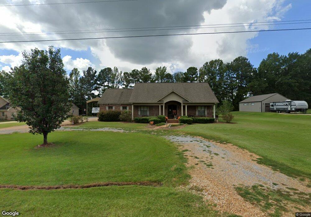
101 Swayze St Mathiston, MS 39752
Estimated Value: $243,547 - $387,000
3
Beds
--
Bath
2,914
Sq Ft
$119/Sq Ft
Est. Value
About This Home
This home is located at 101 Swayze St, Mathiston, MS 39752 and is currently estimated at $347,137, approximately $119 per square foot. 101 Swayze St is a home with nearby schools including East Webster Elementary School and East Webster High School.
Ownership History
Date
Name
Owned For
Owner Type
Purchase Details
Closed on
Jul 29, 2021
Sold by
Urban South Builders Llc
Bought by
South House Porperties Llc
Current Estimated Value
Purchase Details
Closed on
Mar 26, 2009
Sold by
Stokes Terri B Kohen and Stokes Ronald W
Bought by
Mccurdy Mark S and Mccurdy Tara B
Home Financials for this Owner
Home Financials are based on the most recent Mortgage that was taken out on this home.
Original Mortgage
$171,475
Interest Rate
5.14%
Purchase Details
Closed on
Dec 6, 2005
Sold by
Apac
Bought by
Kohen Terri B
Purchase Details
Closed on
May 16, 2005
Sold by
Norwood Keeneth Wayne
Bought by
Kohen Terri B
Create a Home Valuation Report for This Property
The Home Valuation Report is an in-depth analysis detailing your home's value as well as a comparison with similar homes in the area
Purchase History
| Date | Buyer | Sale Price | Title Company |
|---|---|---|---|
| South House Porperties Llc | -- | Burchfield Law Firm Pllc | |
| Mccurdy Mark S | -- | -- | |
| Kohen Terri B | -- | -- | |
| Kohen Terri B | -- | -- |
Source: Public Records
Mortgage History
| Date | Status | Borrower | Loan Amount |
|---|---|---|---|
| Previous Owner | Kohen Terri B | $171,475 |
Source: Public Records
Tax History
| Year | Tax Paid | Tax Assessment Tax Assessment Total Assessment is a certain percentage of the fair market value that is determined by local assessors to be the total taxable value of land and additions on the property. | Land | Improvement |
|---|---|---|---|---|
| 2025 | $2,316 | $19,328 | $1,400 | $17,928 |
| 2024 | $2,316 | $19,328 | $1,400 | $17,928 |
| 2023 | $2,344 | $19,328 | $1,400 | $17,928 |
| 2022 | $2,291 | $19,328 | $1,400 | $17,928 |
| 2021 | $2,057 | $17,664 | $1,400 | $16,264 |
| 2020 | $2,062 | $17,664 | $1,400 | $16,264 |
| 2019 | $2,053 | $17,664 | $1,400 | $16,264 |
| 2018 | $2,038 | $17,664 | $1,400 | $16,264 |
| 2017 | $1,934 | $16,456 | $1,400 | $15,056 |
| 2016 | $1,569 | $16,456 | $1,400 | $15,056 |
| 2015 | -- | $16,456 | $1,400 | $15,056 |
| 2014 | -- | $16,456 | $1,400 | $15,056 |
| 2013 | -- | $15,372 | $1,400 | $13,972 |
Source: Public Records
Map
Nearby Homes
- 220 Paisley Ln
- TBD Mississippi 15
- 0 Mississippi 15
- 218 College St
- 106 Corey’s Dr
- 1363 Spring Valley Rd
- 314 Natchez Trace Rd
- Lot 2 Mississippi 15
- Lot 3 Mississippi 15
- 1799 Maben Starkville Rd
- 1582 Maben Starkville Rd
- 0 Highway 82 W Unit 25-2325
- 0 Highway 82 W Unit 25-532
- 0 Maben-Bell Schoolhouse Rd Unit 25-2082
- Reed Rd
- 0 Hatcher Rd
- 59 Whitetail Dr
- Highway 82
- 01 Highway 82
- 4679 Lagrange Rd
- 77 Swayze St
- 163 Swayze St
- 45 Swayze St
- 123 Swayze St
- 143 Swayze St
- 11 Swayze St
- 147 Mckinley Rd
- 215 Paisley Ln
- 39 Caitlin Ave
- 213 Caitlin Ave
- 273 Caitlin Ave
- 241 Caitlin Ave
- 267 Caitlin Ave
- 187 Caitlin Ave
- 177 Caitlin Ave
- 121 Caitlin Ave
- 40 Caitlin Ave
- 100 Paisley Ln
- 155 Caitlin Ave
- 113 Mckinley Rd
Your Personal Tour Guide
Ask me questions while you tour the home.