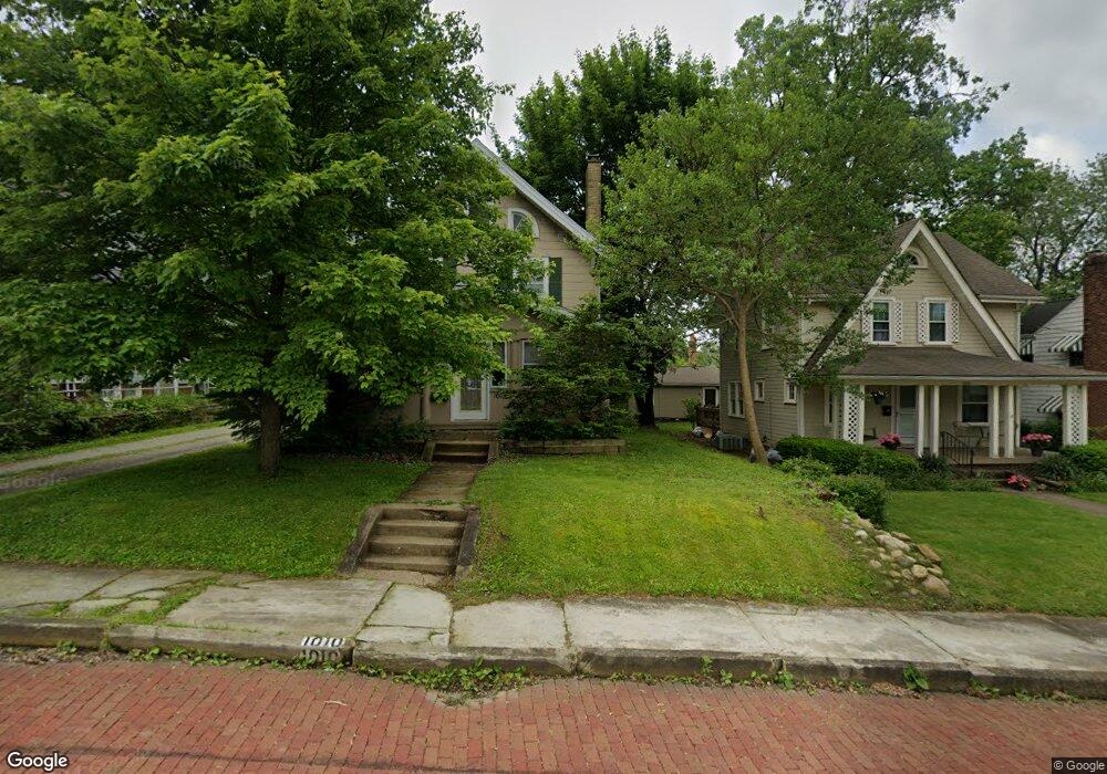
1010 25th St NE Canton, OH 44714
Colonial Heights NeighborhoodEstimated Value: $149,512 - $178,000
3
Beds
2
Baths
1,836
Sq Ft
$91/Sq Ft
Est. Value
About This Home
This home is located at 1010 25th St NE, Canton, OH 44714 and is currently estimated at $166,378, approximately $90 per square foot. 1010 25th St NE is a home located in Stark County with nearby schools including Belle Stone Elementary School, Early Learning Center @ Schreiber, and Youtz Intermediate School.
Ownership History
Date
Name
Owned For
Owner Type
Purchase Details
Closed on
Dec 4, 1996
Sold by
Sanders E W
Bought by
Wilson David H and Wilson Iris
Current Estimated Value
Home Financials for this Owner
Home Financials are based on the most recent Mortgage that was taken out on this home.
Original Mortgage
$71,750
Outstanding Balance
$7,432
Interest Rate
7.91%
Mortgage Type
New Conventional
Estimated Equity
$158,946
Purchase Details
Closed on
Sep 21, 1988
Create a Home Valuation Report for This Property
The Home Valuation Report is an in-depth analysis detailing your home's value as well as a comparison with similar homes in the area
Home Values in the Area
Average Home Value in this Area
Purchase History
| Date | Buyer | Sale Price | Title Company |
|---|---|---|---|
| Wilson David H | $74,000 | -- | |
| -- | $31,000 | -- |
Source: Public Records
Mortgage History
| Date | Status | Borrower | Loan Amount |
|---|---|---|---|
| Open | Wilson David H | $71,750 |
Source: Public Records
Tax History Compared to Growth
Tax History
| Year | Tax Paid | Tax Assessment Tax Assessment Total Assessment is a certain percentage of the fair market value that is determined by local assessors to be the total taxable value of land and additions on the property. | Land | Improvement |
|---|---|---|---|---|
| 2025 | -- | $37,210 | $9,870 | $27,340 |
| 2024 | -- | $37,210 | $9,870 | $27,340 |
| 2023 | $1,685 | $28,180 | $7,980 | $20,200 |
| 2022 | $1,637 | $28,180 | $7,980 | $20,200 |
| 2021 | $1,653 | $28,180 | $7,980 | $20,200 |
| 2020 | $1,526 | $23,280 | $6,440 | $16,840 |
| 2019 | $1,332 | $23,280 | $6,440 | $16,840 |
| 2018 | $1,339 | $23,280 | $6,440 | $16,840 |
| 2017 | $1,341 | $21,220 | $6,090 | $15,130 |
| 2016 | $1,346 | $21,220 | $6,090 | $15,130 |
| 2015 | $1,367 | $21,430 | $6,090 | $15,340 |
| 2014 | $1,431 | $21,080 | $6,270 | $14,810 |
| 2013 | $689 | $21,080 | $6,270 | $14,810 |
Source: Public Records
Map
Nearby Homes
- 1220 25th St NE
- 908 22nd St NE
- 1115 Colonial Blvd NE
- 2219 Rowland Ave NE
- 1202 28th St NE
- 1321 Warrick Place NE
- 0 Rowland Ave NE Unit 5089960
- 808 29th St NE
- 708 29th St NE
- 000 Rowland Ave NE
- 2216 University Ave NW
- 1513 22nd St NE
- 918 19th St NE
- 2510 Gross Ave NE
- 1306 Milford St NE
- 1126 18th St NE
- 1638 Warrick Place NE
- 2315 Maple Ave NE
- 1734 Rowland Ave NE
- 206 21st St NW
- 1006 25th St NE
- 1014 25th St NE
- 2421 Gibbs Ave NE
- 918 25th St NE
- 1011 24th St NE
- 916 25th St NE
- 1003 24th St NE
- 1011 25th St NE
- 1019 24th St NE
- 1005 25th St NE
- 2505 Gibbs Ave NE
- 1001 25th St NE
- 921 24th St NE
- 917 25th St NE
- 906 25th St NE
- 1106 25th St NE
- 2416 Gibbs Ave NE
- 915 24th St NE
- 1101 24th St NE
- 911 25th St NE