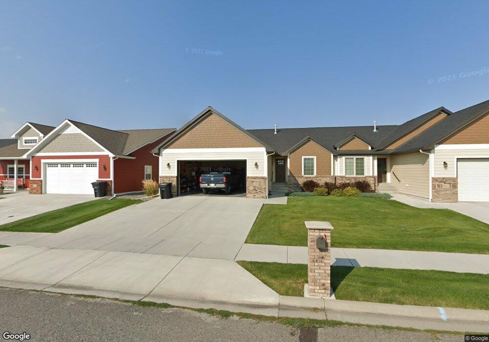
1010 Els Dr Laurel, MT 59044
Estimated Value: $348,000 - $458,000
3
Beds
3
Baths
2,572
Sq Ft
$149/Sq Ft
Est. Value
About This Home
This home is located at 1010 Els Dr, Laurel, MT 59044 and is currently estimated at $383,707, approximately $149 per square foot. 1010 Els Dr is a home located in Yellowstone County with nearby schools including West School, Fred W. Graff School, and Laurel Middle School.
Ownership History
Date
Name
Owned For
Owner Type
Purchase Details
Closed on
Mar 14, 2025
Sold by
Kennedy Denise A and Breshears Denise A
Bought by
Solid Capital Investments Llc
Current Estimated Value
Purchase Details
Closed on
Dec 24, 2018
Sold by
Kennedy Properties Llc
Bought by
Kennedy Denise A
Create a Home Valuation Report for This Property
The Home Valuation Report is an in-depth analysis detailing your home's value as well as a comparison with similar homes in the area
Home Values in the Area
Average Home Value in this Area
Purchase History
| Date | Buyer | Sale Price | Title Company |
|---|---|---|---|
| Solid Capital Investments Llc | -- | None Listed On Document | |
| Kennedy Denise A | -- | -- |
Source: Public Records
Tax History
| Year | Tax Paid | Tax Assessment Tax Assessment Total Assessment is a certain percentage of the fair market value that is determined by local assessors to be the total taxable value of land and additions on the property. | Land | Improvement |
|---|---|---|---|---|
| 2025 | $2,908 | $335,600 | $17,485 | $318,115 |
| 2024 | $2,908 | $309,700 | $12,185 | $297,515 |
| 2023 | $2,670 | $309,700 | $12,185 | $297,515 |
| 2022 | $2,220 | $243,900 | $0 | $0 |
| 2021 | $2,239 | $243,900 | $0 | $0 |
| 2020 | $2,307 | $248,800 | $0 | $0 |
| 2019 | $2,256 | $248,800 | $0 | $0 |
| 2018 | $2,326 | $237,200 | $0 | $0 |
| 2017 | $2,213 | $237,200 | $0 | $0 |
| 2016 | $499 | $35,933 | $0 | $0 |
| 2015 | $326 | $17,523 | $0 | $0 |
| 2014 | $446 | $9,326 | $0 | $0 |
Source: Public Records
Map
Nearby Homes
- 1712 Paynes Place
- 1014 Rochelle Ln
- 1013 W 12th St
- 1109 10th Ave
- 1216 W 12th Street Cir
- 1254 W Beartooth Dr
- 310 (and 814 w 4) 8th Ave
- 102 8th Ave Unit B
- 603 5th Ave
- 319 6th Ave
- 1735 Lobo Dr
- 320 4th Ave
- 1319 Valley Dr
- 810 1st Ave
- 1960 Coyote Ridge Rd N
- 208 West Ave
- 1631 Valley Dr
- 310 1st Ave
- 211 Woodland Ave
- 809 Pennsylvania Ave
Your Personal Tour Guide
Ask me questions while you tour the home.