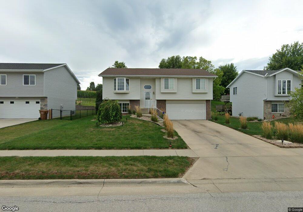
1010 Mockingbird Dr Carroll, IA 51401
Estimated Value: $196,000 - $219,000
3
Beds
2
Baths
1,122
Sq Ft
$188/Sq Ft
Est. Value
About This Home
This home is located at 1010 Mockingbird Dr, Carroll, IA 51401 and is currently estimated at $211,346, approximately $188 per square foot. 1010 Mockingbird Dr is a home with nearby schools including Fairview Elementary School, Adams Elementary School, and Carroll Middle School.
Ownership History
Date
Name
Owned For
Owner Type
Purchase Details
Closed on
Feb 27, 2007
Sold by
Mcmicken Samuel H and Mcmicken Helga R
Bought by
Wessling Todd
Current Estimated Value
Home Financials for this Owner
Home Financials are based on the most recent Mortgage that was taken out on this home.
Original Mortgage
$92,800
Outstanding Balance
$56,600
Interest Rate
6.4%
Mortgage Type
New Conventional
Estimated Equity
$154,746
Purchase Details
Closed on
Jan 16, 2007
Sold by
Mcmicken Samuel H and Mcmicken Helga R
Bought by
Wessling Todd
Home Financials for this Owner
Home Financials are based on the most recent Mortgage that was taken out on this home.
Original Mortgage
$92,800
Outstanding Balance
$56,600
Interest Rate
6.4%
Mortgage Type
New Conventional
Estimated Equity
$154,746
Create a Home Valuation Report for This Property
The Home Valuation Report is an in-depth analysis detailing your home's value as well as a comparison with similar homes in the area
Home Values in the Area
Average Home Value in this Area
Purchase History
| Date | Buyer | Sale Price | Title Company |
|---|---|---|---|
| Wessling Todd | $116,000 | Security Title & Investment | |
| Wessling Todd | $1,116,000 | Security Title & Investments |
Source: Public Records
Mortgage History
| Date | Status | Borrower | Loan Amount |
|---|---|---|---|
| Open | Wessling Todd | $92,800 | |
| Closed | Wessling Todd | $114,200 |
Source: Public Records
Tax History Compared to Growth
Tax History
| Year | Tax Paid | Tax Assessment Tax Assessment Total Assessment is a certain percentage of the fair market value that is determined by local assessors to be the total taxable value of land and additions on the property. | Land | Improvement |
|---|---|---|---|---|
| 2025 | $2,094 | $194,580 | $24,440 | $170,140 |
| 2024 | $2,094 | $173,310 | $24,440 | $148,870 |
| 2023 | $2,153 | $173,310 | $24,440 | $148,870 |
| 2022 | $2,040 | $149,660 | $18,330 | $131,330 |
| 2021 | $2,040 | $149,660 | $18,330 | $131,330 |
| 2020 | $2,087 | $149,660 | $18,330 | $131,330 |
| 2019 | $2,048 | $149,660 | $18,330 | $131,330 |
| 2018 | $1,926 | $149,660 | $18,330 | $131,330 |
| 2017 | $1,920 | $143,166 | $16,350 | $126,816 |
| 2016 | $1,790 | $133,800 | $0 | $0 |
| 2015 | $1,790 | $118,250 | $0 | $0 |
| 2014 | $1,550 | $118,250 | $0 | $0 |
Source: Public Records
Map
Nearby Homes
- 1550 Edgewood Dr
- 1620 Edgewood Dr
- 746 Granada Rd
- 638 Capistrano Ave
- 621 Alta Vista Dr
- 1137 High Ridge Rd
- 1068 Amy Ave
- 1399 E 11th St
- 1401 E 11th St
- 1102 Skyline Dr
- 1022 Skyline Dr
- 260 Bass St
- 1037 Bella Vista Dr
- 265 Perch St
- 1407 E 10th St
- 1409 E 10th St
- 1505 E 10th St
- 1206 Woodland Dr
- 222 Bass St
- 0 Monterey Dr Unit 6307161
- 1004 Mockingbird Dr
- 1014 Mockingbird Dr
- 922 Mockingbird Dr
- 1009 Mockingbird Dr
- 1018 Mockingbird Dr
- 1017 Mockingbird Dr
- 1011 Capistrano Ave
- 1538 Oakwood Dr
- 916 Mockingbird Dr
- 1020 Mockingbird Dr
- 921 Capistrano Ave
- 1539 Edgewood Dr
- 1535 Oakwood Dr
- 1001 Capistrano Ave
- 1104 Mockingbird Dr
- 1539 Oakwood Dr
- 1545 Edgewood Dr
- 1107 Mockingbird Dr
- 1545 Oakwood Dr
- 915 Capistrano Ave