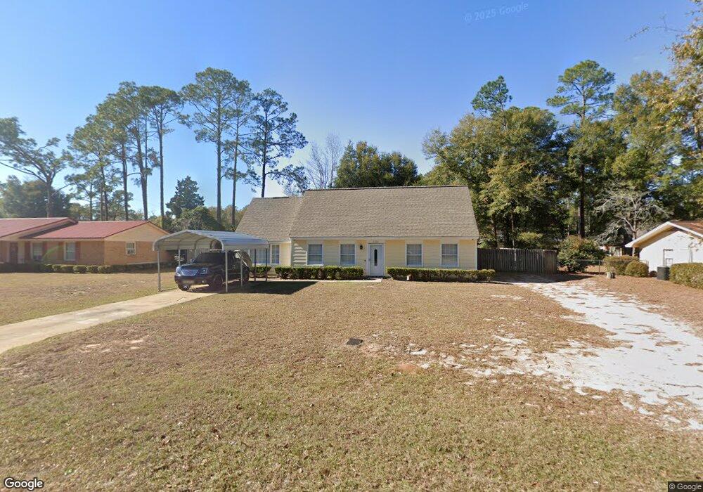
1010 Stewart Ave Bainbridge, GA 39819
Estimated Value: $180,931 - $217,000
--
Bed
1
Bath
1,828
Sq Ft
$108/Sq Ft
Est. Value
About This Home
This home is located at 1010 Stewart Ave, Bainbridge, GA 39819 and is currently estimated at $196,983, approximately $107 per square foot. 1010 Stewart Ave is a home located in Decatur County with nearby schools including Bainbridge High School and Grace Christian Academy.
Ownership History
Date
Name
Owned For
Owner Type
Purchase Details
Closed on
Mar 5, 2019
Sold by
Federal National Mtg Association
Bought by
King Nathaniel
Current Estimated Value
Home Financials for this Owner
Home Financials are based on the most recent Mortgage that was taken out on this home.
Original Mortgage
$117,800
Outstanding Balance
$103,566
Interest Rate
4.4%
Mortgage Type
New Conventional
Estimated Equity
$93,417
Purchase Details
Closed on
Apr 3, 2018
Sold by
Georgia Housing & Finance Authority
Bought by
Federal National Mortgage Association
Create a Home Valuation Report for This Property
The Home Valuation Report is an in-depth analysis detailing your home's value as well as a comparison with similar homes in the area
Home Values in the Area
Average Home Value in this Area
Purchase History
| Date | Buyer | Sale Price | Title Company |
|---|---|---|---|
| King Nathaniel | $124,000 | -- | |
| Federal National Mortgage Association | $66,000 | -- | |
| Georgia Housing And Finance Au | $66,000 | -- |
Source: Public Records
Mortgage History
| Date | Status | Borrower | Loan Amount |
|---|---|---|---|
| Open | King Nathaniel | $117,800 |
Source: Public Records
Tax History Compared to Growth
Tax History
| Year | Tax Paid | Tax Assessment Tax Assessment Total Assessment is a certain percentage of the fair market value that is determined by local assessors to be the total taxable value of land and additions on the property. | Land | Improvement |
|---|---|---|---|---|
| 2024 | $1,472 | $48,332 | $3,200 | $45,132 |
| 2023 | $981 | $48,332 | $3,200 | $45,132 |
| 2022 | $1,436 | $48,332 | $3,200 | $45,132 |
| 2021 | $1,290 | $42,487 | $3,200 | $39,287 |
| 2020 | $1,232 | $38,595 | $3,200 | $35,395 |
| 2019 | $1,253 | $36,047 | $3,200 | $32,847 |
| 2018 | $1,178 | $36,047 | $3,200 | $32,847 |
| 2017 | $1,355 | $38,763 | $3,200 | $35,563 |
| 2016 | $1,296 | $38,763 | $3,200 | $35,563 |
| 2015 | $1,333 | $38,763 | $3,200 | $35,563 |
| 2014 | $1,236 | $38,763 | $3,200 | $35,563 |
| 2013 | -- | $38,763 | $3,200 | $35,563 |
Source: Public Records
Map
Nearby Homes
- 1103 Stewart Ave
- 1014 Morningside Dr
- 1504 Woodland Dr
- 1511 Woodland Dr
- 1602 Twin Lakes Dr
- 1604 Twin Lakes Dr
- 1402 Pineland Dr
- 1606 Twin Lakes Dr
- 904 Parham Ln
- 703 S Boulevard Dr
- 1600 Dogwood Dr
- 1106 E Pine St
- 1702 Culbreth St
- 1512 Douglas Dr
- 1715 Douglas Dr
- 606 Chason St
- 809 S Lamar St
- 1109 Quail Run
- 1901 Douglas Dr
- 910 E Pine St
- 1008 Stewart Ave
- 1012 Stewart Ave
- 1011 Morningside Dr
- 1009 Morningside Dr
- 1006 Stewart Ave
- 1400 Pecan Dr
- 1041 S Morningside Dr
- 1100 Stewart Ave
- 1007 Morningside Dr
- 1105 Stewart Ave
- 1401 Pecan Dr
- 1004 Stewart Ave
- 1101 Morningside Dr
- 1107 Stewart Ave
- 1403 Pecan Dr
- 1005 Morningside Dr
- 1102 Stewart Ave
- 1008 Morningside Dr
- 1100 Morningside Dr
- 1402 Pecan Dr