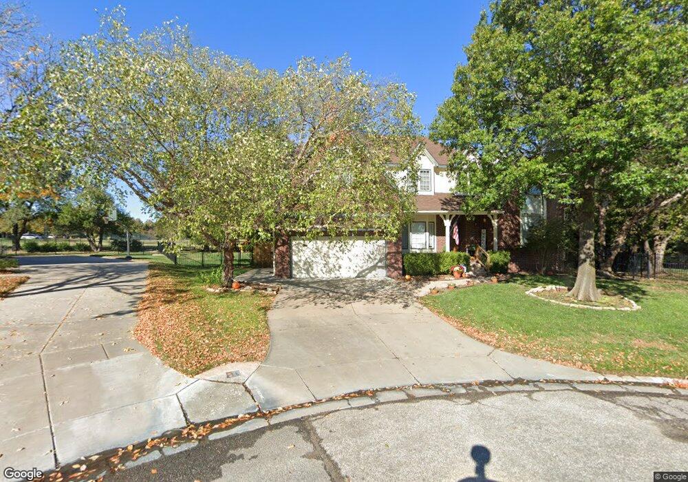
10102 E Mainsgate Cir Wichita, KS 67226
Northeast Wichita NeighborhoodEstimated Value: $371,130 - $395,000
5
Beds
4
Baths
2,647
Sq Ft
$145/Sq Ft
Est. Value
About This Home
This home is located at 10102 E Mainsgate Cir, Wichita, KS 67226 and is currently estimated at $383,065, approximately $144 per square foot. 10102 E Mainsgate Cir is a home located in Sedgwick County with nearby schools including Minneha Core Knowledge Elementary School, Coleman Environmental Magnet Middle School, and Wichita Southeast High School.
Ownership History
Date
Name
Owned For
Owner Type
Purchase Details
Closed on
Jun 24, 2021
Sold by
Green Timothy D and Green Jackie R
Bought by
Whitfield Charles and Whitfield Marisa
Current Estimated Value
Home Financials for this Owner
Home Financials are based on the most recent Mortgage that was taken out on this home.
Original Mortgage
$280,000
Outstanding Balance
$253,505
Interest Rate
2.9%
Mortgage Type
New Conventional
Estimated Equity
$129,560
Purchase Details
Closed on
Feb 12, 2015
Sold by
Green Timothy D and Green Jackie R
Bought by
Timothy D & Jackie E Green Living Trust and Green Jackie R
Create a Home Valuation Report for This Property
The Home Valuation Report is an in-depth analysis detailing your home's value as well as a comparison with similar homes in the area
Home Values in the Area
Average Home Value in this Area
Purchase History
| Date | Buyer | Sale Price | Title Company |
|---|---|---|---|
| Whitfield Charles | -- | Security 1St Title Llc | |
| Timothy D & Jackie E Green Living Trust | -- | None Available |
Source: Public Records
Mortgage History
| Date | Status | Borrower | Loan Amount |
|---|---|---|---|
| Open | Whitfield Charles | $280,000 |
Source: Public Records
Tax History Compared to Growth
Tax History
| Year | Tax Paid | Tax Assessment Tax Assessment Total Assessment is a certain percentage of the fair market value that is determined by local assessors to be the total taxable value of land and additions on the property. | Land | Improvement |
|---|---|---|---|---|
| 2025 | $4,058 | $39,526 | $9,143 | $30,383 |
| 2023 | $4,058 | $36,939 | $7,602 | $29,337 |
| 2022 | $3,679 | $32,683 | $7,176 | $25,507 |
| 2021 | $3,497 | $30,257 | $4,416 | $25,841 |
| 2020 | $3,354 | $29,095 | $4,416 | $24,679 |
| 2019 | $3,230 | $27,980 | $4,416 | $23,564 |
| 2018 | $3,156 | $27,164 | $2,174 | $24,990 |
| 2017 | $3,158 | $0 | $0 | $0 |
| 2016 | $3,036 | $0 | $0 | $0 |
| 2015 | $3,117 | $0 | $0 | $0 |
| 2014 | $3,054 | $0 | $0 | $0 |
Source: Public Records
Map
Nearby Homes
- 2507 N Cranbrook Ct
- 10227 E Windemere Ct
- 10231 E Windemere Ct
- 2323 N Stoneybrook Ct
- 2526 N Fox Run
- 2455 N Regency Lakes Ct
- 2530 N Greenleaf Ct
- 9510 E Shannon Woods St
- 9400 E Wilson Estates Pkwy
- 1906 N Frederic Cir
- 8913 E Boxthorn St
- 2610 N Wilderness Cir
- 8812 E Churchill Cir
- 8811 E Churchill Cir
- 1810 N Veranda St
- 10611 E Summerfield Cir
- 2230 N Penstemon Ct
- 8319 E Oxford Cir
- 2280 N Tara Cir
- 2856 N Tallgrass St
- 10106 E Mainsgate Cir
- 10103 E Mainsgate Cir
- 10110 E Mainsgate Cir
- 10107 E Mainsgate Cir
- 10111 E Mainsgate Cir
- 2515 N Cranbrook Ct
- 2519 N Cranbrook Ct
- 10114 E Mainsgate Cir
- 2511 N Cranbrook Ct
- 2411 N Cranbrook Ct
- 10115 E Mainsgate Cir
- 2415 N Cranbrook Ct
- 2523 N Cranbrook Ct
- 2407 N Cranbrook Ct
- 2531 N Cranbrook Ct
- 2510 N Fox Run Ct
- 10202 E Mainsgate Rd
- 2527 N Cranbrook Ct
- 2535 N Cranbrook Ct
- 2506 N Cranbrook St