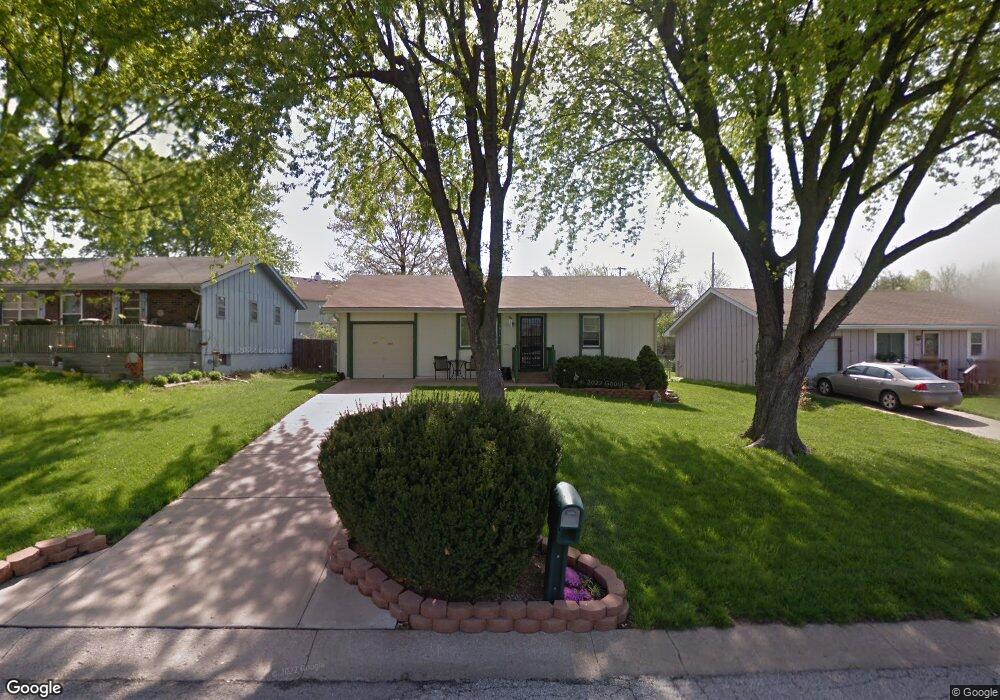
1011 S Scott Ave Belton, MO 64012
Estimated Value: $202,000 - $221,000
3
Beds
1
Bath
868
Sq Ft
$245/Sq Ft
Est. Value
About This Home
This home is located at 1011 S Scott Ave, Belton, MO 64012 and is currently estimated at $212,853, approximately $245 per square foot. 1011 S Scott Ave is a home located in Cass County with nearby schools including Cambridge Elementary School, Belton Middle School, and Mill Creek Upper Elementary School.
Ownership History
Date
Name
Owned For
Owner Type
Purchase Details
Closed on
Sep 26, 2023
Sold by
Sodders Carol J
Bought by
Sodders Carol J and Allen James Duane
Current Estimated Value
Purchase Details
Closed on
Jan 16, 2023
Sold by
Sodders Carol J
Bought by
Sodders Carol J and Reynolds John Thomas
Purchase Details
Closed on
May 29, 2008
Sold by
Sodders Gerald L and Sodders Carol J
Bought by
Sodders Gerald L and Sodders Carol J
Create a Home Valuation Report for This Property
The Home Valuation Report is an in-depth analysis detailing your home's value as well as a comparison with similar homes in the area
Home Values in the Area
Average Home Value in this Area
Purchase History
| Date | Buyer | Sale Price | Title Company |
|---|---|---|---|
| Sodders Carol J | -- | None Listed On Document | |
| Sodders Carol J | -- | None Listed On Document | |
| Sodders Carol J | -- | None Listed On Document | |
| Sodders Gerald L | -- | -- |
Source: Public Records
Tax History Compared to Growth
Tax History
| Year | Tax Paid | Tax Assessment Tax Assessment Total Assessment is a certain percentage of the fair market value that is determined by local assessors to be the total taxable value of land and additions on the property. | Land | Improvement |
|---|---|---|---|---|
| 2024 | $1,709 | $20,780 | $1,650 | $19,130 |
| 2023 | $1,709 | $20,780 | $1,650 | $19,130 |
| 2022 | $1,526 | $18,390 | $1,650 | $16,740 |
| 2021 | $1,526 | $18,390 | $1,650 | $16,740 |
| 2020 | $1,485 | $17,790 | $1,650 | $16,140 |
| 2019 | $1,454 | $17,790 | $1,650 | $16,140 |
| 2018 | $1,290 | $15,920 | $1,320 | $14,600 |
| 2017 | $1,139 | $15,920 | $1,320 | $14,600 |
| 2016 | $1,139 | $13,970 | $1,320 | $12,650 |
| 2015 | $1,138 | $13,970 | $1,320 | $12,650 |
| 2014 | -- | $13,970 | $1,320 | $12,650 |
| 2013 | -- | $13,970 | $1,320 | $12,650 |
Source: Public Records
Map
Nearby Homes
- 1009 S Scott Ave
- 1013 S Scott Ave
- 1007 S Scott Ave
- 1015 S Scott Ave
- 907 Brentwood Cir
- 105 Brent Rd
- 1101 S Scott Ave
- 905 Brentwood Cir
- 104 Brent Rd
- 1005 S Scott Ave
- 903 Brentwood Cir
- 104 W 181st St
- 1009 Brentwood Cir
- 1103 S Scott Ave
- 106 Brent Rd
- 107 Brent Rd
- 901 Brentwood Cir
- 106 W 181st St
- 103 Brentwood Dr
- 127 Brentwood Dr