Estimated Value: $435,000 - $518,000
3
Beds
2
Baths
1,704
Sq Ft
$277/Sq Ft
Est. Value
About This Home
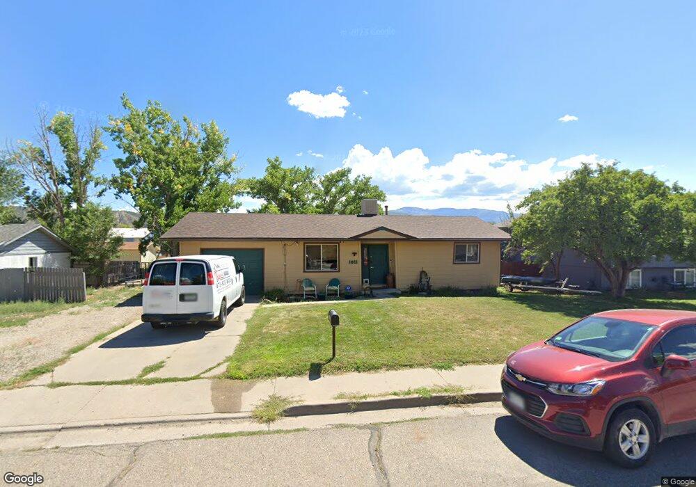
This home is located at 1011 W 5th St, Rifle, CO 81650 and is currently estimated at $471,270, approximately $276 per square foot. 1011 W 5th St is a home located in Garfield County with nearby schools including Graham Mesa Elementary School, Rifle Middle School, and Rifle High School.
Ownership History
Date
Name
Owned For
Owner Type
Purchase Details
Closed on
May 29, 2024
Sold by
Pioneer Mesa Development Company
Bought by
Salgado Borja Tiburcio and Salgado Eduardo Eduardo
Current Estimated Value
Purchase Details
Closed on
Jan 26, 2009
Sold by
Soiu Michael J
Bought by
Soiu Michael J and Soiu Jean M
Home Financials for this Owner
Home Financials are based on the most recent Mortgage that was taken out on this home.
Original Mortgage
$221,600
Interest Rate
5.09%
Mortgage Type
New Conventional
Purchase Details
Closed on
Apr 16, 1990
Purchase Details
Closed on
May 15, 1987
Create a Home Valuation Report for This Property
The Home Valuation Report is an in-depth analysis detailing your home's value as well as a comparison with similar homes in the area
Home Values in the Area
Average Home Value in this Area
Purchase History
| Date | Buyer | Sale Price | Title Company |
|---|---|---|---|
| Salgado Borja Tiburcio | $145,000 | None Listed On Document | |
| Soiu Michael J | -- | Stewart Title Of Co Inc | |
| -- | $55,000 | -- | |
| -- | $35,500 | -- |
Source: Public Records
Mortgage History
| Date | Status | Borrower | Loan Amount |
|---|---|---|---|
| Previous Owner | Soiu Michael J | $221,600 |
Source: Public Records
Tax History Compared to Growth
Tax History
| Year | Tax Paid | Tax Assessment Tax Assessment Total Assessment is a certain percentage of the fair market value that is determined by local assessors to be the total taxable value of land and additions on the property. | Land | Improvement |
|---|---|---|---|---|
| 2024 | $1,341 | $17,590 | $3,320 | $14,270 |
| 2023 | $1,341 | $17,590 | $3,320 | $14,270 |
| 2022 | $1,199 | $16,750 | $3,820 | $12,930 |
| 2021 | $1,377 | $17,230 | $3,930 | $13,300 |
| 2020 | $1,190 | $16,270 | $2,860 | $13,410 |
| 2019 | $1,126 | $16,270 | $2,860 | $13,410 |
| 2018 | $918 | $12,960 | $2,660 | $10,300 |
| 2017 | $829 | $12,960 | $2,660 | $10,300 |
| 2016 | $626 | $11,070 | $2,550 | $8,520 |
| 2015 | $578 | $11,070 | $2,550 | $8,520 |
| 2014 | -- | $9,120 | $1,750 | $7,370 |
Source: Public Records
Map
Nearby Homes
- 1110 Arnold Ct
- 990 Wamsley Way
- 342 Elm Ave
- 1008 Wamsley Way
- 336 Will Ave
- 500 Fairway Ave
- 580 Will Ave
- 335 Hutton Ave
- 1617 W 7th St
- 531 Park Ave
- 663 Park Ave
- 381 W 5th St Unit 2
- TBD Stillwell Ave
- 751 Park Ave
- 1016 Stillwell Ave
- 108 Ray Ave
- 758 Railroad Ave
- 629 Whiteriver Ave
- 216 E 1st St
- 440 Whiteriver Ave