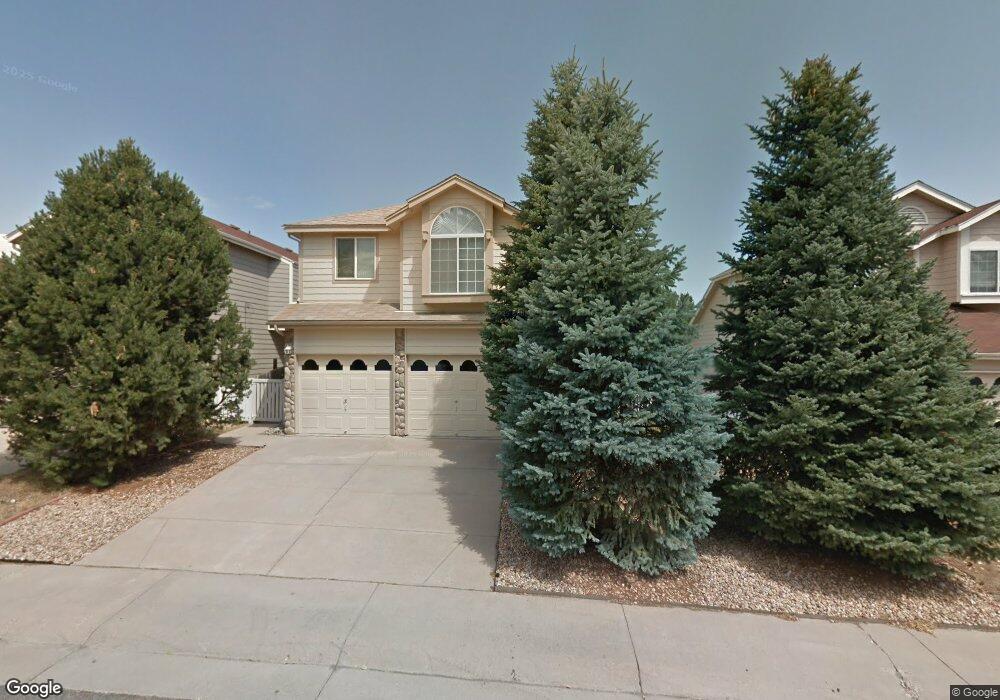
10113 Westside Cir Littleton, CO 80125
Estimated Value: $516,000 - $565,000
3
Beds
5
Baths
1,691
Sq Ft
$320/Sq Ft
Est. Value
About This Home
This home is located at 10113 Westside Cir, Littleton, CO 80125 and is currently estimated at $540,283, approximately $319 per square foot. 10113 Westside Cir is a home located in Douglas County with nearby schools including Roxborough Elementary School, Roxborough Intermediate School, and Ranch View Middle School.
Ownership History
Date
Name
Owned For
Owner Type
Purchase Details
Closed on
Nov 6, 1992
Sold by
Federal Home Loan Mtg Corp
Bought by
Day Clifford A and Day Ursula E
Current Estimated Value
Purchase Details
Closed on
Jun 19, 1992
Sold by
Public Trustee
Bought by
Federal Home Loan Mtg Corp
Purchase Details
Closed on
Feb 16, 1988
Sold by
Village Homes Roxborough Inc
Bought by
Nishiyama Jerrie Lee
Purchase Details
Closed on
May 20, 1987
Sold by
Roxborough Village Joint Venture & Esl Co
Bought by
Village Homes Roxborough
Create a Home Valuation Report for This Property
The Home Valuation Report is an in-depth analysis detailing your home's value as well as a comparison with similar homes in the area
Home Values in the Area
Average Home Value in this Area
Purchase History
| Date | Buyer | Sale Price | Title Company |
|---|---|---|---|
| Day Clifford A | $91,500 | -- | |
| Federal Home Loan Mtg Corp | -- | -- | |
| Nishiyama Jerrie Lee | $119,000 | -- | |
| Village Homes Roxborough | $61,800 | -- |
Source: Public Records
Tax History Compared to Growth
Tax History
| Year | Tax Paid | Tax Assessment Tax Assessment Total Assessment is a certain percentage of the fair market value that is determined by local assessors to be the total taxable value of land and additions on the property. | Land | Improvement |
|---|---|---|---|---|
| 2024 | $2,834 | $37,500 | $6,550 | $30,950 |
| 2023 | $2,853 | $37,500 | $6,550 | $30,950 |
| 2022 | $2,055 | $26,590 | $4,890 | $21,700 |
| 2021 | $2,147 | $26,590 | $4,890 | $21,700 |
| 2020 | $2,122 | $25,450 | $5,680 | $19,770 |
| 2019 | $2,156 | $25,450 | $5,680 | $19,770 |
| 2018 | $1,948 | $20,710 | $4,050 | $16,660 |
| 2017 | $1,872 | $20,710 | $4,050 | $16,660 |
| 2016 | $1,427 | $18,130 | $3,580 | $14,550 |
| 2015 | $1,474 | $18,130 | $3,580 | $14,550 |
| 2014 | $579 | $14,850 | $1,990 | $12,860 |
Source: Public Records
Map
Nearby Homes
- 8032 Mount Ouray Rd
- 8109 Mount Ouray Rd
- 7832 Elmwood St
- 7888 Canvasback Cir
- 8145 Monte Vista Cir
- 8129 Locust Dr
- 8176 Locust Dr
- 9804 Rosalee Peak St
- 9753 Middle Peak St
- 9786 Rosalee Peak St
- 9780 Banner Peak St
- 8132 Mount Harvard Rd
- 7910 Jared Way
- 7680 Elmwood St
- 10441 Beech St
- 9613 Browns Peak Cir
- 9625 Browns Peak Cir
- 9617 Browns Peak Cir
- Panorama Plan at Prospect Village at Sterling Ranch - Townhomes
- Peak Plan at Prospect Village at Sterling Ranch - Townhomes
- 10119 Westside Cir
- 10107 Westside Cir
- 10086 Jasmine Ct
- 10125 Westside Cir
- 10095 Westside Cir
- 10082 Jasmine Ct
- 10072 Jasmine Ct
- 10092 Jasmine Ct
- 10112 Westside Cir
- 10118 Westside Cir
- 10089 Westside Cir
- 10131 Westside Cir
- 10060 Jasmine Ct
- 10100 Westside Cir
- 10097 Jasmine Ct
- 10094 Westside Cir
- 10081 Westside Cir
- 10143 Westside Cir
- 10130 Westside Cir
- 10050 Jasmine Ct