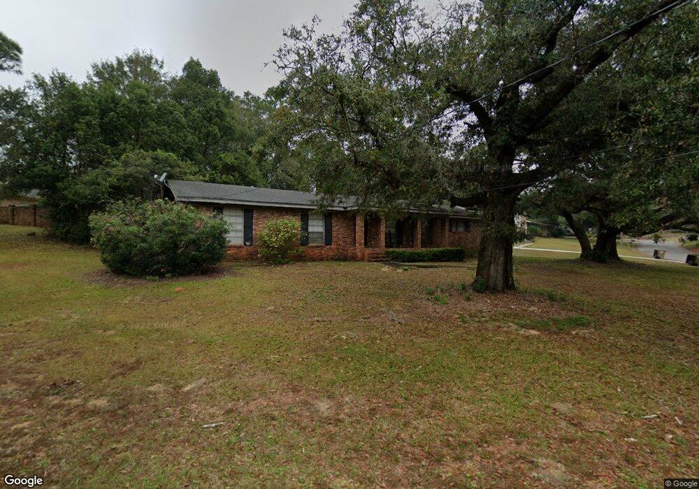
1012 Highpoint Dr E Mobile, AL 36693
Skyland Park NeighborhoodEstimated Value: $182,000 - $243,000
3
Beds
2
Baths
1,456
Sq Ft
$140/Sq Ft
Est. Value
About This Home
This home is located at 1012 Highpoint Dr E, Mobile, AL 36693 and is currently estimated at $203,780, approximately $139 per square foot. 1012 Highpoint Dr E is a home located in Mobile County with nearby schools including Kate Shepard Elementary School, Chastang-Fournier K-8 School, and WP Davidson High School.
Ownership History
Date
Name
Owned For
Owner Type
Purchase Details
Closed on
Mar 20, 2003
Sold by
Tatum Fillers Mark D and Tatum Fillers Jessica Erin
Bought by
Porter Timothy L
Current Estimated Value
Home Financials for this Owner
Home Financials are based on the most recent Mortgage that was taken out on this home.
Original Mortgage
$104,400
Outstanding Balance
$43,487
Interest Rate
5.82%
Mortgage Type
Purchase Money Mortgage
Estimated Equity
$160,293
Purchase Details
Closed on
Sep 22, 2000
Sold by
Fillers Marlin D and Fillers Susan N
Bought by
Fillers Mark D and Tatum Jessica Erin
Home Financials for this Owner
Home Financials are based on the most recent Mortgage that was taken out on this home.
Original Mortgage
$68,800
Interest Rate
7.69%
Mortgage Type
Purchase Money Mortgage
Create a Home Valuation Report for This Property
The Home Valuation Report is an in-depth analysis detailing your home's value as well as a comparison with similar homes in the area
Home Values in the Area
Average Home Value in this Area
Purchase History
| Date | Buyer | Sale Price | Title Company |
|---|---|---|---|
| Porter Timothy L | -- | -- | |
| Fillers Mark D | $69,300 | Surety Land Title Inc |
Source: Public Records
Mortgage History
| Date | Status | Borrower | Loan Amount |
|---|---|---|---|
| Open | Porter Timothy L | $104,400 | |
| Previous Owner | Fillers Mark D | $68,800 |
Source: Public Records
Tax History
| Year | Tax Paid | Tax Assessment Tax Assessment Total Assessment is a certain percentage of the fair market value that is determined by local assessors to be the total taxable value of land and additions on the property. | Land | Improvement |
|---|---|---|---|---|
| 2025 | $831 | $14,010 | $3,000 | $11,010 |
| 2024 | $831 | $13,070 | $3,000 | $10,070 |
| 2023 | $766 | $12,950 | $3,000 | $9,950 |
| 2022 | $670 | $11,600 | $3,000 | $8,600 |
| 2021 | $670 | $11,600 | $3,000 | $8,600 |
| 2020 | $670 | $11,600 | $3,000 | $8,600 |
| 2019 | $649 | $11,280 | $0 | $0 |
| 2018 | $649 | $11,280 | $0 | $0 |
| 2017 | $649 | $11,280 | $0 | $0 |
| 2016 | $665 | $11,520 | $0 | $0 |
| 2013 | $673 | $11,540 | $0 | $0 |
Source: Public Records
Map
Nearby Homes
- 4138 Burma Hills Dr
- 2127 Ryegate Ct
- 951 Highpoint Dr W
- 2109 Ryegate Ct
- 2104 Marchfield Dr E
- 2100 Japonica Ln
- 2371 Carriage Dr
- 0 Trenton Ln Unit 7567904
- 4956 Ringold Dr N
- 4052 Hillcrest Ln W
- 2359 Demetropolis Rd
- 4207 Burma Rd
- 4031 Cottage Hill Rd
- 5012 Cottage Hill Rd
- 3951 Byronell Dr N
- 4017 Cottage Hill Rd Unit 50
- 4017 Cottage Hill Rd Unit 58
- 4017 Cottage Hill Rd Unit 53
- 708 Ynestra Dr
- 4213 Malibar Dr
- 1008 Highpoint Dr E
- 1009 Highpoint Ct
- 1013 Highpoint Dr E
- 1005 Highpoint Ct
- 4101 Highpoint Dr S
- 4056 S Highpoint Dr
- 1004 Highpoint Dr E
- 1015 Highpoint Ct
- 4105 Highpoint Dr S
- 4056 Highpoint Dr E
- 4059 Highpoint Dr S
- 4109 Highpoint Dr S
- 4118 Highpoint Dr S
- 1000 Highpoint Ct
- 1009 Highpoint Dr E
- 1004 Highpoint Ct
- 4050 Highpoint Dr S
- 4109 Libby Dr
- 4101 Libby Dr
- 4055 Highpoint Dr S
Your Personal Tour Guide
Ask me questions while you tour the home.