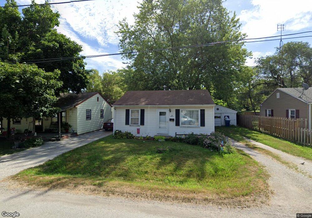
1012 N Wolfe St Unit 1 Springfield, IL 62702
Estimated Value: $81,000 - $88,000
Studio
--
Bath
--
Sq Ft
5,968
Sq Ft Lot
About This Home
This home is located at 1012 N Wolfe St Unit 1, Springfield, IL 62702 and is currently estimated at $84,673. 1012 N Wolfe St Unit 1 is a home located in Sangamon County with nearby schools including Feitshans Elementary School, Washington Middle School, and Lanphier High School.
Ownership History
Date
Name
Owned For
Owner Type
Purchase Details
Closed on
Feb 7, 2013
Current Estimated Value
Purchase Details
Closed on
May 21, 2008
Purchase Details
Closed on
Jun 5, 2007
Purchase Details
Closed on
Jun 14, 2006
Purchase Details
Closed on
Oct 24, 2000
Purchase Details
Closed on
Oct 16, 2000
Purchase Details
Closed on
Jul 17, 2000
Purchase Details
Closed on
Jun 4, 1999
Purchase Details
Closed on
Jun 23, 1997
Purchase Details
Closed on
Jul 15, 1994
Create a Home Valuation Report for This Property
The Home Valuation Report is an in-depth analysis detailing your home's value as well as a comparison with similar homes in the area
Purchase History
| Date | Buyer | Sale Price | Title Company |
|---|---|---|---|
| -- | -- | -- | |
| -- | $38,200 | -- | |
| -- | -- | -- | |
| -- | -- | -- | |
| -- | $27,000 | -- | |
| -- | -- | -- | |
| -- | -- | -- | |
| -- | -- | -- | |
| -- | $44,000 | -- | |
| -- | $38,500 | -- |
Source: Public Records
Tax History
| Year | Tax Paid | Tax Assessment Tax Assessment Total Assessment is a certain percentage of the fair market value that is determined by local assessors to be the total taxable value of land and additions on the property. | Land | Improvement |
|---|---|---|---|---|
| 2024 | $1,480 | $22,359 | $4,178 | $18,181 |
| 2023 | $1,370 | $20,256 | $3,785 | $16,471 |
| 2022 | $1,292 | $19,282 | $3,603 | $15,679 |
| 2021 | $1,151 | $17,682 | $3,304 | $14,378 |
| 2020 | $1,114 | $17,580 | $3,285 | $14,295 |
| 2019 | $1,088 | $17,514 | $3,273 | $14,241 |
| 2018 | $1,082 | $17,846 | $3,335 | $14,511 |
| 2017 | $1,028 | $17,302 | $3,233 | $14,069 |
| 2016 | $944 | $16,332 | $3,052 | $13,280 |
| 2015 | $939 | $16,257 | $3,038 | $13,219 |
| 2014 | $973 | $16,784 | $3,136 | $13,648 |
| 2013 | $1,021 | $17,727 | $3,312 | $14,415 |
Source: Public Records
Map
Nearby Homes
- 2267 Cincinnati Ave
- 1037 N Wesley St Unit 1
- 1111 N Albany St Unit 1
- 905 N Wesley St Unit 1
- 2169 N Grand Ave E
- 2277 E Converse St Unit 1
- 2373 E Keys Ave
- 2314 Ramsey Rd
- 2256 E Black Ave
- 300 Forrest Ave Unit 62
- 300 Forrest Ave Unit 107
- 300 Forrest Ave Unit 109
- 2264 E Eleanor Ave
- 1050 N 19th St
- 516 N Milton Ave Unit 1
- 1624 N 28th St
- 2102 E Black Ave
- 2800 E Keys Ave
- 29 Melody Ln
- 2304 Sutherland Rd
- 1016 N Wolfe St Unit 1
- 1008 N Wolfe St
- 2316 Cincinnati Ave Unit 1
- 1020 N Wolfe St Unit 1
- 2308 Cincinnati Ave Unit 1
- 1015 N Wolfe St
- 2310 E Enterprise St
- 1007 N Wolfe St Unit 1
- 2320 Cincinnati Ave Unit 1
- 1011 N Wolfe St Unit 1
- 2320 E Enterprise St
- 2324 Cincinnati Ave Unit 1
- 2276 Cincinnati Ave Unit 1
- 2257 E Enterprise St
- 2332 Cincinnati Ave Unit 1
- 2328 Cincinnati Ave Unit 1
- 2260 E Enterprise St Unit 1
- 2235 E Enterprise St
- 2301 Cincinnati Ave
- 2250 E Enterprise St Unit 1
Your Personal Tour Guide
Ask me questions while you tour the home.