1012 N Wolfe St Unit 1 Springfield, IL 62702
Estimated Value: $69,000 - $85,000
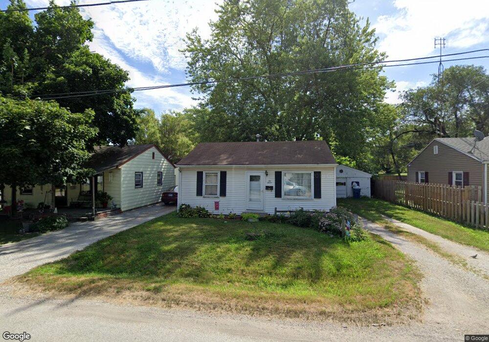
About This Home
This home is located at 1012 N Wolfe St Unit 1, Springfield, IL 62702 and is currently estimated at $78,897, approximately $117 per square foot. 1012 N Wolfe St Unit 1 is a home located in Sangamon County with nearby schools including Feitshans Elementary School, Washington Middle School, and Lanphier High School.
Ownership History
We collect this data history from publicly available records. To have your information removed, we recommend requesting removal directly through your county’s website.
Purchase Details
Purchase Details
Purchase Details
Purchase Details
Purchase Details
Purchase Details
Purchase Details
Purchase Details
Purchase Details
Purchase Details
Purchase History
We collect this data history from publicly available records. To have your information removed, we recommend requesting removal directly through your county’s website.
| Date | Buyer | Sale Price | Title Company |
|---|---|---|---|
| -- | -- | ||
| $38,200 | -- | ||
| -- | -- | ||
| -- | -- | ||
| $27,000 | -- | ||
| -- | -- | ||
| -- | -- | ||
| -- | -- | ||
| $44,000 | -- | ||
| $38,500 | -- |
Tax History
We collect this data history from publicly available records. To have your information removed, we recommend requesting removal directly through your county’s website.
| Year | Tax Paid | Tax Assessment Tax Assessment Total Assessment is a certain percentage of the fair market value that is determined by local assessors to be the total taxable value of land and additions on the property. | Land | Improvement |
|---|---|---|---|---|
| 2025 | $1,533 | $23,624 | $4,414 | $19,210 |
| 2024 | $1,480 | $22,359 | $4,178 | $18,181 |
| 2023 | $1,370 | $20,256 | $3,785 | $16,471 |
| 2022 | $1,292 | $19,282 | $3,603 | $15,679 |
| 2021 | $1,151 | $17,682 | $3,304 | $14,378 |
| 2020 | $1,114 | $17,580 | $3,285 | $14,295 |
| 2019 | $1,088 | $17,514 | $3,273 | $14,241 |
| 2018 | $1,082 | $17,846 | $3,335 | $14,511 |
| 2017 | $1,028 | $17,302 | $3,233 | $14,069 |
| 2016 | $944 | $16,332 | $3,052 | $13,280 |
| 2015 | $939 | $16,257 | $3,038 | $13,219 |
| 2014 | $973 | $16,784 | $3,136 | $13,648 |
| 2013 | $1,021 | $17,727 | $3,312 | $14,415 |
Map
- 905 N Wesley St Unit 1
- 2413 North Grand Ave E
- 2201 E Converse St
- 2335 Ramsey Rd
- 2141 E Watch Ave
- 3076 Louise Ln
- 2102 E Black Ave
- 2800 Ridge Ave Unit 116
- 1624 N 28th St
- 1702 E Cummins Ave
- 1617 E Matheny Ave
- 2325 Sutherland Rd
- 1904 E Black Ave
- 3229 E Enos Ave
- 1521 E Matheny Ave
- 1525 E Converse Ave
- 220 S David St
- 50 Midland Ct
- 2309 E Griffiths Ave
- 2234 E Monroe St
- 1016 N Wolfe St Unit 1
- 1008 N Wolfe St
- 2316 Cincinnati Ave Unit 1
- 1020 N Wolfe St Unit 1
- 2308 Cincinnati Ave Unit 1
- 1015 N Wolfe St
- 2310 E Enterprise St
- 1007 N Wolfe St Unit 1
- 2320 Cincinnati Ave Unit 1
- 2320 E Enterprise St
- 1011 N Wolfe St Unit 1
- 2324 Cincinnati Ave Unit 1
- 2276 Cincinnati Ave Unit 1
- 2257 E Enterprise St
- 2332 Cincinnati Ave Unit 1
- 2328 Cincinnati Ave Unit 1
- 2260 E Enterprise St Unit 1
- 2235 E Enterprise St
- 2301 Cincinnati Ave
- 2250 E Enterprise St Unit 1
Ask me questions while you tour the home.