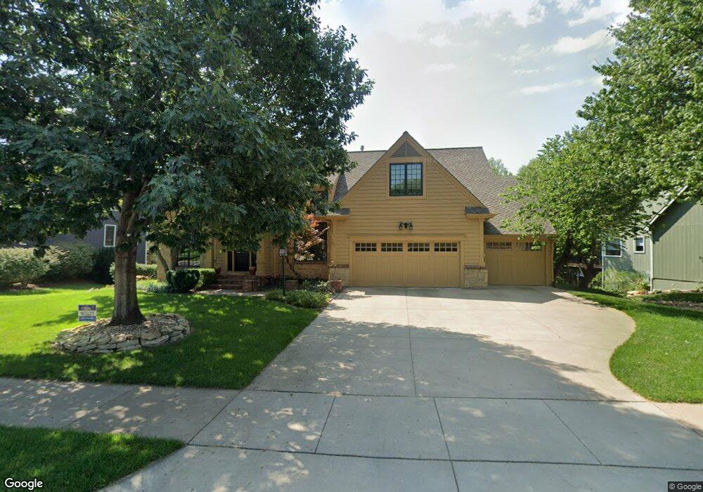
1012 Oak Tree Dr Lawrence, KS 66049
Quail Run NeighborhoodEstimated Value: $635,132 - $682,000
4
Beds
5
Baths
4,234
Sq Ft
$155/Sq Ft
Est. Value
About This Home
This home is located at 1012 Oak Tree Dr, Lawrence, KS 66049 and is currently estimated at $658,283, approximately $155 per square foot. 1012 Oak Tree Dr is a home located in Douglas County with nearby schools including Quail Run Elementary School, Southwest Middle School, and Lawrence Free State High School.
Ownership History
Date
Name
Owned For
Owner Type
Purchase Details
Closed on
Nov 4, 2019
Sold by
Amyx Elizabeth N and Amyx Ronald M
Bought by
Talbott Ryan A and Talbott Jennifer Elizabeth Neuburger
Current Estimated Value
Home Financials for this Owner
Home Financials are based on the most recent Mortgage that was taken out on this home.
Original Mortgage
$388,000
Outstanding Balance
$341,679
Interest Rate
3.65%
Mortgage Type
New Conventional
Estimated Equity
$316,604
Purchase Details
Closed on
Mar 22, 2006
Sold by
Morris Kenneth D
Bought by
Morris Elizabeth N
Create a Home Valuation Report for This Property
The Home Valuation Report is an in-depth analysis detailing your home's value as well as a comparison with similar homes in the area
Home Values in the Area
Average Home Value in this Area
Purchase History
| Date | Buyer | Sale Price | Title Company |
|---|---|---|---|
| Talbott Ryan A | -- | Continental Title Company | |
| Morris Elizabeth N | -- | None Available |
Source: Public Records
Mortgage History
| Date | Status | Borrower | Loan Amount |
|---|---|---|---|
| Open | Talbott Ryan A | $388,000 |
Source: Public Records
Tax History
| Year | Tax Paid | Tax Assessment Tax Assessment Total Assessment is a certain percentage of the fair market value that is determined by local assessors to be the total taxable value of land and additions on the property. | Land | Improvement |
|---|---|---|---|---|
| 2025 | $9,126 | $72,519 | $8,625 | $63,894 |
| 2024 | $10,112 | $80,155 | $7,475 | $72,680 |
| 2023 | $9,342 | $71,979 | $7,475 | $64,504 |
| 2022 | $8,444 | $64,665 | $7,475 | $57,190 |
| 2021 | $7,486 | $55,775 | $6,334 | $49,441 |
| 2020 | $7,449 | $55,775 | $6,334 | $49,441 |
| 2019 | $7,711 | $57,787 | $6,334 | $51,453 |
| 2018 | $7,362 | $54,786 | $6,334 | $48,452 |
| 2017 | $7,303 | $53,739 | $6,334 | $47,405 |
| 2016 | $6,863 | $52,750 | $5,753 | $46,997 |
| 2015 | $6,801 | $52,267 | $5,753 | $46,514 |
| 2014 | $6,675 | $51,807 | $5,753 | $46,054 |
Source: Public Records
Map
Nearby Homes
- 1113 Somerset Cir
- 1204 Chadwick Ct
- 1232 Belair Ct
- 4600 Royal Birkdale Ct
- 904 Moundridge Dr
- 4624 Hearthside Dr
- 4207 Timberline Ct
- 1215 Hacienda Ln
- 3922 Willshire Dr
- 1407 Brighton Cir
- 916 Christie Ct
- 5007 Congressional Way
- 1503 Crossgate Dr
- 1202 Little Knife
- 1315 Research Park Dr
- 3808 Pinnacle Cir
- 416 Eldridge St
- 1608 Prestwick Dr
- 1168 Parkside Cir
- 3921 Monterey Place
- 1008 Oak Tree Dr
- 1018 Oak Tree Dr
- 4508 Goldfield St
- 4512 Goldfield St
- 1004 Oak Tree Dr
- 4504 Goldfield Ct
- 1024 Oak Tree Dr
- 1017 Oak Tree Dr
- 4504 Goldfield St
- 1025 Oak Tree Dr
- 1021 Oak Tree Dr
- 1013 Oak Tree Dr
- 4517 Goldfield St
- 1000 Oak Tree Dr
- 1032 Oak Tree Dr
- 1009 Oak Tree Dr
- 4517 Goldfield St
- 1005 Oak Tree Dr
- 1029 Oak Tree Dr
- 4513 Goldfield St
Your Personal Tour Guide
Ask me questions while you tour the home.