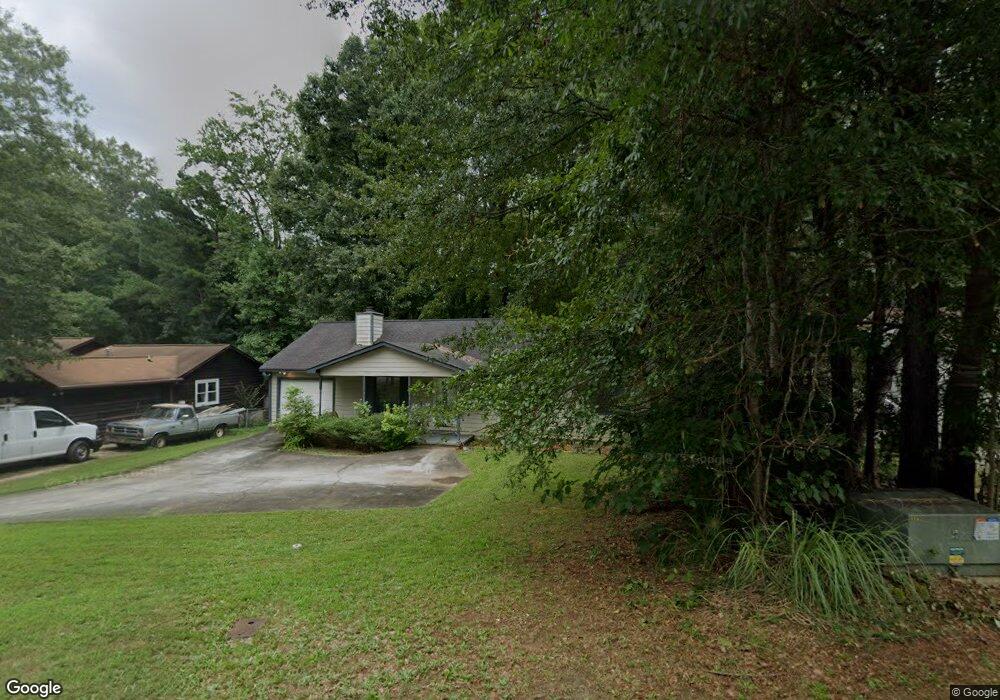
10126 Brass Ring Rd Unit 2 Jonesboro, GA 30238
Estimated Value: $206,000 - $219,000
3
Beds
2
Baths
1,288
Sq Ft
$164/Sq Ft
Est. Value
About This Home
This home is located at 10126 Brass Ring Rd Unit 2, Jonesboro, GA 30238 and is currently estimated at $211,055, approximately $163 per square foot. 10126 Brass Ring Rd Unit 2 is a home located in Clayton County with nearby schools including Hawthorne Elementary School, Mundys Mill Middle School, and Mundy's Mill High School.
Ownership History
Date
Name
Owned For
Owner Type
Purchase Details
Closed on
Apr 7, 2017
Sold by
Mason Randall
Bought by
Mason Monika
Current Estimated Value
Purchase Details
Closed on
Sep 19, 1997
Sold by
Mckinney Robert A and Mckinney Joann M
Bought by
Mason Randall O
Home Financials for this Owner
Home Financials are based on the most recent Mortgage that was taken out on this home.
Original Mortgage
$61,100
Interest Rate
7.46%
Mortgage Type
New Conventional
Create a Home Valuation Report for This Property
The Home Valuation Report is an in-depth analysis detailing your home's value as well as a comparison with similar homes in the area
Home Values in the Area
Average Home Value in this Area
Purchase History
| Date | Buyer | Sale Price | Title Company |
|---|---|---|---|
| Mason Monika | -- | -- | |
| Mason Randall O | $67,900 | -- |
Source: Public Records
Mortgage History
| Date | Status | Borrower | Loan Amount |
|---|---|---|---|
| Previous Owner | Mason Randall O | $61,100 |
Source: Public Records
Tax History Compared to Growth
Tax History
| Year | Tax Paid | Tax Assessment Tax Assessment Total Assessment is a certain percentage of the fair market value that is determined by local assessors to be the total taxable value of land and additions on the property. | Land | Improvement |
|---|---|---|---|---|
| 2024 | $2,993 | $76,720 | $7,200 | $69,520 |
| 2023 | $2,767 | $76,640 | $7,200 | $69,440 |
| 2022 | $2,396 | $61,040 | $7,200 | $53,840 |
| 2021 | $1,637 | $41,440 | $7,200 | $34,240 |
| 2020 | $1,421 | $35,524 | $7,200 | $28,324 |
| 2019 | $1,316 | $32,414 | $6,400 | $26,014 |
| 2018 | $1,152 | $28,373 | $6,400 | $21,973 |
| 2017 | $1,037 | $25,491 | $6,400 | $19,091 |
| 2016 | $1,086 | $26,682 | $6,400 | $20,282 |
| 2015 | $977 | $0 | $0 | $0 |
| 2014 | $914 | $22,978 | $8,000 | $14,978 |
Source: Public Records
Map
Nearby Homes
- 1296 Todiway Ct
- 1352 Labelle St
- 10085 Brass Ring Rd
- 10065 Brass Ring Rd
- 1147 Dunivin Dr
- 1253 Todiway Ct
- 10248 Briarbay Loop
- 10197 Hamilton Glen
- 1485 Bola Ct
- 1241 Larkwood Dr
- 1172 Faulkner Way
- 10200 Commons Crossing Unit 1
- 1091 Commons Ct Unit 2
- 1892 Old Dogwood
- 1478 Interlaken Pass
- 1544 Iris Walk
- 1342 Winslow Dr
- 1560 Iris Walk
- 1565 Iris Walk
- 1970 Old Dogwood
- 10132 Brass Ring Rd Unit 2
- 10120 Brass Ring Rd
- 1327 Labelle St
- 0 Brass Ring Rd Unit 8690554
- 0 Brass Ring Rd Unit 7449730
- 0 Brass Ring Rd Unit 9001083
- 0 Brass Ring Rd Unit 3157341
- 0 Brass Ring Rd
- 10138 Brass Ring Rd
- 10121 Brass Ring Rd
- 10127 Brass Ring Rd Unit 2
- 0 Labelle St Unit 7293656
- 0 Labelle St Unit 8738443
- 0 Labelle St Unit 8573681
- 0 Labelle St Unit 7351994
- 0 Labelle St Unit 7158898
- 0 Labelle St Unit 7495522
- 0 Labelle St
- 10133 Brass Ring Rd
- 1333 Labelle St Unit 1