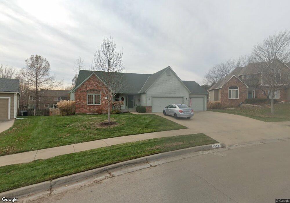
1013 Langston Ct Lawrence, KS 66049
West Lawrence NeighborhoodEstimated Value: $531,281 - $589,000
About This Home
This home is located at 1013 Langston Ct, Lawrence, KS 66049 and is currently estimated at $565,320, approximately $199 per square foot. 1013 Langston Ct is a home located in Douglas County with nearby schools including Langston Hughes Elementary School, Southwest Middle School, and Lawrence Free State High School.
Ownership History
We collect this data history from publicly available records. To have your information removed, we recommend requesting removal directly through your county’s website.
Purchase Details
Home Financials for this Owner
Home Financials are based on the most recent Mortgage that was taken out on this home.Purchase Details
Home Financials for this Owner
Home Financials are based on the most recent Mortgage that was taken out on this home.Home Values in the Area
Average Home Value in this Area
Purchase History
We collect this data history from publicly available records. To have your information removed, we recommend requesting removal directly through your county’s website.
| Date | Buyer | Sale Price | Title Company |
|---|---|---|---|
| -- | Capital Title Ins Co Lc | ||
| -- | Commerce Title |
Mortgage History
We collect this data history from publicly available records. To have your information removed, we recommend requesting removal directly through your county’s website.
| Date | Status | Borrower | Loan Amount |
|---|---|---|---|
| Closed | $220,000 | ||
| Closed | $240,000 | ||
| Closed | $199,430 |
Tax History
We collect this data history from publicly available records. To have your information removed, we recommend requesting removal directly through your county’s website.
| Year | Tax Paid | Tax Assessment Tax Assessment Total Assessment is a certain percentage of the fair market value that is determined by local assessors to be the total taxable value of land and additions on the property. | Land | Improvement |
|---|---|---|---|---|
| 2025 | $7,425 | $59,249 | $9,200 | $50,049 |
| 2024 | $6,953 | $55,534 | $7,475 | $48,059 |
| 2023 | $7,042 | $54,441 | $7,475 | $46,966 |
| 2022 | $6,669 | $51,221 | $7,475 | $43,746 |
| 2021 | $5,713 | $42,642 | $6,334 | $36,308 |
| 2020 | $5,517 | $41,400 | $6,334 | $35,066 |
| 2019 | $4,951 | $37,225 | $6,334 | $30,891 |
| 2018 | $4,955 | $36,984 | $6,334 | $30,650 |
| 2017 | $4,909 | $36,236 | $6,334 | $29,902 |
| 2016 | $4,528 | $34,925 | $5,753 | $29,172 |
| 2015 | $2,250 | $34,707 | $5,753 | $28,954 |
| 2014 | $2,172 | $33,844 | $5,753 | $28,091 |
Map
- 5221 Congressional Place
- 801 Fox Chase Ct
- 5200 Congressional Place
- 5813 Robinson Dr
- 1140 Waverly Dr
- 5625 Johnson Dr
- 5621 Johnson Dr
- 5609 Johnson Dr
- 5617 Johnson Dr
- 5629 Johnson Dr
- 5004 Cedar Grove Way
- 5705 Johnson Dr
- 5709 Johnson Dr
- 5524 Chamney Ct
- 5714 Silverstone Dr
- 5908 Johnson Dr
- 5905 Johnson Dr
- 5712 Warren Ct
- 5513 Chamney Ct
- 1448 Legends Cir
- 1009 Langston Ct
- 1017 Langston Ct
- 1112 Stoneridge Dr
- 1108 Stoneridge Dr
- 1116 Stoneridge Dr
- 1104 Stoneridge Dr
- 1005 Langston Ct
- 1021 Langston Ct
- 1012 Langston Ct
- 1016 Branchwood Dr
- 1012 Branchwood Dr
- 1120 Stoneridge Dr
- 1100 Stoneridge Dr
- 1008 Branchwood Dr
- 1016 Langston Ct
- 1001 Langston Ct
- 1004 Branchwood Dr
- 1113 Stoneridge Dr
- 1109 Stoneridge Dr
- 1008 Langston Ct
Ask me questions while you tour the home.