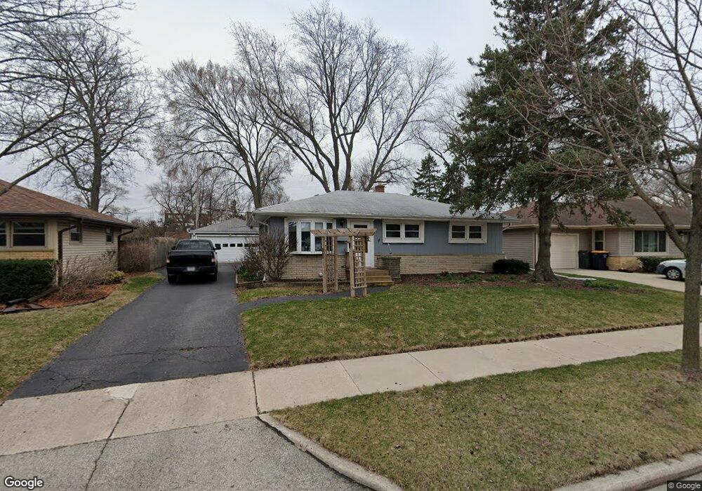
10133 W Manitoba St Milwaukee, WI 53227
Wildwood Estates NeighborhoodEstimated Value: $278,236 - $314,000
3
Beds
1
Bath
1,030
Sq Ft
$282/Sq Ft
Est. Value
About This Home
This home is located at 10133 W Manitoba St, Milwaukee, WI 53227 and is currently estimated at $290,809, approximately $282 per square foot. 10133 W Manitoba St is a home located in Milwaukee County with nearby schools including Mitchell Elementary School, Frank Lloyd Wright Intermediate School, and Nathan Hale High School.
Ownership History
Date
Name
Owned For
Owner Type
Purchase Details
Closed on
May 20, 2016
Sold by
Johnson William T
Bought by
Johnson Tenny J
Current Estimated Value
Home Financials for this Owner
Home Financials are based on the most recent Mortgage that was taken out on this home.
Original Mortgage
$60,000
Interest Rate
3.59%
Mortgage Type
Credit Line Revolving
Create a Home Valuation Report for This Property
The Home Valuation Report is an in-depth analysis detailing your home's value as well as a comparison with similar homes in the area
Home Values in the Area
Average Home Value in this Area
Purchase History
| Date | Buyer | Sale Price | Title Company |
|---|---|---|---|
| Johnson Tenny J | $133,400 | -- |
Source: Public Records
Mortgage History
| Date | Status | Borrower | Loan Amount |
|---|---|---|---|
| Previous Owner | Johnson Tenny J | $60,000 |
Source: Public Records
Tax History Compared to Growth
Tax History
| Year | Tax Paid | Tax Assessment Tax Assessment Total Assessment is a certain percentage of the fair market value that is determined by local assessors to be the total taxable value of land and additions on the property. | Land | Improvement |
|---|---|---|---|---|
| 2024 | $4,005 | $209,000 | $41,700 | $167,300 |
| 2023 | $3,484 | $133,000 | $24,500 | $108,500 |
| 2022 | $3,515 | $133,000 | $24,500 | $108,500 |
| 2021 | $3,429 | $133,000 | $24,500 | $108,500 |
| 2020 | $3,497 | $133,000 | $24,500 | $108,500 |
| 2019 | $3,364 | $133,000 | $24,500 | $108,500 |
| 2018 | $3,911 | $133,000 | $24,500 | $108,500 |
| 2017 | $3,555 | $133,000 | $24,500 | $108,500 |
| 2016 | $3,445 | $133,000 | $24,500 | $108,500 |
| 2015 | $3,448 | $133,000 | $24,500 | $108,500 |
| 2014 | $3,441 | $133,000 | $24,500 | $108,500 |
Source: Public Records
Map
Nearby Homes
- 9810 W Manitoba St
- 3122 S 97th St
- 3168 S 97th St
- 9727 W Ohio Ave
- 3160 S 95th St
- 2732 S 96th St
- 9851 W Beloit Rd Unit C8
- 3243 S 92nd St Unit 111
- 3406 S 95th St
- 3436 S 95th St
- 3320 S 92nd St
- 3538 S 96th St
- 3562 S 97th St
- 2472 S 95th St
- 2450 S 95th St
- 3608 S 95th St
- 9035 W Morgan Ave
- 11444 W Montana Ave
- 8624 W Beloit Rd
- 3558 S 92nd St
- 10205 W Manitoba St
- 10123 W Manitoba St
- 10134 W Oklahoma Ave
- 10213 W Manitoba St
- 10204 W Oklahoma Ave
- 10212 W Oklahoma Ave
- 3008 S 103rd St
- 10136 W Manitoba St
- 10124 W Manitoba St
- 10204 W Manitoba St
- 10214 W Manitoba St
- 10224 W Oklahoma Ave
- 10114 W Manitoba St
- 2988 S 103rd St
- 2995 S 101st St
- 2980 S 102nd St
- 2986 S 102nd St
- 10303 W Manitoba St
- 2987 S 101st St
- 10306 W Oklahoma Ave