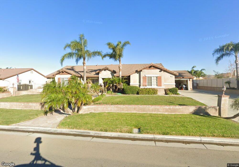
10135 Berkshire Dr Riverside, CA 92509
Estimated Value: $955,660 - $1,242,000
5
Beds
3
Baths
3,263
Sq Ft
$333/Sq Ft
Est. Value
About This Home
This home is located at 10135 Berkshire Dr, Riverside, CA 92509 and is currently estimated at $1,085,165, approximately $332 per square foot. 10135 Berkshire Dr is a home located in Riverside County with nearby schools including Van Buren Elementary School, Mira Loma Middle School, and Jurupa Valley High School.
Ownership History
Date
Name
Owned For
Owner Type
Purchase Details
Closed on
Jun 8, 2021
Sold by
Arabella Ranch Lp
Bought by
Orozco Erma L
Current Estimated Value
Purchase Details
Closed on
Aug 3, 2006
Sold by
Orozlo Erma L
Bought by
Arabella Ranch Lp
Purchase Details
Closed on
Jun 13, 2003
Sold by
Tract 28808 Llc
Bought by
Orozlo Erma L
Home Financials for this Owner
Home Financials are based on the most recent Mortgage that was taken out on this home.
Original Mortgage
$287,250
Interest Rate
5.6%
Mortgage Type
Stand Alone First
Create a Home Valuation Report for This Property
The Home Valuation Report is an in-depth analysis detailing your home's value as well as a comparison with similar homes in the area
Home Values in the Area
Average Home Value in this Area
Purchase History
| Date | Buyer | Sale Price | Title Company |
|---|---|---|---|
| Orozco Erma L | -- | None Available | |
| Arabella Ranch Lp | -- | None Available | |
| Orozlo Erma L | $383,000 | Orange Coast Title Company |
Source: Public Records
Mortgage History
| Date | Status | Borrower | Loan Amount |
|---|---|---|---|
| Previous Owner | Orozlo Erma L | $287,250 |
Source: Public Records
Tax History Compared to Growth
Tax History
| Year | Tax Paid | Tax Assessment Tax Assessment Total Assessment is a certain percentage of the fair market value that is determined by local assessors to be the total taxable value of land and additions on the property. | Land | Improvement |
|---|---|---|---|---|
| 2025 | $10,988 | $855,119 | $216,485 | $638,634 |
| 2023 | $10,988 | $821,916 | $208,080 | $613,836 |
| 2022 | $10,722 | $805,800 | $204,000 | $601,800 |
| 2021 | $7,322 | $503,055 | $105,071 | $397,984 |
| 2020 | $7,236 | $497,898 | $103,994 | $393,904 |
| 2019 | $7,103 | $488,136 | $101,955 | $386,181 |
| 2018 | $6,910 | $478,565 | $99,956 | $378,609 |
| 2017 | $6,814 | $469,183 | $97,997 | $371,186 |
| 2016 | $6,713 | $459,984 | $96,076 | $363,908 |
| 2015 | $6,618 | $453,077 | $94,634 | $358,443 |
| 2014 | $6,234 | $444,204 | $92,781 | $351,423 |
Source: Public Records
Map
Nearby Homes
- 4795 Bain St
- 10457 50th St
- 10517 50th St
- 9600 51st St
- 9567 51st St
- 9931 Union St
- 10538 54th St
- 4052 Lindsay St
- 9265 52nd St
- 4900 Eclipse Ave
- 0 Felspar St Unit DW25190204
- 11129 Ryder Rd
- 11101 Gemini Ct
- 4737 Hot Creek Rd
- 8963 Bold Ruler Ln
- 3880 Fox Tail Ln
- 3865 Fox Tail Ln
- 4694 Filly Ln
- 11234 Owen Ct
- 9950 60th St
- 10171 Berkshire Dr
- 4915 Manchester Ln
- 4903 Manchester Ln
- 10164 Oxford Cir
- 4891 Manchester Ln
- 10146 Oxford Cir
- 10144 Berkshire Dr
- 10126 Berkshire Dr
- 10162 Berkshire Dr
- 10189 Berkshire Dr
- 10108 Berkshire Dr
- 10182 Oxford Cir
- 4879 Manchester Ln
- 10090 Berkshire Dr
- 10180 Berkshire Dr
- 10155 Oxford Cir
- 4910 Manchester Ln
- 4898 Manchester Ln
- 4922 Manchester Ln
- 10129 Willowbrook Rd