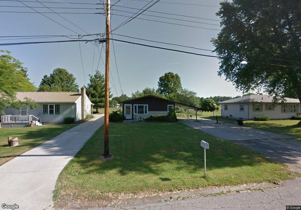
1014 Brad St Lansing, MI 48911
Southern Lansing NeighborhoodEstimated Value: $126,000 - $132,000
3
Beds
1
Bath
901
Sq Ft
$144/Sq Ft
Est. Value
About This Home
This home is located at 1014 Brad St, Lansing, MI 48911 and is currently estimated at $129,333, approximately $143 per square foot. 1014 Brad St is a home located in Ingham County with nearby schools including Reo Elementary School, Attwood School, and Everett High School.
Ownership History
Date
Name
Owned For
Owner Type
Purchase Details
Closed on
May 11, 2016
Sold by
Finet David and Sosulski Marya
Bought by
Jefferson Ryan
Current Estimated Value
Purchase Details
Closed on
Jun 28, 2007
Sold by
Chapman Christine M
Bought by
Wells Fargo Bank Na and Certificateholders Of Asset Backed Pass
Purchase Details
Closed on
Feb 28, 2003
Sold by
Sarber Kimberly K
Bought by
Chapman Christine M
Purchase Details
Closed on
Dec 13, 2001
Sold by
Chapman Roger W
Bought by
Chapman Roger W and Chapman Trust
Purchase Details
Closed on
Sep 4, 2001
Sold by
Chapman Roger W
Bought by
Chapman Roger W
Home Financials for this Owner
Home Financials are based on the most recent Mortgage that was taken out on this home.
Original Mortgage
$65,000
Interest Rate
7.06%
Mortgage Type
Purchase Money Mortgage
Create a Home Valuation Report for This Property
The Home Valuation Report is an in-depth analysis detailing your home's value as well as a comparison with similar homes in the area
Home Values in the Area
Average Home Value in this Area
Purchase History
| Date | Buyer | Sale Price | Title Company |
|---|---|---|---|
| Jefferson Ryan | $28,000 | None Available | |
| Wells Fargo Bank Na | $77,400 | None Available | |
| Chapman Christine M | -- | -- | |
| Chapman Roger W | -- | -- | |
| Chapman Roger W | -- | First American Title Ins Co |
Source: Public Records
Mortgage History
| Date | Status | Borrower | Loan Amount |
|---|---|---|---|
| Previous Owner | Chapman Roger W | $65,000 |
Source: Public Records
Tax History Compared to Growth
Tax History
| Year | Tax Paid | Tax Assessment Tax Assessment Total Assessment is a certain percentage of the fair market value that is determined by local assessors to be the total taxable value of land and additions on the property. | Land | Improvement |
|---|---|---|---|---|
| 2025 | $2,510 | $55,900 | $8,300 | $47,600 |
| 2024 | $21 | $47,500 | $8,300 | $39,200 |
| 2023 | $2,363 | $41,900 | $8,300 | $33,600 |
| 2022 | $2,159 | $36,600 | $8,300 | $28,300 |
| 2021 | $2,109 | $33,400 | $6,100 | $27,300 |
| 2020 | $2,094 | $30,400 | $6,100 | $24,300 |
| 2019 | $2,022 | $29,000 | $6,100 | $22,900 |
| 2018 | $1,918 | $24,900 | $6,100 | $18,800 |
| 2017 | $1,846 | $24,900 | $6,100 | $18,800 |
| 2016 | $3,350 | $24,500 | $6,100 | $18,400 |
| 2015 | $3,350 | $23,700 | $12,125 | $11,575 |
| 2014 | $3,350 | $23,800 | $18,187 | $5,613 |
Source: Public Records
Map
Nearby Homes
- 1020 R G Curtiss Ave
- 1014 W Northrup St
- 5750 Ashley Dr
- 1119 W Miller Rd
- 6037 Hughes Rd
- 5902 Hilliard Rd
- 825 Ferley St
- 5838 S Martin Luther King Junior Blvd
- 5636 Ellendale Dr
- 6270 S Washington Ave
- 0 W Jolly Rd
- 218 Raritan Rd
- 6029 Ellendale Dr
- 5026 Delray Dr Unit A
- 5006 Delbrook Ave
- 5727 Annapolis Dr
- 129 Village Dr
- 6421 S Washington Ave
- 4935 Delray Dr
- 0 Midwood St