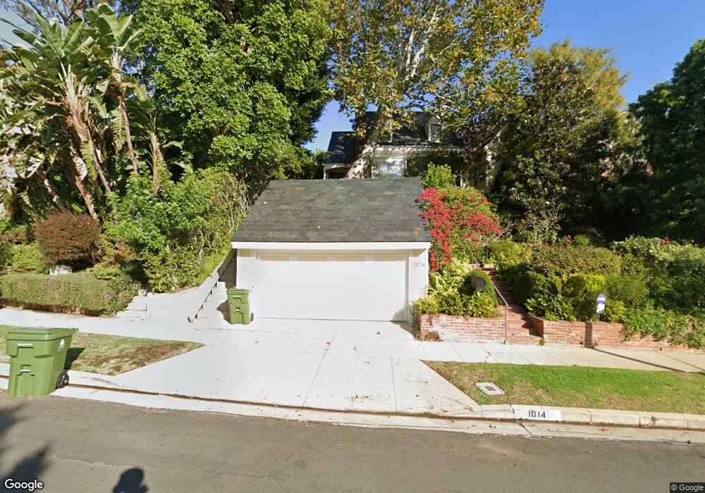
1014 Manning Ave Los Angeles, CA 90024
Westwood NeighborhoodEstimated Value: $2,875,000 - $3,702,000
3
Beds
4
Baths
2,502
Sq Ft
$1,245/Sq Ft
Est. Value
About This Home
This home is located at 1014 Manning Ave, Los Angeles, CA 90024 and is currently estimated at $3,115,255, approximately $1,245 per square foot. 1014 Manning Ave is a home located in Los Angeles County with nearby schools including Warner Avenue Elementary, Ralph Waldo Emerson Community Charter Middle School, and University High School Charter.
Ownership History
Date
Name
Owned For
Owner Type
Purchase Details
Closed on
May 14, 2018
Sold by
Isacoff Susan E
Bought by
Isacoff Susan E and The Susan E Isacoff Trust
Current Estimated Value
Purchase Details
Closed on
Apr 16, 2008
Sold by
Isacoff William H and Isacoff Susan E
Bought by
Isacoff Susan E
Purchase Details
Closed on
Feb 13, 2008
Sold by
Isacoff William
Bought by
Isacoff Susan E
Create a Home Valuation Report for This Property
The Home Valuation Report is an in-depth analysis detailing your home's value as well as a comparison with similar homes in the area
Home Values in the Area
Average Home Value in this Area
Purchase History
| Date | Buyer | Sale Price | Title Company |
|---|---|---|---|
| Isacoff Susan E | -- | None Available | |
| Isacoff Susan E | -- | Equity Title | |
| Isacoff Susan E | -- | None Available |
Source: Public Records
Tax History Compared to Growth
Tax History
| Year | Tax Paid | Tax Assessment Tax Assessment Total Assessment is a certain percentage of the fair market value that is determined by local assessors to be the total taxable value of land and additions on the property. | Land | Improvement |
|---|---|---|---|---|
| 2025 | $3,646 | $281,510 | $121,823 | $159,687 |
| 2024 | $3,646 | $275,991 | $119,435 | $156,556 |
| 2023 | $3,584 | $270,581 | $117,094 | $153,487 |
| 2022 | $3,431 | $265,277 | $114,799 | $150,478 |
| 2021 | $3,373 | $260,077 | $112,549 | $147,528 |
| 2019 | $3,277 | $252,364 | $109,211 | $143,153 |
| 2018 | $3,239 | $247,417 | $107,070 | $140,347 |
| 2016 | $3,077 | $237,812 | $102,913 | $134,899 |
| 2015 | $3,035 | $234,241 | $101,368 | $132,873 |
| 2014 | $3,054 | $229,654 | $99,383 | $130,271 |
Source: Public Records
Map
Nearby Homes
- 10736 Le Conte Ave
- 10701 Wilshire Blvd Unit 503
- 10701 Wilshire Blvd Unit 1601
- 10701 Wilshire Blvd Unit 306
- 10727 Wilshire Blvd Unit 404
- 10727 Wilshire Blvd Unit 301
- 10727 Wilshire Blvd Unit 1802
- 10727 Wilshire Blvd Unit 501
- 10727 Wilshire Blvd Unit 806
- 10727 Wilshire Blvd Unit 1805
- 10727 Wilshire Blvd Unit 2002
- 10747 Wilshire Blvd Unit 1208
- 10747 Wilshire Blvd Unit 1102
- 10601 Wilshire Blvd Unit 303
- 10601 Wilshire Blvd Unit 602
- 10601 Wilshire Blvd Unit 1201
- 10601 Wilshire Blvd Unit 1603
- 10601 Wilshire Blvd Unit PHE
- 10601 Wilshire Blvd Unit 403
- 10601 Wilshire Blvd Unit 19E
- 1022 Manning Ave
- 1030 Manning Ave
- 1000 Manning Ave
- 1015 Hilts Ave
- 1038 Manning Ave
- 1007 Hilts Ave
- 1021 Hilts Ave
- 962 Manning Ave
- 1015 Manning Ave
- 1009 Manning Ave
- 1001 Manning Ave
- 1001 Hilts Ave
- 1021 Manning Ave
- 1027 Hilts Ave
- 1044 Manning Ave
- 1027 Manning Ave
- 956 Manning Ave
- 957 Manning Ave
- 1035 Manning Ave
- 941 Hilts Ave