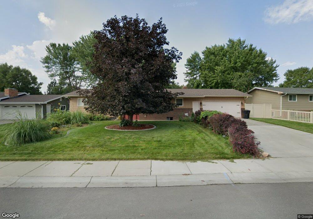
1014 Nutter Blvd Billings, MT 59105
Billings Heights NeighborhoodEstimated Value: $363,046 - $401,000
4
Beds
3
Baths
1,400
Sq Ft
$273/Sq Ft
Est. Value
About This Home
This home is located at 1014 Nutter Blvd, Billings, MT 59105 and is currently estimated at $381,512, approximately $272 per square foot. 1014 Nutter Blvd is a home located in Yellowstone County with nearby schools including Sandstone School, Castle Rock Junior High School, and Skyview High School.
Ownership History
Date
Name
Owned For
Owner Type
Purchase Details
Closed on
Jan 21, 2009
Sold by
Watson Anthony Charles and Watson Angela Christine
Bought by
Watson Anthony C and Watson Angela C
Current Estimated Value
Home Financials for this Owner
Home Financials are based on the most recent Mortgage that was taken out on this home.
Original Mortgage
$165,343
Interest Rate
5.49%
Mortgage Type
FHA
Create a Home Valuation Report for This Property
The Home Valuation Report is an in-depth analysis detailing your home's value as well as a comparison with similar homes in the area
Home Values in the Area
Average Home Value in this Area
Purchase History
| Date | Buyer | Sale Price | Title Company |
|---|---|---|---|
| Watson Anthony C | -- | Ctic |
Source: Public Records
Mortgage History
| Date | Status | Borrower | Loan Amount |
|---|---|---|---|
| Closed | Watson Anthony C | $165,343 |
Source: Public Records
Tax History
| Year | Tax Paid | Tax Assessment Tax Assessment Total Assessment is a certain percentage of the fair market value that is determined by local assessors to be the total taxable value of land and additions on the property. | Land | Improvement |
|---|---|---|---|---|
| 2025 | $3,652 | $390,000 | $68,005 | $321,995 |
| 2024 | $3,652 | $359,300 | $65,517 | $293,783 |
| 2023 | $3,661 | $359,300 | $65,517 | $293,783 |
| 2022 | $2,485 | $263,200 | $0 | $0 |
| 2021 | $2,928 | $263,200 | $0 | $0 |
| 2020 | $2,768 | $235,900 | $0 | $0 |
| 2019 | $2,649 | $235,900 | $0 | $0 |
| 2018 | $2,629 | $230,100 | $0 | $0 |
| 2017 | $2,560 | $230,100 | $0 | $0 |
| 2016 | $2,366 | $213,600 | $0 | $0 |
| 2015 | $2,316 | $213,600 | $0 | $0 |
| 2014 | $2,071 | $100,382 | $0 | $0 |
Source: Public Records
Map
Nearby Homes
- 1224 Watson Peak Rd
- 1239 Watson Peak Rd
- 52 Prince of Wales Dr
- 126 Erickson Ct N
- 1315 Watson Peak Rd
- 914 Aronson Ave
- 1320 Mineral Place Unit 2
- 1152 Toole Ct
- 0 Easy St
- 228 Nash Ln
- 1322 Babcock Cir
- TBD Antelope Place
- 373 Stewart Ct S
- 11 Prince of Wales Dr
- 11 Queen Victoria Place
- 1017 Toole Cir
- 66 Antelope Trail W Unit 5
- 66 Antelope Trail W Unit 10
- 636 Antelope Cir
- 423 Kuhlman Dr
- 1018 Nutter Blvd
- 1010 Nutter Blvd
- 113 Norris Ct N
- 119 Norris Ct N
- 109 Norris Ct N
- 123 Norris Ct N
- 1022 Nutter Blvd
- 1006 Nutter Blvd
- 1013 Nutter Blvd
- 1009 Nutter Blvd
- 1017 Nutter Blvd
- 105 Norris Ct N
- 127 Norris Ct N
- 1005 Nutter Blvd
- 1026 Nutter Blvd
- 1021 Nutter Blvd
- 198 Norris Ct E
- 116 Norris Ct N
- 1025 Nutter Blvd
- 101 Norris Ct N
Your Personal Tour Guide
Ask me questions while you tour the home.