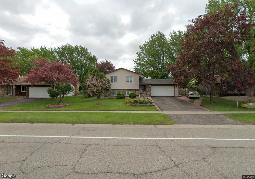
1014 Whitney Dr Saint Paul, MN 55124
Old Town NeighborhoodEstimated Value: $467,000 - $537,987
6
Beds
3
Baths
1,495
Sq Ft
$332/Sq Ft
Est. Value
About This Home
This home is located at 1014 Whitney Dr, Saint Paul, MN 55124 and is currently estimated at $495,747, approximately $331 per square foot. 1014 Whitney Dr is a home located in Dakota County with nearby schools including Southview Elementary School, Valley Middle School, and Apple Valley Senior High School.
Ownership History
Date
Name
Owned For
Owner Type
Purchase Details
Closed on
Sep 7, 2017
Sold by
Adam Abdirahman Afi and Mahamed Abdi Abdullahi
Bought by
Ask Richard P and Ask Merlina M
Current Estimated Value
Home Financials for this Owner
Home Financials are based on the most recent Mortgage that was taken out on this home.
Original Mortgage
$295,000
Outstanding Balance
$246,346
Interest Rate
3.9%
Mortgage Type
VA
Estimated Equity
$249,401
Purchase Details
Closed on
Jun 17, 2016
Bought by
Abdi Abdirahman
Purchase Details
Closed on
May 1, 2014
Sold by
Rogers Brett C
Bought by
Wells Fargo Bank Na
Purchase Details
Closed on
Nov 20, 2009
Sold by
Brown Judson and Brown Lori
Bought by
Rogers Brett
Purchase Details
Closed on
Feb 5, 1996
Sold by
Hud
Bought by
Brown Judson D and Brown Lori A
Create a Home Valuation Report for This Property
The Home Valuation Report is an in-depth analysis detailing your home's value as well as a comparison with similar homes in the area
Home Values in the Area
Average Home Value in this Area
Purchase History
| Date | Buyer | Sale Price | Title Company |
|---|---|---|---|
| Ask Richard P | $295,000 | Burnet Title | |
| Abdi Abdirahman | $187,500 | -- | |
| Wells Fargo Bank Na | $195,800 | None Available | |
| Rogers Brett | $229,000 | -- | |
| Brown Judson D | $122,000 | -- |
Source: Public Records
Mortgage History
| Date | Status | Borrower | Loan Amount |
|---|---|---|---|
| Open | Ask Richard P | $295,000 |
Source: Public Records
Tax History Compared to Growth
Tax History
| Year | Tax Paid | Tax Assessment Tax Assessment Total Assessment is a certain percentage of the fair market value that is determined by local assessors to be the total taxable value of land and additions on the property. | Land | Improvement |
|---|---|---|---|---|
| 2024 | $1,630 | $444,600 | $87,100 | $357,500 |
| 2023 | $1,630 | $444,000 | $87,300 | $356,700 |
| 2022 | $934 | $443,500 | $87,000 | $356,500 |
| 2021 | $586 | $380,500 | $75,700 | $304,800 |
| 2020 | $482 | $349,300 | $71,400 | $277,900 |
| 2019 | $169 | $339,300 | $68,000 | $271,300 |
| 2018 | $3,473 | $314,400 | $64,700 | $249,700 |
| 2017 | $3,501 | $291,300 | $61,600 | $229,700 |
| 2016 | $3,269 | $270,100 | $58,700 | $211,400 |
| 2015 | $4,751 | $246,051 | $54,531 | $191,520 |
| 2014 | -- | $238,748 | $52,332 | $186,416 |
| 2013 | -- | $218,692 | $47,781 | $170,911 |
Source: Public Records
Map
Nearby Homes
- 892 Redwell Ln
- 15813 Garden View Dr
- 921 Cortland Dr S
- 889 Whitney Dr
- 15979 Harwell Ave
- 841 Cortland Dr
- 15964 Hyland Dr
- 8090 159th St W
- 249 Elm Dr
- 15931 Hyland Pointe Ct
- 148 Spruce Dr
- 16187 Hawthorn Path
- 834 Fireside Dr
- 15722 Griffon Ct
- 7765 157th St W
- 14786 Hallmark Dr
- 1516 Rushmore Dr
- 15887 Griffon Path
- 441 Walnut Ln
- 16421 Gunflint Trail
- 1010 Whitney Dr
- 1018 Whitney Dr
- 15609 Highview Dr
- 15613 Highview Dr
- 15605 Highview Dr
- 1022 Whitney Dr
- 1006 Whitney Dr
- 15617 Highview Dr
- 15601 Highview Dr
- 1026 Whitney Dr
- 15621 Highview Dr
- 1030 Whitney Dr
- 15627 Highview Ln
- 1000 Whitney Dr
- 8481 156th Street Ct
- 1001 Whitney Dr
- 15631 Highview Ln
- 1034 Whitney Dr
- 996 Whitney Dr
- 8461 156th Street Ct