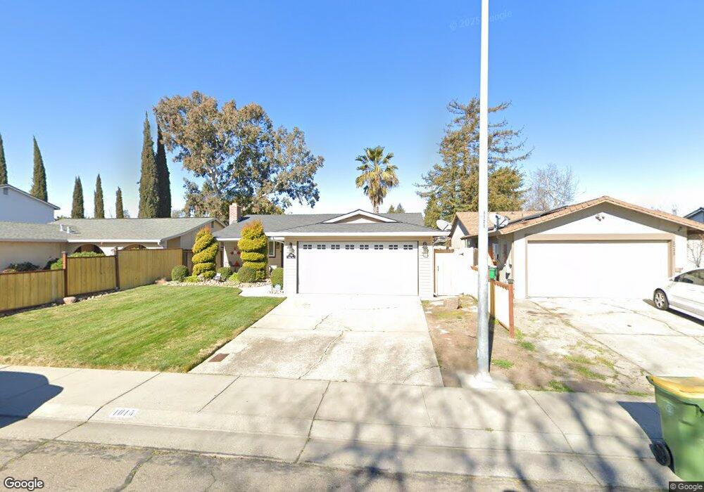
1015 Burns Way Stockton, CA 95209
Stonewood NeighborhoodEstimated Value: $265,000 - $390,000
4
Beds
3
Baths
1,202
Sq Ft
$282/Sq Ft
Est. Value
About This Home
This home is located at 1015 Burns Way, Stockton, CA 95209 and is currently estimated at $339,046, approximately $282 per square foot. 1015 Burns Way is a home located in San Joaquin County with nearby schools including Colonial Heights School, Sierra Middle School, and Lincoln High School.
Ownership History
Date
Name
Owned For
Owner Type
Purchase Details
Closed on
Sep 14, 2018
Sold by
Lewis Edna
Bought by
Carson Felicia K and Lewis Edna
Current Estimated Value
Purchase Details
Closed on
Nov 7, 2007
Sold by
Fainter Patricia A and Betty J Taggart Living Trust
Bought by
Lewis Edna
Purchase Details
Closed on
Nov 30, 1999
Sold by
Taggart B J
Bought by
Taggart Betty J and The Betty J Taggart Living Tru
Create a Home Valuation Report for This Property
The Home Valuation Report is an in-depth analysis detailing your home's value as well as a comparison with similar homes in the area
Home Values in the Area
Average Home Value in this Area
Purchase History
| Date | Buyer | Sale Price | Title Company |
|---|---|---|---|
| Carson Felicia K | $88,500 | None Available | |
| Lewis Edna | $153,000 | Chicago Title Co | |
| Taggart Betty J | -- | -- |
Source: Public Records
Tax History Compared to Growth
Tax History
| Year | Tax Paid | Tax Assessment Tax Assessment Total Assessment is a certain percentage of the fair market value that is determined by local assessors to be the total taxable value of land and additions on the property. | Land | Improvement |
|---|---|---|---|---|
| 2025 | $2,456 | $200,958 | $78,805 | $122,153 |
| 2024 | $2,407 | $197,018 | $77,260 | $119,758 |
| 2023 | $2,391 | $193,156 | $75,746 | $117,410 |
| 2022 | $2,356 | $189,369 | $74,261 | $115,108 |
| 2021 | $2,326 | $185,656 | $72,805 | $112,851 |
| 2020 | $2,325 | $183,753 | $72,059 | $111,694 |
| 2019 | $2,291 | $180,151 | $70,647 | $109,504 |
| 2018 | $2,249 | $176,619 | $69,262 | $107,357 |
| 2017 | $2,206 | $173,156 | $67,904 | $105,252 |
| 2016 | $2,184 | $169,761 | $66,573 | $103,188 |
| 2014 | $1,895 | $143,000 | $43,000 | $100,000 |
Source: Public Records
Map
Nearby Homes
- 948 Macduff Ave
- 8324 Rothesay Place
- 8160 Encino Ave
- 8518 Burns Place
- 8350 Encino Ave
- 8306 Galloway Dr
- 1355 Paloma Ave
- 764 Macduff Ave
- 8603 Acapulco Way
- 8441 Skye Dr
- 8715 Eastwood Ct
- 8013 El Cajon St
- 610 Highmoor Ave
- 1328 Woodmont Way
- 8011 N Pershing Ave
- 1617 Seville Ave
- 811 San Miguel Ave
- 939 Goldenoak Way
- 1629 Cortez Ave
- 916 Springoak Way
- 1011 Burns Way
- 1019 Burns Way
- 1007 Burns Way
- 8404 Macduff Ct
- 1023 Burns Way
- 1027 Burns Way
- 8319 Tarbat St
- 1003 Burns Way
- 8411 Macduff Ct
- 1014 Burns Way
- 1018 Burns Way
- 1010 Burns Way
- 8325 Tarbat St
- 1022 Burns Way
- 1006 Burns Way
- 8412 Macduff Ct
- 1031 Burns Way
- 1026 Burns Way
- 8331 Tarbat St
- 1002 Burns Way